Swanley, Kent, UK - Missing Maps Monday sessions
Posted by Tallguy on 28 February 2015 in English. Last updated on 4 March 2015.If you fancy getting involved in the Missing Maps Project, or Humanitarian OpenStreetMap Team - HOT, but don’t fancy a trip to London for one of the Mapathons which are held there, how would Swanley, Kent suit you.
Brief explanation for those not familiar with HOT or “Missing Maps Organisation”
The Humanitarian OpenStreetMap Team (HOT) are a team of volunteers who map areas needed by the Aid Organisations.
The American Red Cross, British Red Cross, Medecins Sans Frontiere (Doctors without Borders) (MSF) and HOT have teamed up under the banner “Missing Maps” with the aim of mapping those areas in greatest need. There is much more information on their individual websites which you can access from their logo’s on the Missing Maps website.
Weekly sessions in Swanley
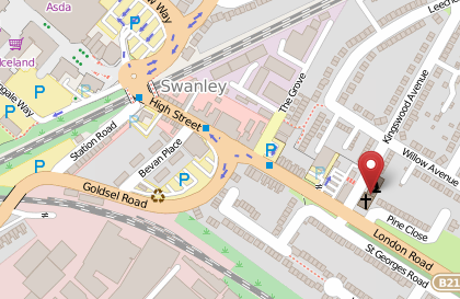
A small team of us are organizing a weekly Monday afternoon session based in the Christ Church Centre, Swanley (The map below is a clickable link)
If you already know how to map using the Tasking Manager, then come along and socialise whilst helping with the mapping - we have the upstairs rooms booked from 1.15pm to 4.30pm for Monday afternoons starting on the 9th March 2015. Please send me a message if you are coming in case we are getting full.
We’re also running a couple of training sessions, each an hour and a half long, starting respectively at 1.15pm & 2.30pm aimed at getting someone with no knowledge of OpenStreetMap & how to edit, through to using JOSM or iD and making a real contribution towards mapping the areas needed by the Aid organisations. These are bookable sessions for up to 8 people - please message me to book a session.
For our first session on the 9th March we’ll aim to do more work on an area in Epworth, Zimbabwe where MSF need a detailed map to help them deal with HIV - There is a lot more information under the description tab of Tasking Manager project #868 . The aim is to get the whole of this project complete before a ground survey at the beginning of April.
What do you need?
Please bring a laptop & mouse (There are a couple of spares in case they are needed - let me know if you need the use of one). Nothing fancy, just a basic laptop which can connect to WiFi. You’ll be using a web browser - iD does not work with Internet Explorer, so install an alternative such as Firefox or Chrome. JOSM is a Java application, and it would be good if you followed the link & installed it before coming along.
Skill level - If you’ve followed the links on this message we should be able to teach you the remaining skills needed. You’ll never know unless you try!
I hope to see you at one or more of the sessions - contact me from the links at the bottom of this message for more info.
Cost - Free!
I forgot to mention the cost - free to you. But it would be really good if you did some mapping for Missing Maps Project as they are making this all happen.
Thanks for reading.
Tallguy = Nick
Discussion