OpenStreetMap logo OpenStreetMap

Zethradon's Diary

Recent diary entries

Tools for helping community imports

Posted by Zethradon on 7 December 2014 in English.

This post is about some new tools I and others have made to facilitate community-based import of data into OpenStreetMap. These tools cover converting .csv files to .osm files and splitting .osm files for the Tasking Manager, and I am writing this post hoping they can be of help to others. The code is available in the mtl2osm GitHub project (“mtl” stands for “Montreal”).

(Please note: mostly if not all links here are to French web pages.)

The Montreal community import process

Here in Montreal we are slowly preparing to import open data provided the city. Said data is licensed under CC-BY 4.0, and we got the required legal authorization from the City to import them into OpenStreetMap.

Our import process is documented here. We have not started any data import yet. We are currently in the process of getting feedback from the local community through the OpenStreetMap Montréal user group.
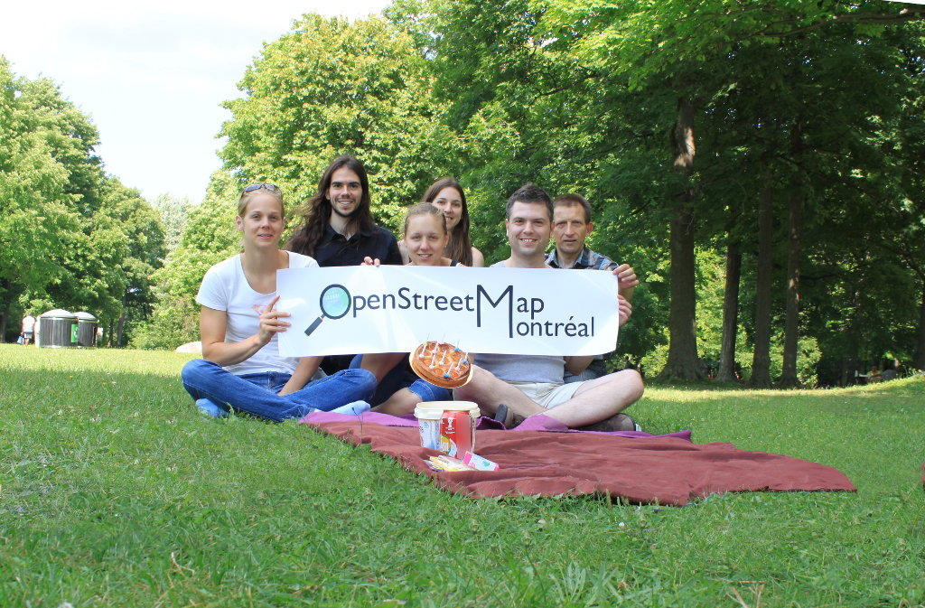
The OpenStreetMap Montréal user group celebrating the 10th birthday of OpenStreetMap

Tools & dataset

See full entry

Nous avons été 8 personnes aujourd’hui à braver le froid, un dimanche après-midi de la fin du mois d’octobre, pour cartographier les commerces et les points d’intérêts du chemin de la Côte-des-Neiges dans le quartier du même nom à Montréal.

On sent bien que l’hiver est à nos portes, et qu’il sera froid!

La zone inventoriée est très dense en terme de commerces de toutes sortes, mais ces commerces étaient très peu représentés dans OpenStreetMap.

Voici le résultat. La carte avant:

Avant

La carte après:

See full entry

Location: Côte-des-Neiges–Notre-Dame-de-Grâce, Montréal, Agglomération de Montréal, Montréal (région administrative), Québec, Canada

I have been a serious user of OpenStreetMap for less than six months, and I am proud to recently have achieved my one hundredth contribution to the project. I really love the OpenStreetMap project, and I would like to replace my daily usage of Google Maps with OpenStreetMap.

But it just seems I cannot.

I’ll give a few concrete examples why, humbly hoping that my words can encourage changes to the main website.

First point: searching. I have OpenStreetMap zoomed in to some region of Montreal, Canada. I input “café”, looking for a coffee shop. I get results from Nominatim, inviting me to visit a village in Brazil named “Café” or even the “Café point” in Antarctica. While these search results awaken my globetrotter’s desire to explore the world, they frustrate me at the same time. Why couldn’t Nominatim priorize results from the bounding box or surrounding? Why can’t OpenStreetMap show me results on the map like the OverPass API does, performing a search on the tag amenity=cafe and showing the results on the map?

Second point: accessing POI information. I cannot click on point of interests (POI) to get more info about them. Why do we input address, business hours and phone numbers on shops and restaurants if the map cannot easily display this information to the user? Why do I have to show the map’s data in order to have information on a point of interest?

Third point: maximum zoom level. Some area are densely populated, and OpenStreetMap’s current zoom level is not enough to see all details of the map. This is really unfortunate. Example: osm.org/go/cIrNs6Qzp– What are the restaurant surrounding the Hard Rock Café on this map? I have to use the editor to be able to zoom and see all data.

Fourth point: sharing a point of interest. There should be an easy way to do that. I have found a (complicated) way to do it, which is all but obvious to newcomers. Here is how:

See full entry