
Quite a lot of news sources have asked almost all cartographic providers if they will change Crimea’s owner on their maps. No international provider answered positively. In Russia companies are more willing to comply: Mail.ru maps are showing Crimea as a part of Russia, and Yandex now has two separate maps, for Russians and Ukrainians, which show Crimea in different colors. Wikipedia contributors started a tiny edit war between images that show Crimea as a disputed territory or a part of Russia.
_-_disputed_territories.svg)
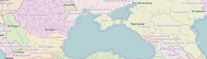
Members of Russian and Ukrainian OpenStreetMap communities have discussed the matter during the first few days of the Crimea situation, and have come to an agreement ten days ago. We declared a moratorium on touching administrative borders in Crimea, as well as name tags (since some mappers started changing Ukrainian names to Russian), active until 1st of June, 0:01 MSK. Until at least then Crimea stays a part of Ukraine on our map. Every edit altering name tags or administrative borders will be treated as provoking an edit war and reverted, users who do that repeatedly will be banned. There were some cases of that already.
Of course users are encouraged to map non-political things, like buildings and landuses, and add language-specific name tags: name:uk, name:ru and name:crh. Right now there is a mapping event in progress, focusing on improving Crimea’s coverage on OpenStreetMap, which has attracted around 70 mappers.
For Russian patriots I’ve made a special political map which shows Russia’s position on Crimea, Kosovo, Abkhazia and South Ossetia to users with Russian IP addresses, and a normal map with Ukrainian names for visitors from other countries.
토론
2014년 3월 28일 15:17에 Vincent de Phily님의 의견
What is your process for displaying data that is (presumably) coming from OSM but using different boundaries ? Just a set of manually-edited polygons in an overlay, or something smarter ?
Seeing as there’ll always be governments that do not agree with OSM’s set of boundaries, it’d be nice if there was a howto to render custom borders.
2014년 3월 28일 15:21에 Zverik님의 의견
In this political map I’ve manually updated data in a PostGIS database, and rendered a patch for Crimea, which I then overlayed on top of a world map. Much visual effect comes just from different colouring, which is easy to create using one of TileMill’s example projects.