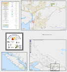
OpenStreetMap logo OpenStreetMap

acrosscanadatrails's Diary

Recent diary entries

With special thanks to Daniel & the CanVec product team,
They have figured out a way to get the original .shp files into the OSM format and also figured out how to create the address:interpolation, data (for those provinces that have the data available).

Daniel has provided 6 sample datasets, so then the community will be able to proved feedback. Covering most of the available feature types, to get a better idea of the complete set.

osm.wiki/CanVec#Sample_Datasets

Feel free to Open Up these sample files, and take a close look at them. We recommend that you PLEASE DO NOT upload anything, (unless your actually close to the area or plan on visiting the area). (I plan in visiting Halifax in the fall :) ), and i contacted the local area mapper & awaiting a response.

So if you have comments / questions about this data, please feel free to join in the talk-ca@openstreetmap.org discussion list, and the community welcomes new ideas :)

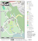
I am working on the Fergons Cove and Purcells Cove area (just south of Halifax City) & keeping the main road that was already in OSM & just ehancing the map with this data. Yes, it meant adding in more detail to the main road, but it preserves the whole length of it, as im just working on 1 side-road section at a time.
& the for the larger waterbody area & fixing the coastline, i will leave that to after i get in touch with the local area mapper as it covers a big area & dont want to mess up any local area work.

That's all for now, I'll report back later :0)

Happy Mapping,
Sam

Location: Fergusons Cove, Halifax Regional Municipality, Halifax County, Nova Scotia, Canada

I started to "Virtually" Bike Across Canada

So it's doing the mapping part & writing the travel journal for as if i was actually doing the trip. (which i plan on it for next year)

Here's a basic map i made up from http://hikebikemap.de/ and just using windows PaintBrush & the 'PrtScr' button on the keyboard.

From Across Canada Trails

I'm drawing in the route (daily trip) using bikemap.net as it has a nice OpenCycleMap background.

http://acrosscanadatrails.posterous.com/day-004-port-alberni-log-train-trail-route-of


Bike route 511872 - powered by Bikemap 

Because the actual trail has not yet been mapped (i know that it exists) so i just guessed. My hopes is that by next year, someone will have actually bike/hiked this Log Train Trail.

See full entry

Location: Alberni, Port Alberni, Alberni-Clayoquot Regional District, British Columbia, V9Y 6B3, Canada

I created the event with
http://osmvictoriabc.eventbrite.com/

I sent a message to the local are mappers about it.
With a few responses so far. Mostly people are busy, it might also me short notice.

So it might be some remote mapping.
over on the oftc.net IRC #osm-ca might be a good place to connect & coordinate mapping activity.

There are lots of buildings that still need to be mapped.

Cheers,
Sam

Location: Downtown, Victoria, Capital Regional District, British Columbia, Canada

This one is a very big park. More than 2,000 nodes around.... and that's with fuzzy detail. So i split it up into sections & merged nodes along the edges. It was traced from the Atlas of Canada WMS layer (as it wasn't available int he NRCan protected areas SHP file set).

It will take a while for the renderers to get this whole park. So the pointer is at a zoomed in area.

from http://en.wikipedia.org/wiki/Strathcona_Provincial_Park

Strathcona Provincial Park is the oldest provincial park in British Columbia, Canada, and the largest on Vancouver Island. Founded in 1911, the park was named for Donald Alexander Smith, 1st Baron Strathcona and Mount Royal, a wealthy philanthropist and railroad pioneer. It lies within the Strathcona Regional District. The Clayoquot Sound UNESCO Biosphere Reserve, established in 2000, includes three watersheds in the western area of the park.

From OpenStreetMap
Location: Area D (Sproat Lake), Alberni-Clayoquot Regional District, British Columbia, Canada

Hi, Im just adding in some National Parks, and want to run it by anyone reading this..

The area is right around Tobermory, Ontario. It's listed as a boundary=national_park, but i really think it should be rendered and a different tag to indicate that is on water rather than land.

Any ideas?

Thanks,
Sam Vekemans
Across Canada Trails

P.S here's the wiki page for it.
osm.wiki/Geobase/NRCan_Protected_Areas

Location: Tobermory, Municipality of Northern Bruce Peninsula, Bruce County, Ontario, N0H 2R0, Canada

Hi all,
Yuppee!

The Cowichan Valley Regional District has make their data available for free to use and remix. With direct consent.
osm.wiki/Canada:British_Columbia:Cowichan_Valley_Regional_District

The full transcript of the communication is available on in the talk-ca@openstreetmap.org Archives here
http://lists.openstreetmap.org/pipermail/talk-ca/2010-March/002425.html

Because there is written direct consent, it's OK to use the data :)

Great thanks to all the local area mappers who have made the map so detailed so far.

It looks like there is lots of create data that will be a great help to assisting local area mappers to improve the map.

In April or May, we'll have a mapping party to go over the details in the area.

Yupee!!

Great work everyone!

Location: Area F (Cowichan Lake South / Skutz Falls), Cowichan Valley Regional District, British Columbia, Canada

osm.wiki/AlbanianFloodingCrisisCamp#Road_Network

Im drawing in some of the roads from the WMS Roads Network file, as it looks to be around the flooded area.
There is still lots more roads that need to be traced. Looking at the cyclemap I can see that the area is hilly & so i think that alot of the roads should be tagged as 'residential' rather than 'tertiary'.

I can see from the imported roads that they are listed as eithor "Village Road", or "Dwelling Area Road". In some cases i saw it tagged the opposite.

Well anyway, once all of the roads get actually drawn in, i think it will be easier to tell which roads are which. :)

Using the WMS layer seems to be more effective for mapping than importing the .osm files. I am noticing that at some of the junctions there are duplicate nodes (where the roads don't actually connect) ... but not everywhere.

The reason why this happens is that the conversion script that is used, converts the ways directly to OSM ways, and a 'node-deduplicator' wasn't passed through. This happened to me before, when i used the shp-to-osm script. This is why im now more a fan of tracing, since it becomes upto the mapper to decide which tags to use.

So the way it is now seems to be great. There are road-fragments all over the place, so all that's needed is to extend the roads so that they line-up with the WMS layer.

Thats all for now,
Sam

Location: Dramosh, Ana e Malit, Shkodër Municipality, Shkodër County, Northern Albania, 4017, Albania

Yup, that's right.
We now have an active IRC channel. ...

I use Pidgin as the messenger to logon to the IRC chat.
I'd also recommend using the main IRC channel #osm as it's a great way to get answers to questions.

We also have an #osm-int channel, that one is an international list for all languages.

Also, this new Canada channel is happy to welcome all languages, as Canada's main official languages is English & French. .. so all other languages are welcome. ... since many folks can speak other languages :)
The more people in the room, the better chance that someone will be able to answer you :)

http://irc.openstreetmap.org/irc.cgi

and enter in your nickname (preferably your OSM username)

then select the #osm-ca Channel... and your in :)

Cheers,
Sam Vekemans
Across Canada Trails

Location: Saanich, Capital Regional District, British Columbia, Canada

Ok, so i got word back that the OSM POI now accepts Images in the Google Earth KML overlay

From OpenStreetMap

So now, it has the GoogleEarth Opencyclemap KML overlay, along with this OSM POI
.. the KML is editable, so i made it now part of my Across Canada Trails .kmz set of useful stuff.

I dont see alot of the image=http:// .. .jpg tags around, but it works :)
I use Picasa Web Albums and just find the direct .jpg link to add to openstreetmap. I guess flickr or any other website would work too, as long as it direct to the .jpg file.

http://www.jrq.ch/osmpoi/osmpoi.kml
(from user:Andy9FromSpace)

Im not sure if it's possible to change those icons, but what is shows is pretty good.
I added a feed so it would search for "image=http:// ....jpg" as well as one for "barrier".

I think for all of the POI that are "tourism=viewpoint" they should really get a .jpg link on it as well. ... so then people can see this viewpoint :)

Thats all for now,
Sam

Location: Tofino, Alberni-Clayoquot Regional District, British Columbia, V0R 2Z0, Canada

So i had a mapping party in Sidney, BC today. Only 1 person turned up, but it was a week-day and many work during the week.

A fellow long distance cyclist, so it was great to cover both detailed mapping techniques... PLUS long distance cycling, and how OSM helps.

Which reminds me, i'll be adding more zips for the Ibycus Topo Map (an intern solution until all the Canada Data gets imported).

For now, there is only the world-wide routable maps (that has a handy install file)
http://garmin.na1400.info/routable.php
The maps get updated weekly or every 2 weeks, so it's not too bad, but would be great to make these on-the-fly with the latest data.

So anyway, no actual mapping got done, accept afterwords when i added in the different shops in town.

FINALLY the local bike shop has now been mapped :)
.... I think Sidney has a very high concentration of Books Shops, not sure why.

Next time i visit, i'll make some of these things polygons when adding parking etc.

Location: Sidney, Capital Regional District, British Columbia, Canada

I have attempted to tag this area with it's new name
(check the history tab of it)

But not exactly sure. The landmass is actually made up of a whole bunch of islands where bridges & ferries connect it all.

I think that when the aboriginal lands database gets uploaded it will be easier to see. As well as from the canvec & geobase data, we will see it better.

I just wanted to add it in 'cause it can show how our map can be updated faster :-)

http://www.cbc.ca/canada/british-columbia/story/2009/12/11/bc-queen-charlottle-islands-renamed-haida-gwaii.html?ref=rss

Cheers,
Sam

Location: Area D (Graham Island), North Coast Regional District, British Columbia, Canada

Hi everyone,
In about an hour, 6pm PST (2am GMT (i think) I'll be hosting a live video feed of my update on the Canada Import progress.

I wrote down a list of things to broadcast about, and plan on recording it, so it can be shared to YouTube, or other sites.

http://tinychat.com/acrosscanada

http://www.ustream.tv/channel/across-canada-trails

I'll be able to (hopefully answer questions that people have) as there is live tweeting and commenting going on at the same time.

Hopefully some people will be able to see it. :)

Cheers,
Sam

Location: Unorganized Division No. 18, Saskatchewan, Canada

Hi all,
I've started my work with Across Canada Trails.
Tomorrow (later today) at 3pm PST Tuesday will be the 'Official Launch'
Right now im screen-casting what i am doing (creating the route using mapsource)

I'll be showing people how they can use OSM data to create routes and share them on bikemap and how to donate their tracks.
I'm on a microphone, so when people join in, they are free to ask questions and comment as im working.

I'll use Potlatch/JOSM/Kosmos/Marble Desktop and all the tools available to work with :)

This is my 1st time trying this out, so it's a test run. (pre-launch show)

If anyone is up right now, feel free to join in :)

cheers,
Sam

url http://tinychat.com/acrosscanada

Location: Area F (Cherry Creek), Alberni-Clayoquot Regional District, British Columbia, V9Y 8R2, Canada

So i made a little same area of the trials data.
I think i still need to update the big chart.
I have the tags i used posted to my main google docs chart, that's because the list of features is gonna be BIG and un-managable with the wiki.

I just the 'Validator' plugin with helps, as it squaks when something isn't right.
Like duplicate nodes...
I probably need to use the python script.. as now i know how (kind of) to edit it.
...
I put it as highway=path

osm.org/browse/way/44817089

the 'LIO:surface' tag wasnt' added. In some of the source tags it's listed as 'Grass/Natural' for example. Which is rather ambiguous. So the area needs to be physically surveyed anyway (to get more features)

Location: Nipigon Township, Thunder Bay District, Northwestern Ontario, Ontario, Canada

I did some mapping while up here, ... a little break from the Canada Import conversion fun.

I mapped out some paths to the beaches and added more points in town. The next one around will probably want to draw in outlines of buildings.. but for now the points are in there... so its good.
Added in some bus stops, and main attractions.

There is a new development that has been just finished... i wish i could stay here longer. :( ... i'll leave that for someone else.

I went whale watching, and saw lots of islands, and some that i put in there. (and a few Grey Whales too). Some of the islands were natural=wood right up to where it would be coastline... but there were lots of reefs that all need to get mapped, as well as the buoys that are around to help boaters.

... it would be cool if there was a way that boaters with their GPS's could submit their depth readings and have then posted a nodes with the depth number, as these help give an idea of where water is at.
.. i think thats the idea with the openseamap project.

Oh ya, subject line. With regards to surfing as a sport. Its generally understood that these ideal surging spots do NOT get mapped. So just listing the beach name is (whats physically on the ground).

What's cool is that you can see all the rocks now, and how that help form these beaches, and awesome waves.

Thats all for now,
Sam

Location: Tofino, Alberni-Clayoquot Regional District, British Columbia, V0R 2Z0, Canada

Hi all,
This is long over due. But here we go.

1 - I have the canvec-to-osm data conversion utility script, which is still in beta 'cause there are some more known errors. (spot checks need to be done)

2 - I have converted the data for the tiles for the whole 082 area, and for the 031 area.
So you can download the .zip files and view the .osm files that are included.

3 - If you want to help copy in the data, your welcome to (ideally it's local area mappers who can verify the data) that should be the ones copying in the data.
... just as you should really only be editing your own area where you have actually been. ('cause you know it the best)
If you want editing access, all you need todo is just ask on the talk-ca discussion list, and i'll be happy to add you to the list of editors.

4 - the cities listed are; Ottawa, Montreal, Kingston, Barrie areas
To view that tiles you would like you can use the slippy map on the NRCan site.
http://geogratis.gc.ca/geogratis/en/product/search.do?id=28954 (

And if you have any requests for tiles to be converted, please let me know, and i'll move requests to the front of the que for conversion.

http://spreadsheets.google.com/ccc?key=0Am70fsptsPF2dG1ZN1YwMmZCVDhDOHZpbUNmOGlvWGc&hl=en

Location: Dominionville, North Glengarry, Stormont, Dundas and Glengarry Counties, Eastern Ontario, Ontario, K0C 1T0, Canada

http://trac.openstreetmap.org/wiki

re: [OSM-talk] Please

I guess I'm guilty of this too :(

I'm so exited to see new stuff and cool new features added to this site, so i just send off an email to talk@openstreetmap.org about what i'd like to see.

When really, the talk@ discussion should only be used for a 'light' discussion, and to share links of where people can find more information. So for example, if i wanted to make a recommendation, i would do so first by submitting a ticket, then ....
http://trac.openstreetmap.org/ticket/2337

When really, just like any other website, in order for technical things to happen. (Ie. this trac.openstreetmap.org link to be more visible on the home page.) And actual BUG needs to be reported. This way, it's a process where those people who have the technical ability to make it happen can do so.

Since there's only 24 hours in a day, and those programmers DO sleep sometimes, they gotta prioritize their time to deal with 1 issue at a time. This Bug tracker does this, and helps to identify which feature additions to be working on.

(personally) im now becoming a bit of a (basic) programmer, since i created canvec2osm. The conversion script that takes all the Natural Resources Canada data from one dataset 'CanVec', and converts it into OSM format, making it nice and need in a handy folder.

So once i start making the .osm files available, people start complaining about issues. ie. things not tagged correctly, or things not showing up as they should. For me, i can handle it. I just take each bug as it happens and fix it.

The point is, if i was working on the main OSM site, and responding to errors, i would need to work with a talented team, where others know how to fix the problem. So it wont be all me. Then i would need to record in better detail what bugs im fixing, and how i resolved the problem. (and others could respond saying that it was already handled on another ticket, so that ticket would be closed)

See full entry

Just doing a google search to see whats the latest out there, and found this.

http://www.cognitivecombine.com/2009/08/tool-compare-google-maps-to-openstreetmap/

It's cool, 'cause it shows how far we've gone in the details. .. and gives a quick glimps what what else of a 'basic-map' is still needed to be physically surveyed. And it also shows Yahoo maps as an option to view also.

I contacted the author, and just wanted to share it here as i haven't seen it before, and maybe it can be added to the wiki list (if there is one)

Cheers,
Sam