
(Noticed this for the 1st time)
- Map Search for “HU3 6ED” at Historic England
(unfortunately, a useless searchpage, but does use OSM) -
Advanced search page at HE
(not honestly a great deal better, but more functional) - OSM HE_ref tag
- OSM listed_status tag
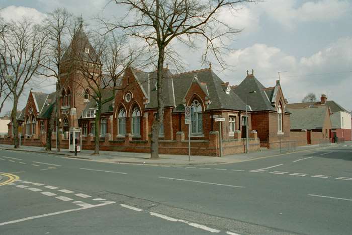
Ploughing through East Yorkshire schools, using a combo of mathmos.net & the government Schools Information Service to add full Address & Contact details to all HU schools, I’ve reached St George’s Primary School off Anlaby Road in Hull. Whilst checking that this was the correct school (very few EY schools — and how absolutely fantastic is it that the entire County has refused to accept the 1975 “Humberside” as their county & gone in their entirety back to “East Riding of Yorkshire”? yeah! — are properly mapped & registered, so it is necessary to check most carefully the mathmos.net correlation) I came across a photo showing on the front of the building that this was a “Board School”, and thus probably established in Victorian times (start_date=1881).
I spent a little time living not too far from this school and, after completing the main mapping, began to try to find when it was built. That brought me to the Hull Carnegie Heritage Centre, where I discovered that the road was started in the 1870s & the school was built in 1881 by the Newington School Board in the very classic Gothic style of that era. The page also states that it is “now a Grade II Listed building and one of Hull’s oldest surviving school buildings”. And here it is (list entry:1197690):–
Thus, the HE tags to use for the school (these are specific for the UK):–
heritage:operator=Historic Englandheritage=2listed_status=Grade IIHE_ref=1197690
Discussion