OpenStreetMap logo OpenStreetMap

alexkemp's Diary

Recent diary entries

Re-learning JOSM :: Installation

Posted by alexkemp on 10 March 2019 in English. Last updated on 12 March 2019.

The Operating System (OS) is different on my computer now from when I last used JOSM, so it had to be installed from scratch. Here is a bunch of stuff that should be useful if you need to install JOSM:–

  1. JOSM == “Java OpenStreetMap Editor”
  2. JOSM Wiki
  3. Available for Windows, Linux, and macOS
    (you are strongly advised to use a desktop machine with a large display)
  4. Install instructions

The following will be install instructions for Devuan / Debian / Ubuntu:–

This is my OS:–

$ lsb_release -da    
Distributor ID:	Devuan
Description:	Devuan GNU/Linux 2.0 (ascii)
Release:	2.0
Codename:	ascii

See full entry

Re-Learning JOSM :: Intro

Posted by alexkemp on 10 March 2019 in English. Last updated on 12 March 2019.

At this moment my profile shows 1,822 edits, all done with JOSM, so it would seem reasonable to assume that I know JOSM inside-out. Well, yes & no.

  1. The last time I went out surveying was 28 May 2017 (19 months ago)
  2. I never completed adding that survey into OSM
    (I got to Chedington Avenue on Spring Lane)
  3. After creating another batch of OSM Promotional Leaflets it remains only for me to finish the necessary editing on the last survey. Then I can get on the road again for some more surveying.
  4. I fell down dead 20 years ago so I try not to be too hard on myself if I forget things
    (23 February 1999 — heart went into fibrillation — on awakening I did not know where I lived nor worked, and had the memory of a goldfish (’bout 4 minutes))

My OS is different than the last time I used JOSM, so everything needed to be done from the beginning, again. My thought was to make use of this opportunity to give advice to those starting from scratch and trying to learn how on earth to use this programme. Uniquely, I’m both well-experienced and a complete novice in using it at the same time, and that may help give me an insight into what newbies may need to know.

This will be just an introductory post. The meat of the matter will start at the next post.

I do not intend to structure the help too strongly. It will be a bunch of disparate stuff as I come across it whilst editing. I strongly urge others to add in their own useful titbits in the comments, or to correct wrongful info.

Location: Thorneywood, Sneinton, Nottingham, East Midlands, England, NG3 2PB, United Kingdom

A new record for Mapillary - 62 blurs on a street sign

Posted by alexkemp on 18 February 2019 in English. Last updated on 23 June 2022.
  1. Mapillary seems to be Losing It’s Marbles
  2. Git Along, Little Dogies
    (speeding up renaming files)
  3. I’m losing my Marbles because of Mapillary
  4. A new record for Mapillary - 62 blurs on a street sign

a new record

I know that on first sight that it does not look like it, but this street sign (above) at the corner of Foxhill Road & Forester Grove near Carlton, Nottingham contains 62 blurs! There are so many that the listing (see the window in an earlier diary) stops at #44 with all the rest on the LHS out of site below the window.

A piece of advice from an old man:
Make sure that you admit your mistakes, and try to do so promptly. Otherwise you will find yourself unable to change and making the same stupid errors over & over again, which is most boring.

Update 23 June 2022

See full entry

Location: Gedling, Carlton, Gedling, Nottinghamshire, East Midlands, England, NG4 4BH, United Kingdom

I'm losing my Marbles because of Mapillary

Posted by alexkemp on 17 February 2019 in English. Last updated on 23 June 2022.
  1. Mapillary seems to be Losing It’s Marbles
  2. Git Along, Little Dogies
    (speeding up renaming files)
  3. I’m losing my Marbles because of Mapillary
  4. A new record for Mapillary - 62 blurs on a street sign

The picture below was shot on 15 July 2016 on the corner of Carnarvon Grove & Cavendish Road within the parish of Carlton, Nottingham. Like so many other Nottingham street signs it has been vandalised, in this case quite recently, and the vandalism was performed by Mapillary.

Carnarvon Grove street sign

I suspect that Mapillary may have jumped the shark. They are certainly losing my affections. After about 10 12-hour days spent editing a few thousand blurs within 69 sets of photographs, yet without any action on their part, I recently sent them an email:

From: Me
Subject: Re: [Mapillary] Re: Re: [Mapillary] Blur editor ineffective
To: Mapillary <support@mapillary.com>

More problems with the Blur Editor window:

See full entry

Location: Gedling, Carlton, Gedling, Nottinghamshire, East Midlands, England, NG4 4BH, United Kingdom

Git Along, Little Dogies

Posted by alexkemp on 15 February 2019 in English. Last updated on 23 June 2022.
  1. Mapillary seems to be Losing It’s Marbles
  2. Git Along, Little Dogies
    (speeding up renaming files)
  3. I’m losing my Marbles because of Mapillary
  4. A new record for Mapillary - 62 blurs on a street sign

Git Along, Little Dogies (Be warned that today’s Diary is most whimsical)
(PS That picture above is linked to a “Family singalong”)

There is a house on Kenrick Road, Porchester Gardens, Nottingham that is called “Fool’s Jig”, and there is a link in the map to a picture lodged within Mapillary of that House-Name (below).

See full entry

Location: Porchester Gardens, Woodthorpe, Carlton, Gedling, Nottinghamshire, East Midlands, England, United Kingdom

GPS to have it's 2ⁿᵈ Y2K Moment on April 6 This Year

Posted by alexkemp on 12 February 2019 in English. Last updated on 13 February 2019.

Is Location on my Smartphone going to die? OS updates may well be available, but Vodaphone stopped providing them 0 secs after I bought it.

GPS Rollover This April 6

(boring detail from the Register link above follows)
GPS satellites contain an atomic clock, and the signal that they put out contains a timestamp derived from that clock. The timestamp is an inherent part of the way in which a device Location is calculated from the accumulated GPS signals. However, that Timestamp stores the week number using ten binary bits…

Ten binary bits == 2¹⁰ == 1,024 weeks ≈ 20 years

The first GPS satellite launch was 1978. The first epoch was 6 January 1980 & the first rollover was midnight UTC Sun 22 Aug 1999 & the next will be the first Saturday in April 2019. Yikes!

Extra

If you want to see the timestamp for a JPEG with embedded Location info, then do this (and note: this was done because the time went weird for this set of photos (all 3 timestamps should be the same)):–

$ identify -verbose 2016-10-08_11-27-27.jpg | fgrep 'exif:DateTime'    
exif:DateTime: 2016:10:08 10:27:27
exif:DateTimeDigitized: 2016:10:08 10:27:27
exif:DateTimeOriginal: 2016:10:08 21:58:52

Phew! We are all Saved!

I’m indebted to TheSwavu (see Comments) for a link to wired.com detailing how everything went fine (?) on the last time this happened in 1999:–

At 8 p.m. EDT Saturday (21 Aug 1999), the clock was reset to zero

The US Coast Guard said it was unaware of any serious distress calls from boaters related to malfunctioning GPS receivers.

He said fewer than 12 Coast Guard cutters, aircraft, boats, cars, and other auxiliary vessels reported a glitch, however fleeting, when their GPS receivers failed to update automatically. Fixing those short-lived glitches typically required nothing more than powering down a GPS receiver to get re-synchronized with the satellites, McPherson said.

See full entry

Location: Thorneywood, Sneinton, Nottingham, East Midlands, England, NG3 2PB, United Kingdom

Mapillary seems to be Losing It’s Marbles

Posted by alexkemp on 9 February 2019 in English. Last updated on 23 June 2022.
  1. Mapillary seems to be Losing It’s Marbles
  2. Git Along, Little Dogies
    (speeding up renaming files)
  3. I’m losing my Marbles because of Mapillary
  4. A new record for Mapillary - 62 blurs on a street sign

Mapillary is a location-photo-sharing site dedicated to inter-working with OSM & I like it a lot.

Mapillary is the street-level imagery platform that uses computer vision to fix the world’s maps.
450.7 million images; 6.5 million kilometers covered

I am registered on Mapillary since Apr 10, 2016 and it tells me that in that time I have uploaded 6,200 photographs shot whilst walking across 244.7 km of Nottingham’s suburbs. Most of those photos are registered as links with various PoI on the map, which means that someone browsing OSM can find a link attached to a Nottingham point-of-interest that will instantly let them see a blurred photo of what it looks like 32% of the time.

Blurred Photos

At the moment that I am writing these words the following photo has 33 auto-blurs attached to it, 32 of which affect the street-sign on the right (the 33rd is on the brickwork to the right):–

See full entry

Location: Gedling, Carlton, Gedling, Nottinghamshire, East Midlands, England, NG4 4BH, United Kingdom

Adding a Preview JPG + crop-marks for printing

Posted by alexkemp on 5 February 2019 in English. Last updated on 6 February 2019.

This is a another small update to a sequence of posts on updating some small leaflets originally produced by Andy Allan:–

  1. Fonts missing from OSM Promotional Leaflets
  2. Github HowTo: Clone Repository then make a Pull Request
  3. Printing OSM Promotional Leaflets
  4. Update to OSM Promotional Leaflets due to Padding errors
  5. Adding a Preview JPG + crop-marks for printing

OSM leaflet preview

This is how to add crop-marks and bleed-marks to a production-PDF for printing (the PDFs within GitHub do NOT currently contain any crop-marks and, whilst they contain 3mm bleed, they do NOT contain bleed marks either):–

See full entry

Location: Thorneywood, Sneinton, Nottingham, East Midlands, England, NG3 2PB, United Kingdom

Update to OSM Promotional Leaflets due to Padding errors

Posted by alexkemp on 31 January 2019 in English. Last updated on 5 February 2019.

This is a small update to a sequence of posts on updating some small leaflets originally produced by Andy Allan:–

  1. Fonts missing from OSM Promotional Leaflets
  2. Github HowTo: Clone Repository then make a Pull Request
  3. Printing OSM Promotional Leaflets
  4. Update to OSM Promotional Leaflets due to Padding errors
  5. Adding a Preview JPG + crop-marks for printing

OSM flyers

Diary website 500 errors

Yesterday & earlier today this website was producing a HTTP 500 errors (server error, explicitly reported as an error in communicating with a 3rd-party server). It occurred as I attempted to update my post on Printing OSM Promotional Leaflets. I sent an email to the Server folks.

A few minutes ago I succeeded in updating that post but again noticed occasional problems, which appeared to be connected with the Markdown used on this site. Openstreetmap.org is also sometimes very slow in loading a page.

See full entry

Location: Thorneywood, Sneinton, Nottingham, East Midlands, England, NG3 2PB, United Kingdom

Printing OSM Promotional Leaflets

Posted by alexkemp on 24 January 2019 in English. Last updated on 5 February 2019.

This is the final in a sequence of posts on acquiring some small leaflets originally produced by Andy Allan:–

  1. Fonts missing from OSM Promotional Leaflets
  2. Github HowTo: Clone Repository then make a Pull Request
  3. Printing OSM Promotional Leaflets
  4. Update to OSM Promotional Leaflets due to Padding errors
  5. Adding a Preview JPG + crop-marks for printing

OSM flyers

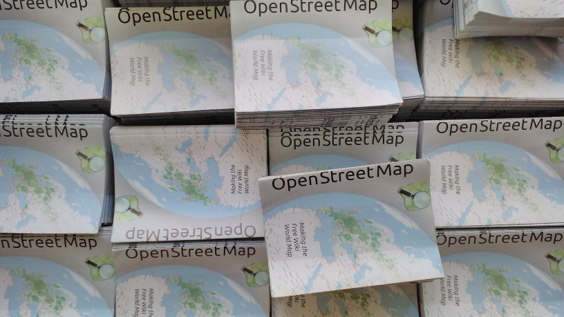
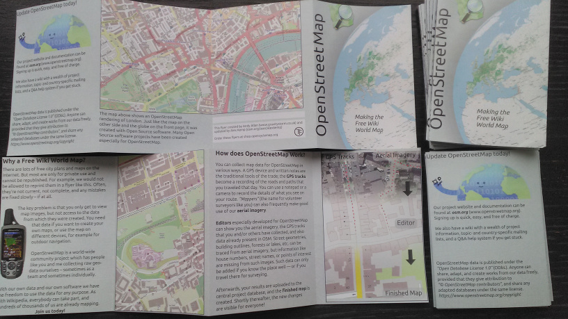
Five years ago Andy Allan produced a GitHub repository of a design for a credit-card sized (A7: 105mm high x 74mm wide) 8-page leaflet based on a Frederik Ramm German design, but updated for the UK (see above + at openstreetmap-promotional-leaflets). Andy had very kindly sent me a bunch of those leaflets on May 2016, and told me that they cost GBP £95 for 5,000 leaflets direct from the printers or GBP ~£165 for 10,000.

See full entry

Github HowTo: Clone Repository then make a Pull Request

Posted by alexkemp on 12 January 2019 in English. Last updated on 23 June 2022.

Most things are easy once you know all the jargon and have done it for a while. That broke down for me with Github. It seemed that everybody just assumed that everybody else already knew all the jargon, and nobody bothered to explain how to do anything step-by-step.

  1. Fonts missing from OSM Promotional Leaflets
  2. Github HowTo: Clone Repository then make a Pull Request
  3. Printing OSM Promotional Leaflets
  4. Update to OSM Promotional Leaflets due to Padding errors
  5. Adding a Preview JPG + crop-marks for printing

I cannot explain everything about git nor Github, but I’ve just successfully created my first git Repository on Github by forking another repository, have cloned it to my local Desktop, made three commits & also a pull request. So, whilst everything is still reasonably fresh in my mind & I have the history available to report it all to you, here is some of what all that shit means and how to get into it if you want to do something similar.

Brief Background & Overview

Near the end of last year (2018) I tried to use Andy Allan’s OSM Promotional Leaflets to get some little giveaway-leaflets printed, and failed. It was missing some crucial items & also needed updating, so I tried, and eventually succeeded in updating it, and also made a post about that: Fonts missing from OSM Promotional Leaflets.

I’ve found Andy to be tremendously helpful in the past, so I was also privately in conversation with him about his Repository. He suggested that I make a Pull Request as to add links for the necessary fonts to the README file. I thought that that might be a great idea, just as soon as I could find out what a Pull Request was, and then how to do it.

Git + Github Overview

See full entry

Location: Lace Market, St Ann's, Nottingham, East Midlands, England, NG1 1PR, United Kingdom

Fonts missing from OSM Promotional Leaflets

Posted by alexkemp on 30 December 2018 in English. Last updated on 5 February 2019.

OSM flyers

  1. Fonts missing from OSM Promotional Leaflets
  2. Github HowTo: Clone Repository then make a Pull Request
  3. Printing OSM Promotional Leaflets
  4. Update to OSM Promotional Leaflets due to Padding errors
  5. Adding a Preview JPG + crop-marks for printing

tl;dr:
You will need to install a combo of ubuntu font, a suitable Sans-Serif font (OpenSans family font is available via GitHub) + Inkscape in addition to mirroring locally the current GitHub OSM files. Then use Inkscape to import one of the SVG files, Save-As a PDF from it, and print from that. Rinse/repeat with the other SVG file:–

Updated PDFs + SVGs (identified by ‘r15371’) are currently available at https://github.com/alexkemp9/openstreetmap-promotional-leaflets. In addition I’ve made a pull-request (a request within Github for the original author to consider pulling-in my changes), so they may soon be available from the original source (next line).

See full entry

Location: Thorneywood, Sneinton, Nottingham, East Midlands, England, NG3 2PB, United Kingdom

OSM 0, Google 1

Posted by alexkemp on 1 December 2018 in English.

As I was walking through NG3 Nottingham this afternoon, on my way towards Tesco at NG1, I was stopped by a chap in an electric car with his wife & 2 kids (lots of electric cars in Nottingham these days) and asked if I knew where Hartley Road was. They were trying to get to the House of Pain Wrestling event in St Peter’s Church Hall.

I have mapped most of NG3, 4 & 5 in Nottingham, but not NG7. He had internet on his mobile so I suggested that he bring up osm.org in his browser. To my surprise, this brought up a long list of short lines of text (I could not read them) (desktop OSM brings up the map) but after a short while he got the map of England up. I told him confidently that he could now search for Hartley Road, but he could not find a search box nor any link to a search box. By this time his wife had used Google to locate the road & also discover the route from ourselves to it (3½ miles). He thanked me and set off.

Oops. Google has got user needs & interactions well worked out, whilst OSM struggles in it’s dust to even get started.

Location: Old Lenton, Lenton, Nottingham, East Midlands, England, NG7 2FE, United Kingdom

Spam is appearing within Changesets

Posted by alexkemp on 10 November 2018 in English.

Hard on the heels of my previous Diary (How to report spam) I’ve discovered spam within a changeset (map edit) for the first time:–

Changeset#6050808957

 addr:city	Hà Nội
 addr:district	Thanh Xuân
 addr:housenumber	25
 description	Video Bài Hát Việt Nam
 email	<redacted>@gmail.com
 name	Ngoc Anh
 phone	<redacted>
 start_date	10/11/2018
 website	https://www.youtube.com/watch?v=<redacted>

Splendid.

HowTo Report Spam in OSM + Information on Spam

Posted by alexkemp on 14 August 2018 in English. Last updated on 18 March 2019.

Registered, logged-in users recently got an additional facility for every Diary, and also every Diary Comment, posted within this site: a report button. At this current moment (Tuesday 14 August 2018) these are the option buttons available after pressing that button (choose just one):–

  • This diary entry is/contains spam
  • This diary entry is obscene/offensive
  • This diary entry contains a threat
  • Other

Registered, logged-in users also got an additional facility for every Diary Profile: a report button. At this current moment (Monday 20 August 2018) these are the option buttons available after pressing that button (choose just one):–

  • This user profile is/contains spam
  • This user profile is obscene/offensive
  • This user profile contains a threat
  • This user is a vandal
  • Other

This diary post is about the first option ((non-email) SPAM) (you-tube (baked-beans are off)). OSM got going in 2004 and, from my POV, it is astonishing that it has taken 14 years to put a Report option in place (I joined StopForumSpam in 2009 and am a Mod on that site, so you will have to accept a strong anti-spam obsession in this post).

tl;dr: most SPAM is posted via bots; AFAIK that has not yet happened with OSM, but it is only a matter of time. However, OSM has been so tolerant of SPAM for so long that a host of human spammers has got used to feasting on OSM. Please login & report all spamming that you find (remember to check the Profiles as well).

There now follows a rambling exposition on the sources of SPAM.

You are never alone with an IP

See full entry

Transfer Script for Android 6 via USB under Devuan/Debian

Posted by alexkemp on 8 August 2018 in English. Last updated on 10 August 2018.

In Transfer files to/from Android 6 via USB under Devuan/Debian it was detailed how to setup both Devuan & the Android smartphone as to import/export files between the two devices. In this post, a script is given to quickly one-touch files from the phone to a designated directory in the desktop.

The script below will need saving into a file called ~/Personal/copyFromPhone. You will then need to:-

:~$ chmod +x ~/Personal/copyFromPhone
:~$ ls -al ~/Personal/copyFromPhone
-rwxr-xr-x 1 user user 1857 Aug  8 21:18 /home/user/Personal/copyFromPhone

The script is launched as :~$ Personal/copyFromPhone. The values $CAMERA, $FUSERMOUNT, … , $MOUNTPOINT will all need checking. $LOCAL + $MOUNTDIR are almost certainly wrong as provided for any specific user.

Problems:

The major problem I had was ‘device is busy’ reports on attempted unmount at end of script. Using the unmount command from terminal always worked (fusermount -u /media/user/disk), but I added the ‘lazy unmount’ option to try to get rid of that.

See full entry

Transfer files to/from Android 6 via USB under Devuan/Debian

Posted by alexkemp on 27 July 2018 in English. Last updated on 23 June 2022.

My home PC is now Devuan and I’ve lost all trace of how I previously set Debian up to be able to transfer osmtracker files between my home PC and my Android 6.0.1 Marshmallow smartphone connected using a USB cable. So, here it all is again, but this time under Devuan 2.0 (ascii).

tl;dr:
1. On the phone enable Developer Options and change the USB default to MTP.
2. On the Desktop install jmtpfs + mtp-tools, then mount
3. Use Thunar to access mounted disk + transfer files

Xfce is my desktop environment & Thunar the File Manager. Once mounted (below) and whilst the phone screen is unlocked it is possible to browse/copy the phone directories with Thunar in the normal way. The jmtpfs README states that “tools like find and rsync work as expected”, although I have not yet explored this.

One item that is currently missing is that, whilst USB Mass-Storage devices are auto-mounted upon insertion & can be stopped/unmounted from Thunar, that is not yet available for me with the phone. You thus need to use the terminal to both mount, and to unmount the phone before removal.

There is every chance that you need root for this on your phone. I wanted to be able to mount the phone from my desktop and thus then use either GUI or terminal to move files created whilst surveying using OSMTracker on my smartphone.

Here is the info detected on the smartphone model after installing mtp-tools:

$ mtp-detect

Listing raw device(s)
Device 0 (VID=19d2 and PID=0307) is a ZTE V880E.
   Found 1 device(s):
   ZTE: V880E (19d2:0307) @ bus 1, dev 6
Device info:
   Manufacturer: Vodafone
   Model: VFD 600

See full entry

Telenav / Scout image

This is a YouTube video uploaded on 7 Aug 2014 by ScoutbyTeleNav, and celebrates 10 years of OSM existence at that time, giving a visual demonstration of the month-by-month build of OSM by all it’s contributors. This video makes me proud to have added a little to OSM, even though for me that did not start until after this video was made.

And yes, I know that this is a bit old but watch it anyway, and I think that you will agree that it is an excellent video, worth watching. The music (also excellent) is Open Electro by Vincent Girès from the album Silence.

10 years of OSM: youtu.be/7sC83j6vzjo

PS
OSM Founder Steve Coast is the Head of OSM at Telenav

OSM & Britain’s Most Upwardly-Mobile Village

Posted by alexkemp on 11 May 2018 in English. Last updated on 22 May 2018.

You may have missed the reports in April about Willand, a pretty little village in Devon that is 2cm (0.7 inches) closer to god each year (from the heliocentric view, of course), yet no-one knows why:

Willand village in Devon

The connection to OSM is a little tortuous, but real.

The University of Nottingham has a Geography department, and it has spun off a commercial company called Geomatic Ventures Limited (GML). GML has created a United Kingdom Relative Deformation Map using results from the Sentinel-1 satellite. Here is the blurb from the mangomap site:

United Kingdom Relative Deformation Map

A relative deformation map of the United Kingdom, generated from ~ 2000 Sentinel-1 images acquired between October 2015 - October 2017. The data was processed using the Intermittent Small Baseline Subset (ISBAS) InSAR method. Each pixel represents the average vertical height change over the period of observations in millimetres per year.

See full entry

Location: Willand, Mid Devon, Devon, Devon and Torbay, England, United Kingdom