
Bichelangelo and GPS Traces as Pictures
Plasing deur apm-wa op 28 Desember 2018 in English. Laas opgedateer op 25 Mei 2019.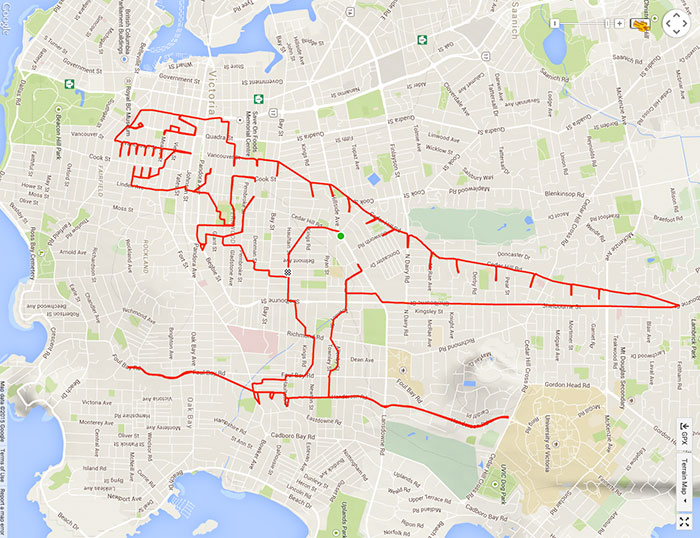 Sorry, I could not resist posting this when it popped up on Facebook. It would never have occurred to me that GPS traces can be used to create art. However….
Happy New Year to one and all!
Discussion
Kommentaar van philippec op 28 Desember 2018 om 09:05
That has been along since GPX tracks exist. Especially the dirty pictures. Nothing has changed since the Romans :). The people of Gent even build their roads to represent dirty pictures :) = osm.org/#map=10/51.1102/3.7973
Kommentaar van TheDutchMan13 op 29 Desember 2018 om 09:37
That is awesome!
Kommentaar van Kaank op 30 Desember 2018 om 22:42
Wow nice!
Kommentaar van koninklijke op 31 Desember 2018 om 11:54
Thank you for sharing the find. Had seen GPS tracks by ships and aeroplanes, drawing hearts for Valentines’. Impressed that this user visualised a dinosaur / T-rex like shape on the map.