OpenStreetMap logo OpenStreetMap

b-unicycling's Diary

Recent diary entries

Adding Sketchfab links to OSM

Posted by b-unicycling on 23 October 2023 in English.

Some time ago, I started adding links to 3D models on Sketchfab to ogham stones, sheela-na-gigs and high crosses in Ireland. I thought that this was a good idea to add value to the map, because we already link 2D images, 3D is just so much cooler and more useful. Some of these artefacts are not accessible to the public at all times, and having a digital 3D model makes them accessible for all the world (with a fast enough internet connection). Of course, you could just browse Sketchfab, but having the geolocation can be interesting and useful too.

Sometimes, museums or universities have contracted someone to make 3D models of artefacts that might be in storage in a museum or inaccessible in a farmyard, thus providing OpenAccess to these models in digital form.

What started this initiative of was that I found a working photogrammetry app called Kiri Engine. Full disclosure now: They have made me an ambassador for their app, since I’ve been promoting it in a video already and have recommended it to a few friends in archaeology. But I would still promote it, even if they hadn’t done that.

I’ve made a video on how to use it (YouTube) which will be followed by another one soon. The previous video was about why and how to link to Sketchfab from OSM: YouTube. I had made a wiki page for Sketchfab, but it has experienced some editing since. For it to be useful, the link has to work as a link, so for now, we cannot use just an identifier for the model, but have to use a full link. Sketchfab does hoewever provide a short link which consists of https://skfb.ly/ followed by a (for now) 5-digit code of letters and numbers. This might be possible to utilize as an identifier. But for now, I’m using and would recommend using url:sketchfab with the short url.

See full entry

Mapping Boot Scrapers

Posted by b-unicycling on 8 October 2023 in English.

Boot scrapers have fascinated me since Helge Schneider’s musical “Mendy das Wusical” in which they play a very important role. #stiefelabstreifkante (It’s a somewhat absurd musical by my favourite German comedian…)

I remember that when I moved to Ireland I kept sending my sister pictures of the ones I came across, because she also likes the musical and the comedian.

For some years now I have been thinking that it would be interesting to map them. Partly because I wanted to know how many there are in Kilkenny and where and also, you never know who might be interested in this data in the future, so OpenStreetMap is the obvious choice to record them.

A.-K. D., CC BY-SA 4.0 https://creativecommons.org/licenses/by-sa/4.0, via Wikimedia Commons

At this point, if you get tired of reading - I’ve made a video about it: watch video on YouTube

See full entry

Location: Gardens, Kilkenny No.1 Urban, The Municipal District of Kilkenny City, County Kilkenny, Leinster, Ireland

Step by step

Posted by b-unicycling on 6 October 2023 in English.

While I was mapping house numbers and other things in Ballyragget today, I noticed something curious: Buildings with “Step” or “Steps” in their name. There is a “Step House” in Ballyragget (check on OSM), probably called thus, because it has 5 steps leading up to the front door (a common feature in Georgian buildings). To my knowledge, there are only one or two more houses like that in Ballyragget, so having steps outside your front door must have seemed remarkable enough for people to give it that name.

A.-K. D., CC BY-SA 4.0, via Wikimedia Commons

Then two other cases came to mind: the Steppes Bar in Callan (check on OSM) which seems to be named after the steps to the left of the entrance. Weird plural, but maybe it’s from ye olde times.

See full entry

Martello towers

Posted by b-unicycling on 2 October 2023 in English.

It seems I have developed a reputation in Ireland and the UK about my history mapping, because SK53 had tagged me in a toot about Martello towers. At first, I somewhat brushed it off, but as he probably knew, my interest was eventually triggered and I looked into the matter.

I remember that DeBigC was the first to tell me about Martello towers, but I can’t remember if he used a specific example or just shared his interest.

For those who aren’t familiar: Martello towers were built by the British Empire at a time when they were still ruling the waves, especially around the time of the Napoleonic Wars, when there was a threat of a Napoleonic invasion into British territory. They continued building them in port towns, so mostly along the coast, but not all of them are coastal. Apparently (according to Wikipedia), they are usually round and built in two levels with the guards living in it (i.e. building). They placed a cannon on the top which had a 360° reach, although one hopes that they only pointed it seawards.

The good news was that a lot of them were already mapped on OpenStreetMap, mostly with name=Martello Tower. The bad news (as pointed out in the toot) was that there was no consistent tagging scheme. Most of them were mapped as man_made=tower, and some had some sort of historic tag on them (ruins/ castle/ yes etc), but few were mapped as buildings. So, I came up with historic=martello_tower, skipping the proposal process and documented the tagging scheme in the wiki.

See full entry

Location: Ireland's Eye, Ben Eadair A ED, Howth, Fingal, County Dublin, Leinster, Ireland

OSM at Heritage Week 2023

Posted by b-unicycling on 27 August 2023 in English.

Heritage Week is an annual number of days (it’s longer than a week by now) taking place in August in Ireland. There is a wide array of events including talks, workshops, guided walks etc all around built and natural heritage. This year’s topic was “Living Heritage”.

Recording Milk Churn Stands

Early on in my effort to map milk churn stands in Ireland, I thought that it was not sustainable for me to travel around the country and look for the needle in the haystack, when the locals knew where all the milk churn stands were. So I decided to give a talk which would hopefully raise awareness about the endless possibilities OpenData, OpenSource and OpenStreetMap offers. It was supposed to be a workshop, but I had a funny feeling that the demographic of the audience would turn it into a talk. It actually turned out to be the first event on the Heritage Week website. The Minister for Heritage (, Housing & Electoral Reford) who I happen to be friends with offered to attend, and of course I thought that would be a great opportunity to promote OSM.

The venue was a library in a rural town which used to have a creamery, because I thought it might attract people who remembered the time when milk churn stands (aka creamery stands) were still in use. Once the librarians heard that the minister was attending, they got a bit excited and let the regional library manager know. The big day arrived on August 16th, and he did attend. I had brought the OSM Ireland pull-up poster for the photo op, and also for branding awareness reasons. - So many people still don’t know about OSM, even though everyone by now must have been exposed to it one way or another.

See full entry

Location: Talbotsinch, Kilkenny Rural, Kilkenny, County Kilkenny, Leinster, R95 P96W, Ireland

Mapping mass paths

Posted by b-unicycling on 14 August 2023 in English.

I had mapped my first mass path a little over two years ago and made a video about it: https://www.youtube.com/watch?v=JyxYRqNG6aI. I’m revisiting the topic now for reasons I will get into.

What is a mass path?

In Ireland, mass paths are either footpaths people used to walk to church or - more often - to school (because the school tended to be very close to the church). Those mass paths are basically short cuts across fields and were used until the 1960s or thereabouts. The other type of mass path dates back to the times of the Penal Laws, when Catholics were forbidden to go to mass (and to school). They met at secret locations, mass rocks or mass pits, to celebrate mass. The went out of use with the end of the Penal Laws.

Why my re-awakened interest?

My local county council had wanted to start a project to record mass paths in the county, and I considered applying for it, but I could not meet their conditions (driver’s license, insurance). This was regrettable, because I could have assembled the perfect team, but it was not possible for us. However, thanks to determination and OpenData platforms like OSM and Wikimedia, it doesn’t mean we can’t record some of them.

Methodology

See full entry

Location: Loughmerans, Dunmore, The Municipal District of Kilkenny City, County Kilkenny, Leinster, Ireland

Inspired by my endeavours to create a colour-coded map of sewer vents/ stink pipes by manufacturer, and by my county council’s endeavour to undertake a survey of holy wells, I started adding name:etymology:wikidata first to the holy wells in Co. Kilkenny, but then to the whole of Ireland.

I had produced a video about mapping holy wells in March 2021, but I think I need to make an updated one, because I was oblivious of the name:etymology group, and instead, had suggested people use subject:wikidata. Silly me. But at least, I only had to retag some of them rather than looking up every name.

Some saints or holy people like St. Patrick and “Our” Lady where easily identified, of course, but there were some very obscure saints there for which I had to create wikidata entries. For some, I just could not figure out which saint the holy wells were named after. I also had to skip St. Brigid and St. Kieran, because either name relates to more than one saint.

The first night I did this, I gave every saint a colour or colour combination, but I had to give up on that, because it is called the land of 1,000 saints after all. Here’s a list of saints IN Ireland on wikipedia: https://en.wikipedia.org/wiki/List_of_saints_of_Ireland. There are holy wells named after Biblical saints and early, non-Irish saints as well.

Some holy wells are also not named after a saint, but after the cure they supposedly give, Tobernasuil would be healing eyes, for example. That’s how far my Irish goes… But I’ve asked someone for help. But I added the wikidata identifier for “eye” in that case.

See full entry

Mapping sewer pipes

Posted by b-unicycling on 18 July 2023 in English. Last updated on 3 August 2023.

I had added the odd sewer pipe using man_made=sewage_vent, because I had spotted some and was curious what they were. But someone in the Irish community had pointed out the under-documentation of man_made tags, so I did a bit of work, looked it up on wikidata and decided to go for man_made=sewer_vent instead. (I thought that man_made=sewer_ventilation_pipe was a bit long.) I retagged the existing ones which weren’t many anyway and added a few more from Wikimedia, especially in England, where many were covered by geograph.co.uk and one particular user (Rodhullandemu) especially. Sewer pipe on Regent Road By Phil Nash from Wikimedia Commons CC BY-SA 4.0, CC BY-SA 4.0 https://creativecommons.org/licenses/by-sa/4.0, via Wikimedia Commons

Some in Ireland and in England are listed monuments, believe it or not.

See full entry

shipwreck discovery

Posted by b-unicycling on 17 July 2023 in English. Last updated on 31 July 2023.

I discovered an unrecorded shipwreck recently on Bing imagery, but because I don’t have the energy to put it all into words again, I’ll just copy and paste the press release I sent out today. It’ll be another chance to get the word out about OpenStreetMap.

I also made a video about it, but it’s a but all over the place, because I recorded, as the story developed, so it might be jumping around a bit. Sorry.

https://youtu.be/0gKV-SA1iNE

wikidata entry

Press release

Craft mapper discovers shipwreck after almost 100 years

Volunteer OpenStreetMap contributor Anne-Karoline Distel discovered a shipwreck on July 9th 2023 in the River Barrow. It was identified as the Tresness, a three-mast schooner which sank on August 21st 1929 on its way from New Ross to St. Mullins.

Anne had been mapping along the River Barrow using newly released Bing satellite imagery, when she discovered the wreck which is about 25m long and clearly visible on the imagery, possibly because the photographs were taken at low tide. After consulting with underwater archaeologist Jimmy Lenehan, she reported the discovery to Karl Brady at the Underwater Archaeology Department of the National Monument Service. Karl was able to identify the ship; it had made the news in the Irish Independent, the Northern Whig and Belfast Post and many other newspapers at the time.

See full entry

Location: New Ross Rural ED, New Ross Municipal District, The Municipal District of New Ross, County Wexford, Leinster, Ireland

Kilkenny History Mappers on Air

Posted by b-unicycling on 11 July 2023 in English.

Last month, a friend and I started an Irish mappers’ “Stammtisch” called the Kilkenny History Mappers. It was his idea to have a regular in-person meeting mapping history, and I organized it.

I had sent a press release about the next meeting to our local paper (this is what they made of it, image not provided by me), and because everyone is connected here, the local community radio station contacted me and asked for an interview. I was hoping it was going to be a recorded one rather than live, because I’ve never done a live radio interview before, but alas…it was live. But it was fine.

His questions were good, I thought. It was lucky that I had mapped the area around his house. Well, maybe not so lucky, since I’ve mapped a lot, but it helped and made it relatable.

If anyone is interested, here’s the link. There are a lot of ads, because the radio is financed through them.

The audience of the radio station is probably 50+, to say the least, so I’m not expecting to recruit any new mappers, but it was nice of them to give us air time.

Location: Hebron Industrial Estate, Kilkenny Rural, The Municipal District of Kilkenny City, County Kilkenny, Leinster, Ireland

A Nice Mapping Trip

Posted by b-unicycling on 4 July 2023 in English. Last updated on 5 July 2023.

I spent the last week with my band in Nice in France playing in an Irish pub, but since we only played late in the evenings, that left plenty of time for some mapping.

The general impression of the quality of mapping in Nice from my Irish (i.e. living and mapping in Ireland) perspective is that the basic mapping is very well done: buildings, house numbers (probably an import), building heights even (most probably a data import), bilingual street names, ebike locations, some street lights, some bins, most businesses. I can only speak for Vieux Nice (i.e. the Old Town) here, because that’s where we spent most of our time.

We used OSMAnd for navigating on foot to find the tram stops, pub, hotel etc which worked fairly well. It wasn’t always the most direct route, but it always got us there.

I used OSMAnd for mapping mostly, but it wasn’t ideal, because I didn’t qualify for the live updates in the short time I was there, so it was a bit tricky to remember what I had already mapped, as to not create duplicates. I had to use it in combination with EveryDoor which at least showed what I had mapped, even though I couldn’t use it to map more of these specific things, because there are no presets in EveryDoor. I also created gpx tracks to know which of the little streets I had already walked and where I had already mapped guard stones.

Urine deflectors

See full entry

Location: Vieux Nice, Nice, Maritime Alps, Provence-Alpes-Côte d'Azur, Metropolitan France, France

OSM "Sales pitch" at OHNI 2023

Posted by b-unicycling on 18 June 2023 in English.

This weekend, I attended the 2023 OHNI Conference, OHNI standing for Oral History Network Ireland. The overall topic was “Power & Resistance”. I had heard about them at a training seminar for Heritage Week where I went in preparation for my events about milk churn stands. I had 4 days before the deadline to hand in an abstract, but I went for it! I was granted a slot in the “moments” section where people get 10 mins to present their project.

My reasoning for participating was to spread the word about OpenStreetMap which seems to be very little known in academia and maybe especially the humanities, as well as local authorities. I did not know how well attended this conference would be, but every little helps.

I decided to talk about the possibility of mapping place names like field names, because that could be considered oral history and because I expected most attendees to be Irish and to know about field names. I was trying to make OSM as relatable as possible.

See full entry

Last week, the climate officer from my local county council reached out to me to see whether “we” (i.e. OSM) had locations for drinking_water:refill mapped. (She used to be the heritage officer, so she knows well what I do).

After some confusion about what she meant (I thought holy wells…), I found that there was one mapped as amenity=drinking_water, but without the drinking_water:refill tag.

I presume the reason she is asking is that the council wants to install more, but doesn’t know where there are already some.

Some more research revealed that there are at least two providers in Ireland, both use GoogleMaps, one not very successfully: EcoFil. In agreement with the OpenStreetMap Ireland board, I sent emails to both companies to ask whether they could make their datasets open giving the county council analysis as one example for the usefulness of #OpenData in this case, pointing out that they could also benefit from a complete dataset.

(overpass-turbo for Republic of Ireland)

Refill Ireland sticker

See full entry

I think it’s fair to say that you can rely on me to come up with obscure things to map. This month, it’s urine deflectors. There are part of hostile architecture, built in the 19th century (in Europe) to prevent public wild urination. urine deflector in Wexford, Ireland 
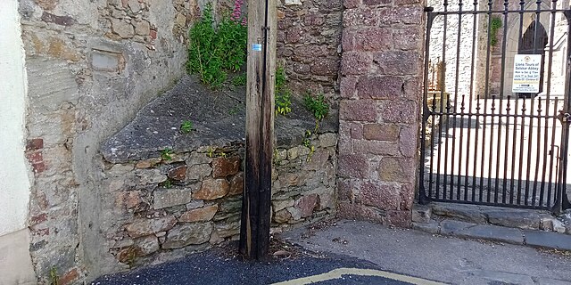
This is one I came across in Wexford, while I was surveying for benchmarks.

An archaeologist I’m friends with posted about them last October, and I had thought since that that would be something to map, but I hadn’t gotten around to it.

The two in Wexford were the first ones I mapped, and I’ve created wiki pages in English and German. I’m using the hashtag #NotTakingThePiss.

I’ve also made a video about mapping some in Kilkenny.

I was able to track down some on wikicommons using Bing Streetview and Mapillary, so there are a couple in Europe mapped now. They must have been used in Arab countries as well, because I found an Arab word for them on wikidata.

See full entry

Location: The North End, Wexford, The Borough District of Wexford, County Wexford, Leinster, Y35 CYD2, Ireland

interesting trip to Co. Sligo

Posted by b-unicycling on 13 May 2023 in English.

Last weekend, I had the opportunity to accompany a friend to an archaeological survey on Ballygawley Lough in Co. Sligo. He’s a metal detectorists who detects on archaeological sites - with a license. Metal detecting is highly restricted in Ireland. There were three divers - one of them had worked on Banshees of Inisheer and Vikings! (At least two of them do diving for movies regularly.) One of the divers doubled as metal detectorist as well, but he also had a sonar device on his canoe. When I had a peak at the screen, I discovered that it was using OpenStreetMap! With attribution! It’s the Lowrance Elite ti2, if anyone is interested. I can’t find any mention of OSM on their website.

There are two crannógs on the lake which was part of why I went with them. I had never seen one in real life, mapped a lot and discovered a few, but never actually seen one. I was offered the spare canoe, but I chickened out when it came to actually paddling over there.

Sallow Island crannóg

See full entry

Location: Ballydawley, Collooney ED, Sligo Municipal Borough District, County Sligo, Connacht, Ireland

Update on mapping milk churn stands

Posted by b-unicycling on 21 April 2023 in English. Last updated on 22 April 2023.

In my last diary post, I had written about the beginnings of mapping milk churn stands. This was kindly featured in the weeklyOSM 662 which resulted in a bit more attention from the OSM community from several countries. Thanks for all your kind comments!

Progress

When I ran an overpass-turbo query on Easter Monday, I noticed a sudden increase of mapped milk churn stands in Finland, a considerable increase (which has still grown more). I checked the changeset history to see who had caused this, found out it was user houtari and sent him a message to thank him. What followed was a very interesting exchange about milk churn stands in Finland. He even sent me a link to a most interesting article in Finnish, kindly translated by a certain popular translation website, but I’ll give you the original link, so you can decide what to use:

It also led us to translate the wiki page into Finnish.

See full entry

Location: Ekonen, Viiskulma, Jämsä, Jämsä sub-region, Central Finland, Mainland Finland, 42101, Finland

Mapping and learning about milk churn stands

Posted by b-unicycling on 21 March 2023 in English. Last updated on 18 May 2023.

About a fortnight ago, I went on a walk/ hike starting in the village of Tullahought, Ireland. There were two milk churn stands in the village which caught my eye, because they were restored and used as decorations and to tell the history of dairying in the area, on a small scale anyway. Tullahought milk churn stand, Author: A.-K. D., CC0 Wikicommons Tullahought milk churn stand, Author: A.-K. D., CC0 Wikicommons

Milk churn stands were used in Ireland (and elsewhere, of course) up to roughly the 1970s. The dairy farmer would leave their full milk churns on them, and someone from the creamery would do their round and pick them all up. They would return the empty churns or churns with skimmed milk in them, sometimes also leaving other purchases from the creamery like flour. It is possible that the milk man left smaller churns on the stands in other countries (judging from photographs of milk churn stands in other countries).

See full entry

Location: Pollrone, Tullaghought, The Municipal District of Callan — Thomastown, County Kilkenny, Leinster, Ireland

So, I went to visit a friend in Westport, Ireland for a few days, stopping in Dublin on the way. I tracked all the bus routes and painstakingly added them to OSM during my stay and when I got home. There were five bus routes in total:

  • bus 760 from Dublin Airport to Galway
  • bus 456 from Galway to Westport
  • bus 450 from Westport to Murrisk and back
  • bus 450 from Westport to Dooagh on Achill Island and back
  • bus 440 from Westport to Athlone
  • bus 73 from Athlone to Kilkenny

See full entry

Location: Cahernamart, Westport Urban Electoral Division, Westport-Belmullet Municipal District, County Mayo, Connacht, Ireland

Mapping National monuments of Ireland

Posted by b-unicycling on 16 February 2023 in English.

As hinted at in my last diary post, I had taken up mapping National Monuments in Ireland using the key ref:IE:nm (as documented in the wiki). I can’t quite remember when I started and how and why, but I think I noticed the numbers in the National Monuments calendar which was kindly sent to me by Jean Farrelly from the National Monuments Service (I presume in recognition of my engagement with them in the shape of reporting possible unknown monuments).

According to ohsome.org, I started on January 20th which happens to be the same day I created the wiki page, makes perfect sense. I “finished” (see TODO below) with Co. Tipperary yesterday.

The first numbers, I added from above mentioned, beautiful calendar (and the 2022 one), but of course, that only gives you roughly 12 per year. (Some beautiful sites are repeatedly presented, apparently.)

See full entry