
How Lyft discovered OpenStreetMap is the Freshest Map for Rideshare
於 2021年二月 9日 由 clarecorthell 以English發表。Mark Huberty & Clare Corthell, Lyft Mapping
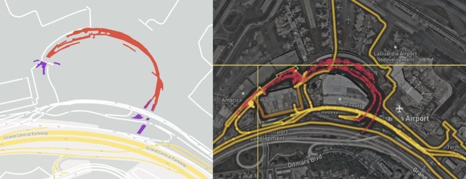 Roads to the new terminal at LaGuardia Airport opened in July 2020, evidenced by aggregate Lyft traffic (left). OpenStreetMap data had been updated (right) shortly after opening, faster than many other maps.
Lyft Mapping study shows crucial OpenStreetMap road attributes are fresh and high quality in 30 North American cities, as compared to groundtruth.
Lyft moves people — from home to work, work to play, play to rest, through cities and beyond. Maps play a critical role, helping Lyft figure out where drivers and riders are, how best to connect them, and estimate how long it will take to get to the destination.
… 查看完整日記項目