OpenStreetMap logo OpenStreetMap

dle0's Diary

Recent diary entries

Queensland DCDB as an iD background

Posted by dle0 on 16 May 2015 in English.

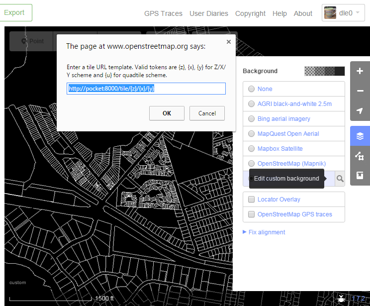
Over the last week I wrote a tiny tileserver. This was to serve my home state’s digital cadastre as a background tileset for iD editing.

iD editor with DCDB background

The data comes from a ‘lite’ version of the Digital Cadastral Database (DCDB). This is released by the state of Queensland under a Creative Commons attribution licence that allows sharing and transformation. The requirement is that the string © State of Queensland (Department of Natural Resources and Mines) 2015 be used for attribution, and indicate if changes were made.

So, I’m using it to fine-tune the entry of OSM landuse polygons in my local area. This is important when park boundaries are obscured by trees, or to avoid parallax errors in rooflines when tracing dense commercial areas.

See full entry

video and my tracks

Posted by dle0 on 4 October 2010 in English.

My latest trick is to prop my smartphone up on the dash and have it record video while it also does a track. Then I narrate the streets while I drive. This seems to work for about one hour of driving. The phone also gets pretty hot, which is disturbing.

Audio cut out at about 1 hour 15 so while I had video and a track, I don't know what the roads were at the end. I guess I'll have to redo that section one day.

Pleasant Grove Blvd

Posted by dle0 on 2 October 2010 in English.

There's a great big divider down PG Blvd which wasn't mapped, so I experimented tonight with propping up my android phone on the dash and videoing a drive down it. That let me go back and split the road properly. Woo! I must see later if I can run My Tracks at the same time as the video because it works really well dictating the names of shops and things that I see along the way.

Location: Pleasant Grove, Utah County, Utah, 84062, United States