OpenStreetMap logo OpenStreetMap

escada's Diary

Recent diary entries

Wer sind Sie?

Mein Name ist Sarah, ich komme aus Deutschland und wohne in Dresden. Ich habe Informatik studiert und arbeite hauptberuflich als Softwareentwickler für ein kleine Firma hier. In OSM bin ich unter dem Nicknamen lonvia unterwegs. Das ist ein Wortspiel mit der lateinischen Form von ‘lange Reise’.

Lonvia ## Wann und wie haben Sie OpenStreetMap entdeckt?
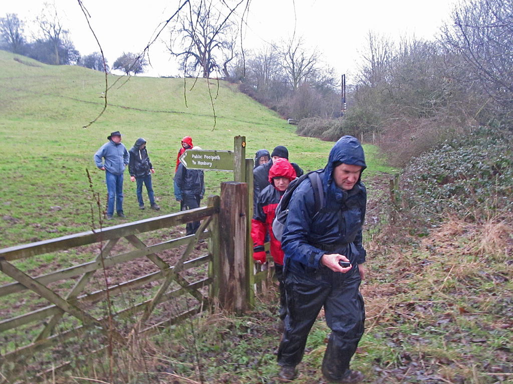
See full entry

State of the Map : Some BoF sessions

Posted by escada on 14 October 2016 in English.

Until now, I did not find the time to report on some of the Birds of a Feather sessions in which I participated during the State of the Map in Brussels last month. A Birds of a Feather (BoF) is an informal session which can be filled in by the presenters as they wish. I visited two BoF sessions on Sunday, one about PT-assistent and one about Kartotherian.

PT-assistent

PT-assistent is a JOSM-plugin for the validation and correction of public transport routes. It was developed during a Google Summer of Code project, mentored by Polyglot and implemented by Darya. Hence, it was not surprising that they lead the session. Polyglot is a long time member of the Belgian community and is responsible for a lot of public transport mapping in our country. He started by introducing some of the problems he has with maintaining public transport (bus and tram) routes and the repetitive correction work for routes running over the same OSM ways.

Since someone in the audience was an avid public transport mapper in the Dortmund area, Darya started the demonstration of the plugin in that area. And low and behold, several problems where detected. We tried to find solutions for the problems, but for some one needs to do a local survey. Others were easily fixed, either manually or by the plugin.

The main power of the plugin is that a fix (done manually or automatically) can be repeated for all other routes that have the same problem in the same spot. One comment was that some of the automated fixes was too much “magic”, but even without it, the plugin is great for locating problems.

The plugin only works for public transport routes of version 2. The people interested in the plugin know what this means.

Great tool to put in your belt ! And great presentation as well, thanks Polyglot and Darya.

Kartotherian

See full entry

Ramblings about State of the Map

Posted by escada on 26 September 2016 in English. Last updated on 27 September 2016.

This was my first State of the Map. That is if you do not count my virtual visits to all previous ones via the video sessions I have seen afterwards.

In this diary entry I will not write about the individual sessions, I keep that for another entry.

Let me start by congratulating the organisers and the volunteers for a great experience. Furthermore a big thank you to all people that did a presentation. I found the talks that I followed of a high level. That is they were informative, entertaining and brought by passionate people. Something I have not seen in other (non-OSM-related) conferences that I visited.

What I did wrong was that I visited too many sessions that are recorded and not enough bird of a feather (BoF) sessions. The ones that I visited (Public transport plugin for JOSM and Wikimedia’s Kartotherian) were very interesting.

It was good to see people that I only met virtually before, either via a forum, a Mapper of the Month interview or as part of the Weekly OSM team.

BTW, a big applause to my colleagues of the Weekly OSM/Wochennotiz team for winning the Influential writer award. It’s a pity that the SOTM team nor the OSMF team made more publicity about the winners of the awards (e.g. live via Twitter). Because I was in a BoF at that time, I still don’t know the other award winners.

Update: They are now listed on https://blog.openstreetmap.org/2016/09/26/we-have-our-winners/

I should also have been braver to talk to more people, but what do you say to famous people like Andy Allen or Frederik Ramm? Anyhow, if I would have talked to you, I would have thanked you for your hard work for OSM and for the “courage” to continue with your work for carto-css or “promotion” for craftmappers despite all critiques.

As for the OpenStreetView team, I love to have discussed the de-blurring in the website. For what I do (mapping destination signs), it’s a necessity and should take far less time than in Mapillary.

See full entry

Mapper of the Month: SomeoneElse (United Kingdom)

Posted by escada on 9 September 2016 in English. Last updated on 10 September 2016.

Mapper of the Month: SomeoneElse

Who are you ?

I’m Andy, and I live in Derbyshire, in England. Since leaving college many years ago I’ve been working in the computer software industry (mostly development and implementation). The “SomeoneElse” name came from the music site last.fm - it was just an alternate playlist to the normal one (as if literally “someone else”).

Staffordshire new year 2015 mapping walk.jpg Photo by SK53 License: CC BY-SA

When and how did you discover OpenStreetMap ?

I’ve always done quite a lot of walking, including “long distance walks a bit at a time”, and while on one of those the display on the GPS that I’d been using was failing. I was looking for somewhere to store the POIs that I had (villages, pubs etc.), and found OSM.

What do you map ? Is there any difference with your early days ?

It’s still mostly footpaths, bridleways and pubs :)

How do you map ?

See full entry

Jorieke, a 28 years old Belgian, has spend a lot of time the past few years to support local OpenStreetMap communities all over the world. She worked on several projects in Africa, Europe and Asia to train people and to promote OpenStreetMap by local and international players.

Jorieke at the  Mapfugees in Duinkerke

Where and when did you discover OpenStreetMap?

See full entry

Jorieke (osm.org/user/Jorieke%20V) , 28 jaar en Belgische, spendeerde de afgelopen jaren veel van haar tijd aan het ondersteunen van lokale OpenStreetMap-gemeenschappen overal ter wereld. Ze werkte voor verschillende projecten in Afrika, Europa en Azië om mensen te trainen en OpenStreetMap te promoten bij lokale en internationale actoren.

Jorieke bij de Mapfugees in Duinkerke

Waar en wanneer ontdekte je OpenStreetMap?

See full entry

Who are you ?

I’m Jinal Foflia from Bengaluru, India. In my free time you’ll see me playing with words which turn into poetries, an amature baker and always trying to make something creative out from the waste. I’m an engineer and currently work at Mapbox as a Data Analyst.

When and how did you discover OpenStreetMap ?

I heard about OpenSteetMap from a friend, there was a discussion about how precise can a map be and that’s when my friend pointed out to OpenStreetMap and stated that ‘you can make this map as precise as you want it to be’. I was curious about it and tried to research about it. Coincidently, after a while I joined Mapbox where I was given a broader perspective about OpenStreetMap and also got a chance to meet some very interesting folks who have immense passion towards OpenStreetMap and have been contributing for years. With all the guidance I started my mapping journey.

What do you map ? Is there any difference with your early days ?

I begun by adding points of interests in Bengaluru, then eventually jumped into tracing roads and understanding their hierarchy and classifications. It was very interesting to know that what we see in reality is no different from what we map. This gave me a lot of understanding about how cities are planned and how different each city is from the other in terms of planning and road networks. Currently I have started mapping turn restrictions and turn lanes. With my experience in OSM, I must say that relationships are complicated here too ;-)

How do you map ?

I’m lucky that my profession allows me to map, other than the mapping that I do with the team, I go for field mapping using field papers in and around my neighbourhood, trying to collect ground data and add that to the map. We also started our first mapping party on the world environment day (5th June), currently there are just two members, but we are hoping for more people to get involved and be a part of it.

See full entry

Can you introduce yourself ?

I have several occupations, and I appreciate that they are in very different domains, althought, it might be tiresome from time to time:

  • I am a software developer at Champs-Libres, where a part of the activities is related to geography. We regularly use data from OpenStreetMap. We also install tile server, Nominatim, etc. Officially this is supposed to be a part-time job, but in reality, it takes much more time.
  • I studied journalism, but after my studies I’ve always been a community worker. I also work part-time as coach for unemployed women at a feminist association.
  • I have been (and sometime I am still) active in several different associations and movements such as GRACQ, which defends the rights of cyclist, de scouts, some unions, …

Last, but not least I am a father and I love spending a good part of my life on that !

Julien

How and when did you discover OpenStreetMap ?

See full entry

Wat doe je in het dagelijkse leven ?

Ik heb meerdere bezigheden, en ik apprecieer het erg dat ze in zeer verschillende domeinen zijn, zelfs als me dat af en toe vermoeit:

  • Ik ben software ontwikkelaar bij Champs-Libres, waar een deel van onze activeiten verbonden is met geografie. We gebruiken daarbij regelmatig data van OpenStreetMap. We installeren ook tile servers, Nominatim, enz. Officieel zou dit een deeltijdse baan moeten zijn, maar in werkelijkheid, neemt het veel meer tijd in beslag.
  • Van opleiding ben ik journalist, maar sinds ik mijn studies heb afgerond ben ik maatschappelijk werker. Ik ben eveneens deeltijds te werk gesteld als begeleider van werkzoekenden in een feministische vereniging.
  • Ik ben ook medewerker geweest (en soms nog) van allerlei verenigingen of bewegingen: GRACQ (fietsersbond), de scouts,vakbonden, … Ik ben eveneens vader en daar spendeer ik ook een mooi deel van mijn tijd aan !

Julien

Hoe en wanneer hebt u OpenStreetMap ontdekt ?

See full entry

Qui es-tu ?

J’ai plusieurs activités, et j’apprécie beaucoup qu’elle soient dans des domaines très variés (même si, parfois, ça me fatigue un peu) : Je suis développeur à Champs-Libres, où une partie de nos travaux sont en lien avec la géographique. On ré-utilise fréquemment les données de OpenStreetMap (OSM). On met également en place des serveurs carto, nominatim, etc. Ça me prend officiellement un mi-temps, mais en réalité, c’est beaucoup plus. J’ai fait des études de journalisme, mais depuis que j’ai quitté l’école, j’ai été travailleur social. Je suis employé également à mi-temps comme formateur avec des demandeuses d’emploi, dans une association féministe. J’ai également été (et parfois je le suis encore) engagé dans beaucoup d’associations ou de mouvements : le GRACQ (Groupe de Recherche et d’Action des Cyclistes Quotidiens, syndicat des cyclistes), les scouts, des syndicats, … Je suis également papa et ça me prend une autre belle partie de mon temps !

Julien

See full entry

Mapcontrib

Posted by escada on 18 June 2016 in English.

I just started playing with MapContrib made by Guillaume AMAT from France. It’s a great tool to create dedicated webpages (or apps if you want) for certain tags.

Here I made one for dog parks

MapContrib Dog Parks http://www.mapcontrib.xyz/t/5d562c-Dog_Parks

You can also allow other people to edit the map data in the way you want. They can change existing data or add new, in this case dog parks

See full entry

Q: Who are you ?

Pete Masters

I am Pete Masters (OSM: pedrito1414 - a hangover from my time living in Mexico). I live in Glasgow and work for MSF, running the Missing Maps project. I am a fairly rubbish climber, a regular footballer and get out to the lochs and mountains as much as possible.

Q: When and how did you discover OpenStreetMap ?

As a user. I have travelled extensively with my various jobs and OSM and associated apps are indispensable. I can never understand why someone heading abroad wouldn’t have OsmAnd or similar on their phone!

Q: What do you map ? Is there any difference with your early days ?

As a contributor, I guess I am a relative newbie. My mapping started with HOT mapping and then Missing Maps of course. The biggest difference? My eyes. It continues to amaze me the level to which we can train our eyes to pick out detail in satellite imagery….

Q: How do you map ?

See full entry

Wie ben je ?

Stijn Rombauts is 37 jaar, bio-ingenieur van opleiding en werkt bij de Vlaamse Milieumaatschappij, waar hij computermodellen van waterlopen bouwt en onderhoudt, die gebruikt worden in overstromingsvoorspellers of bij het ontwerp van wachtbekkens of vistrappen e.d. Omdat hij voor z’n werk meestal achter de computer zit, probeert hij in z’n vrije tijd zoveel mogelijk actief buiten in de natuur te zijn: te voet, met de mountainbike of in de kano.

Stijn Rombauts

Wanneer en op welke manier leerde je OpenStreetMap kennen ?

Vooral als mountainbiker ben ik altijd op zoek naar de interessantere onverharde paden en wegen en ik geraakte op den duur teleurgesteld in de (gedateerde) kaarten van het NGI. Veldwegen en bospaden hebben nogal te nijging te verdwijnen, ergens anders terug te verschijnen of te verharden. En zo ben ik ergens in de herfst van 2012 op OpenStreetMap gebotst: een kaart die op dat vlak vaak nog wel een pak slechter was en is, maar waar ik tenminste zelf kan aan bijdragen.

See full entry

Stijn Rombauts is a 37 year old bio-engineer who works for the Flanders Enviroment Agency, where he builds and maintains computermodels of streams and rivers. Those models are used to predict floods and to plan of e.g. fish steps and waiting basins. Because he spends a lot of time in front of the computer for his job, he tries to be active, in the nature, during his spare time: be it on foot, with the mountain bike or in a canoe.

Stijn Rombauts

How and when did you discover OpenStreetMap ?

As a mountain biker, I am constantly on the lookout for interesting unpaved paths and roads. In the end I got disappointed in the dated maps of the NGI. Field roads and forest paths have the tendency to disappear and to reappear elsewhere or to become a paved way. This lead me to OpenStreetMap, somewhere in the autumn of 2012. A map that was often worse with respect to those unpaved roads, but at least I could improve it myself.

Do you Use OpenStreetMap ?

See full entry

National Missing Maps mapathon

Posted by escada on 16 April 2016 in English.

Today, the geography departments of 7 Belgian universities organised a national missing map mapathon. We had about 190 subscriptions divided over 7 locations in Ghent, Brussels, Namur, Liège and Leuven. The organizers had contacted the press (written, radio and TV). So after hearing about the mapathon on the radio a few more people show up.

The team in Ghent

We were lucky enough to find enough experienced mappers to give introductions and help the people in all locations. I had the honor to do that for the session in Ghent. This was my first time, after just helping out on 2 previous missing map parties.

A chat channel was set up so the organisers could stay in contact and around noon we had Pete Masters tuning via Skype to give some background on the projects.

See full entry

Location: Nieuw Gent, Ghent, Gent, East Flanders, Flanders, 9000, Belgium

Wie ben je ?

Een toevallige mapper met oog voor oude militaire linies. Ik woon midden in de [Nieuwe Hollandse Waterlinie]((https://en.wikipedia.org/wiki/Hollandic_Water_Line). Dat was als potentieel cultureel erfgoed nauwelijks terug te vinden in OSM. Niet alleen de bekende Laaglandse Forten met lunetten en redoutes die in de Lage landen gemaakt werden, ontbraken, maar zeker de details als schuilplaatsen, sluizen en bruggen. Voor een voorbeeld van sluizen verwijs ik naar Nieuwpoort.

Nieuwpoort

Ik maakte bestekken en tekeningen naast het schrijven van beleids- en adviesstukken. Ik ben zo een die je lachend een parkeervergunning aansmeert en die als je protesteert tegen de te betalen kosten achteraf zegt, ja dat kan, maar niet op dit 2 jaar oude legesbesluit. Het aardige is dat, als je nog niet onder de vergunning valt, je ook geen bezwaar kunt maken “niet gegrond”. Maar die uitleg wordt wel geaccepteerd, dat scheelt ;-)

Mijn hobby’s:

See full entry

Who are you ?

I am a casual mapper with an interest in old military lines. I live in the middle of the New Dutch Water Line and noticed that this potential cultural heritage is found barely in OSM. The famous Low Lands Forts with lunettes and redoubts that were made in the Low Countries, with details such as shelters, locks and bridges. For locks, I would just point to Nieuwpoort for a representative example. Nieuwpoort Professionally, I made specifications and drawings in addition to writing policy and opinion pieces. I am one of those that introduce a new parking permit with a smile and if you protest against the costs, says, yes you can complain, but not at this 2 year old act. The nice thing is that if you are not covered by the license, you can not object. But that explanation is accepted, that helps ;-)

My Hobbies:

See full entry