Start of the admin boundries for albania
Käyttäjä h4ck3rm1k3 kirjoitti tämän 5. tammikuuta 2010 kielellä English.From the ADM1/ADM2/ADM3 values, I have split albanian into sections.
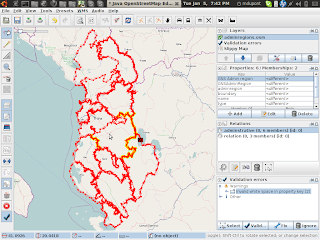
From those files, I have hand traced the borders of the regions in albania.
Instead of archive org, I am using bitbucket.
http://bitbucket.org/h4ck3rm1k3/openstreetmap-albania/
That way we can make changes to the file.
Data :
http://bitbucket.org/h4ck3rm1k3/openstreetmap-albania/
Splitter :
Using saved push location: bzr+ssh://bazaar.launchpad.net/~kosova/%2Bjunk/openstreetmapkosova/
Pushed up to revision 109.
Keskustelu