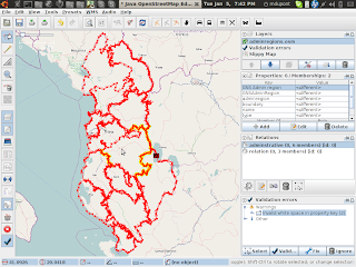
OpenStreetMap logo OpenStreetMap

h4ck3rm1k3's Diary

Recent diary entries

Web guru Berners-Lee highlights open data
http://www.masshightech.com/stories/2010/01/11/daily9-Web-guru-Berners-Lee-highlights-open-data.html

"Data has already become more openly available in categories like mapping, government and scientific research, Berners-Lee said.

He pointed to OpenStreetMap, a free, wiki world map online that, unlike proprietary services such as Google Maps or Mapquest, does not claim ownership of edits or overlays generated by users and developers.

Life sciences researchers, in particular, have made strides toward standardization of data so that it can be used outside traditional research boundaries, he said."

I have made progress on mapnick.

It seems they have implemented this dynamic language
for all things, there is no way that it can be fast as native code.

I am dreaming of turning this expression language into a code generator
so we can use the gcc to unroll loops and to optimizations instead of reinventing the wheel. there is no way that this can be fast.

The c++ demo has been autotoolized
it compiles after I fixed the code that has been broken over time
looks like no one uses it.

run like this :
mapnik/demo/c++$ ./cppdemo .
running demo ...
looking for 'shape.input' plugin in... ./input/
looking for DejaVuSans font in... ./fonts/DejaVuSans.ttf
### Configuration error: Could not create datasource. No plugin found for type 'shape'

It seems that I need to configure something properly.
I have to say that my next task will be to remove all these shared objects
we should be able to run mapnik without installing it.

code committed:
http://github.com/h4ck3rm1k3/MapNickAutotools/commits/master

Working on libredwg

Posted by h4ck3rm1k3 on 6 January 2010 in English.

The libredwg is the reader tool for reading dwg files.
http://www.gnu.org/software/libredwg/

I have a patch for it to make it c++
https://savannah.gnu.org/patch/index.php?7057

am going to fix it to work with the dwg files I have.

And now I am working on getting this tool to run the dwg files

Here are my tests:
https://savannah.gnu.org/bugs/?28504
https://savannah.gnu.org/bugs/?28503

https://savannah.gnu.org/bugs/?28502
for that file, you can find the dxf here :
http://www.openstreetmap.pl/balrog/Planimetria_de_Vitoria.zip

So we have the input and the output, maybe that will help.

here is my patch :
https://savannah.gnu.org/patch/?7057

mike

From the ADM1/ADM2/ADM3 values, I have split albanian into sections.
From those files, I have hand traced the borders of the regions in albania.

Instead of archive org, I am using bitbucket.
http://bitbucket.org/h4ck3rm1k3/openstreetmap-albania/

That way we can make changes to the file.

Data :
http://bitbucket.org/h4ck3rm1k3/openstreetmap-albania/

Splitter :
Using saved push location: bzr+ssh://bazaar.launchpad.net/~kosova/%2Bjunk/openstreetmapkosova/
Pushed up to revision 109.

Location: Derstilë, Gjinar, Elbasan Municipality, Elbasan County, Central Albania, 3014, Albania

http://www.ipsnews.net/news.asp?idnews=49883
KENYA: Mapping An African Slum
By Susan Anyangu-Amu

NAIROBI, Jan 4 (IPS) - In early November, a group of explorers set out to map a blank space in Africa’s map. Twelve youths armed with global positioning system (GPS) devices made the rounds of the Nairobi slum of Kibera.

The teens are working with an organisation called OpenStreetMap to create a public map of their neighbourhood, seven kilometrs southwest of the city centre. It is the second-largest informal settlement in Africa, after South Africa’s Soweto township.

osm.org/?lat=-1.31667&lon=36.78333&zoom=15&layers=B000FTF

Location: Gatwekera, Nairobi County, Kenya

I have gotten the dxf2osm running, it does the
vitoria brasil well, producing the streets. It loads into josm, but needs alot of memory.

I have checked all the source code to github in the TwoNickels project, a branch of dime.

The data is uploaded here , the file is
http://www.archive.org/details/VitoriaOpenstreetmapData

Update: Added map!


Location: São Cristovão, Vitória, Região Geográfica Imediata de Vitória, Greater Vitória, Região Geográfica Intermediária de Vitória, Espírito Santo, Southeast Region, Brazil

cs2cs help

Posted by h4ck3rm1k3 on 2 January 2010 in English.

I am doing the coord transform like that :

echo 358376.5 7753537 | cs2cs -v +proj=utm +south +ellps=intl +zone=24K +units=m -f "%.7f"a
# ---- From Coordinate System ----
#Universal Transverse Mercator (UTM)
# Cyl, Sph
# zone= south
# +proj=utm +south +ellps=intl +zone=24K +units=m
# ---- To Coordinate System ----
#Lat/long (Geodetic alias)
#
# +proj=latlong +ellps=intl
-40.3564136a -20.3105983a 0.0000000a

and it works, but now I want to do this in c++

see the code in MText.cpp
http://github.com/h4ck3rm1k3/TwoNickels

void convertPoint(double x, double y, double & rx, double & ry) 

{
projPJ pj_merc, pj_latlong;

if (!(pj_merc = pj_init_plus("+proj=utm +south +ellps=intl +zone=24K +units=m")) )
exit(1);

if (!(pj_latlong = pj_init_plus("+proj=latlong +ellps=intl")) )
exit(1);

point_offset, double *x, double *y, double *z );
double ax[1], ay[1], az[1];
ax[0] = x * DEG_TO_RAD;
ay[0] = y * DEG_TO_RAD;
az[0] = 0;

/** end of "caution" section. */

pj_transform(pj_merc, pj_latlong, 1, 1, ax, ay, az);

//printf("%.4f\t%.4f -> %.4f\t%.4f\n", *lat, *lon, y[0], x[0]);
rx = ay[0];
ry = ax[0];

}

Program produces ERROR::
node id='-905' version='1' ' lat='-26.92552447' ' lon='0.01349053807'
k='easting' v=358360.6875
k='northing' v=7753529

Please help!

mike

TwoNickels a branch of dime

Posted by h4ck3rm1k3 on 2 January 2010 in English.

I have created a working branch of dime that I intend to reintegrate at some later time.
http://github.com/h4ck3rm1k3/TwoNickels

The autoconf now works with the standard gnu tools, at the expense of the msvc hacks that I have removed. It will not do any special msvc stuff anymore that broke automake.

Now I am turning the dxf2vrml into a dxf2osm and you are all welcome to help.

mike

Brasil Coordinates Transform

Posted by h4ck3rm1k3 on 1 January 2010 in English. Last updated on 2 January 2010.

Skippern asked me to help him with some autocad files of Vitoria, ES, Brasil.
They were donated in an unreadable format.
I had asked who could convert the file, and Balrog-Kun was able to do that very quickly. osm.org/user/balrog-kun
osm.org/user/h4ck3rm1k3/diary/9096

Then I had the dfx files, which are ascii records. with the tool from dime dxf2vrml/dxf2vrml I could convert the dfx to vrml, which gives me the points and the ways, no names.


See full entry

Location: Enseada do Suá, Vitória, Região Geográfica Imediata de Vitória, Greater Vitória, Região Geográfica Intermediária de Vitória, Espírito Santo, Southeast Region, Brazil

Millions of data points donated from Logistics Plus http://www.logisticsplus-ks.com .

We have now a huge set of good points for kosovo :
http://www.archive.org/details/GpsDataFromKosovoDatapoints

I have converted them from the sql format to nodes,
now we are going to use them to trace streets.

More points coming, with timestamps and truckids,
we should be able to create gpx from that as well.
mike

Location: Dardania, Pristina, Municipality of Pristina, District of Prishtina, Kosovo

Openstreetmap in the news, 31.12.09

Posted by h4ck3rm1k3 on 31 December 2009 in English.

Happy new year all !

http://www.marketingvox.com/top-web-30-trends-for-2010-045869/

Openstreetmap.org is about people mapping everything worldwide from great hiking routes to ski runs or and wine tours. Gatt describes it as a kind of wiki of special interest maps.

http://www.vizworld.com/2009/12/demand-content-delivery-2010/

Another major player this year was open data. Open Street Maps (and its licensing struggle) and Britain’s Ordnance Survey take the cake. As Gary Gale writes, “The people behind OpenStreetMap believe in open data, the people behind the Ordnance Survey want to believe in open data and I believe in the GeoVation Challenge … 2009 seemed to be less about technology and more about communities and people, and that means a lot of belief.” If you think that’s a load of hooey, call me the next time your Garmin dumps you in a lake. Real, open communities foster good content.

Further geo-enabling the web, the Open Geospatial Consortium’s OpenGIS matured, with almost 400 global governments, companies and schools coming together to enhance publicly-available standards and interoperable solutions.