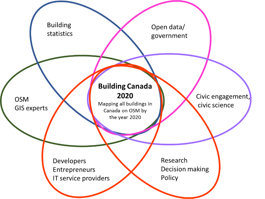
I’ll be participating in the Building Canada 2020 community-led initiative.The goal of this project is to map and digitize every building in Canada on OpenStreetMap by 2020. Creating a free publicly accessible, non-proprietary source of GIS information that stretches from coast to coast to coast.
There is an estimated 10-15 million buildings in Canada that need to be digitized in OpenStreetMap. Over 2 million Canadian buildings have already mapped!