OpenStreetMap logo OpenStreetMap

malenki's Diary

Recent diary entries

During preparing my holidays for Albania (Shqipëria) I found a nice mini howto for creating contourlines. This is just a short writeup for mostly note2self and reinforcing the memory of it for the next time. :)

First I fetched the SRTM Data by a list I created from the files visible here: http://dds.cr.usgs.gov/srtm/version2_1/SRTM3/Eurasia/ - the list looks like this:
N00E072.hgt.zip
N00E073.hgt.zip
Here Nxy and Exy show the lat/lon of the region which the contained SRTM data covers.

for i in $(less list); do wget http://dds.cr.usgs.gov/srtm/version2_1/SRTM3/Eurasia/"$i"; done

Then I converted them to OSM data using the acommodated commandline from the howto:

[phyghtmap][2] -j 3 --source=view1,srtm1,view3,srtm3 --start-node-id=1 --start-way-id=1 --max-nodes-per-tile=0 --max-nodes-per-way=250 --gzip=9 -s 10 -c 100,50 -a 19:39:21:41 -o SRTM-SQ

I just changed to -j 3 for some parallel processing and the -a 19:39:21:41 which defines the bbox -a LEFT:DOWN:RIGHT:UP.

Running mkgmap on the resulting OSM file gave an error - I found out one has to split that OSM file beforehand:

java -Xmx10000m -jar ~/bin/[splitter.jar][3] SRTM-SQ.osm.gz > splitter.log

Then I ran mkgmap on the split files:

java -jar ~/bin/[mkgmap.jar][4] --transparent --draw-priority=100 --gmapsupp 6324000*

Amongst others a gmapsupp.img is created - the file of my desire.

renaming it mv gmapsupp.img srtm_sq.img
and changing it’s name [gmt][5] -wm "srtm sq" srtm_sq.img
is just a minor tuning.
A short test shows the file works - yay!

Thanks to all the people creating that nice lot of OSS and some documentation!

PS: As (not only I) said: MarkDown sucks!
I used the quite handy editor from help.osm.org, but the code he creates is not fully understood by this blog platform.
Here are the links - not integrated but by footnotes..:
* [1]: http://osm.thkukuk.de/srtm.html
* [2]: osm.wiki/Phyghtmap
* [3]: osm.wiki/Mkgmap/help/splitter
* [4]: osm.wiki/Mkgmap
* [5]: http://gmaptool.eu

Location: Soropull, Frashër, Bashkia Përmet, Gjirokastër County, 6408, Albania

New conclusion on average tracks

Posted by malenki on 28 April 2013 in English.

Second thoughts on the R script average tracks:
Although the algorithm partly doesn’t give the most satisfying output I used the script for some long ways which I was to lazy to draw all the way by hand.
One use case were long highways without aerial imagery, several uploaded logfiles and a very rough mapping so far.
Another was a river which banks were mapped but not the central waterway. Locally I merged and split the riverbanks to get a way each for the left and the right bank and exported them as GPX file from JOSM to be used for the calculation.

In both cases I checked the result closely and reworked it slightly before uploading.

One of the highways, for more look at the changeset.
The part of the river Semani I finished

Da vor zwei Wochen der OSM-Stand für die Abenteuertage zu organisieren war, musste ich für den Stand bei den Linuxtagen nur noch wenig vorbereiten.

Im Vorlauf hatte sich André Riedel dankenswerterweise um das Pflichtplakat gekümmert. Er stellte auch noch kurzfristig den Chemnitzer Stadtplan vom letzten Jahr zur Verfügung, da der Drucker der Geofabrik offenbar einen größeren Defekt hatte und wir deshalb keinen aktuellen Stadtplan zur Verfügung hatten.

Am Stand gab es wieder viele Anfragen. Zu Stoßzeiten konnten wir leider nicht alle Besucher gleichzeitig bedienen, zwischendrin gab es teilweise etwas Leerlauf. OSM-Karten für Garmin-Geräte habe ich wohl fünf Stück kopiert. 25 Anleitungen für das Installieren von OSM-Karten auf Garmin-Geräten wurden mitgenommen. Natürlich war auch OSM für Smartphones gefragt, hier konnte eine via QR-Code erreichbare minimalistische Wiki-Unterseite weiterhelfen. Einige Besucher fragten nach Möglichkeiten, auf nächsten Reisen nach Kuba und Afrika Daten für OSM zu sammeln. Es wurden auch wieder etliche Daten mit Hilfe von Besuchern korrigiert oder neu eingetragen, Anleitung zum Umgang mit JOSM gegeben oder überhaupt ein grober Überblick, was OSM ist, hat, macht und kann.

Die Linuxtage waren wieder sehr gut organisiert, alle Helfer freundlich und hilfsbereit - was mehr kann man wünschen? Sogar der Extrawunsch nach Nicknames auf unseren Ausstellerausweisen wurde berücksichtigt. Obwohl ich aufmerksam nach weiteren Nickname-Trägern Ausschau hielt, konnte ich keine entdecken. Waren wir wirklich die einzigen?

Dank geht an Fuss-im-Ohr für die Unterstützung in Hardwaresachen, an Tim Alder, Rockus und strohi (der trotz einiger Beschwerden anreiste) für die Unterstützung am Stand und beim Auf- und Abbau sowie an André Riedel und Jens Pönisch für die Hilfe bei der Planung und Vorbereitung.

See full entry

Location: Bernsdorf, Chemnitz, Sachsen, 09126, Deutschland

OSM-Stand und GPS-Workshop auf den 4. Abenteuertagen in Glauchau

Posted by malenki on 4 March 2013 in German (Deutsch). Last updated on 25 February 2015.

Im November letzten Jahres fragte ich nach Unterstützung für einen OSM-Stand und Workshop. Die User brust59 und Rockus meldeten sich.

Letztes Wochenende war es soweit.
Am Freitag Abend bauten wir den Stand bei den 4. Abenteuertagen auf. Da das Wetter am Samstag sehr schön war und wir einen Platz an der Sonne hatten, sah der Stand nach leichter Überarbeitung so aus:
Der OpenStreetMap-Stand bei den 4. Abenteuertagen in Glauchau
Bildquelle

See full entry

Location: Glauchau, Zwickau, Sachsen, 08371, Deutschland

Markdown sucks!

Posted by malenki on 17 February 2013 in English. Last updated on 18 February 2013.

Normally this would have been an entry about
Workflow for fixing Wikipedia entries
But since there seems to be no way to display complex xml code in this blogs based on ugly Markdown I have to post that on my site:
http://www.malenki.ch/fp/index.php/2013/02/17/workflow-for-fixing-wikipedia-entries-on-osm/

(edit:added “complex” and removed an unnecessary line)

calculate ways instead of drawing or: a look at "average tracks"

Posted by malenki on 30 October 2012 in English. Last updated on 1 December 2012.

Since I was at it I checked again Average tracks mentioned yesterday.

In the valley of Trenta there is a nice highway with a lot of logs uploaded but it isn’t drawn really nice so far. I downloaded all the GPS data using JOSM, converted it to a data layer and cleaned it so that only good traces remained. Saving the data as gpx again, the resulting file contained nearly fifty tracksegments. I split that file into single gpx files each containing one of the segments. These I converted into csv format since the script wants this format.

A first run on all segments I cancelled after short time remembering the runtime of osm-makeroads. I randomly selected some segments but since some covered only a part of that highway the result was unusable.
So I selected nine segments which covered the same part of the road with a length of 19 kilometres. The duration of the calculation with some seconds was satisfying short. The result itself is not to my liking. Though it is in most parts quite usable I will draw a better way by hand.

Conclusion: Most likely won’t use this script in the future. It is not much advantage from drawing some kilometers of a way to checking and fixing a calculated one over its complete length before uploading.

Used scripts:
gpxsplt *cough*
2csv
2gpx

(Sorry for the big screenshots, but all for the best visualisation :) The yellow line is the averaged track.)

See full entry

calculate ways instead of drawing or: a look at "osm-makeroads"

Posted by malenki on 30 October 2012 in English. Last updated on 20 March 2013.

(Hint: first read, then install. Maybe you won’t need this tool at all)

Since my last holidays again resulted in tons of gpx-logs, I once more looked for a way to reduce the time I spend tracing them. Last year I tried Average tracks but wasn’t too satisfied although I can’t recall now exact reasons.

Nevermind, this year I remembered having read on the german weekly OSM notices about osm-makeroads.

The readme seems helpful at the first sight but (at least for me) there were some traps. Since R complained about some missing stuff, I had to install additionally libproj-dev and gfortran. The installation of tools at debian is the following: apt-get install libproj-dev gfortran r-cran-maptools gpsbabel libgdal-dev

The command of the readme to install the R-libraries did not work on my system. I figured out I could successfully install them as user by opening the R shell (by typing “R” in a terminal emulator) and installing the libraries one by one with these commands:

install.packages(“princurve”,dependencies = TRUE)
install.packages(“rgdal”,dependencies = TRUE)
install.packages(“geosphere”,dependencies = TRUE)

Now I could run the script. Only - how…?

First, I saved the files in a folder where I store binaries and scripts, let it be /bin here.
A bit googling and guessing gave me the line with which the script starts:
R -e “source(‘/bin/process.R’)”
Now it complaints that it cannot find makeroads.R, so I substituted the path to the location of makeroads.R
source(‘makeroads.R’) with
source(‘/bin/makeroads.R’)
in process.R

Now I could finally run the program. Yeah! But I was a little surprised to find out it calculates only ways it can fetch for a defined bounding box from OSM. (Yes, you may call me an unalert manual reader.) Since the calculated result looked good I decided to go on since I invested quite some time already.

See full entry

In letzter Zeit hat Garmin für die 62er/78er Serie mehrere Firmware-Updates herausgegeben, die neue Funktionen mitbringen.

“Offizielle” neue Sprachdateien gibt es dagegen nicht - die aktuelle deutsche hat die Version 2.90. In den Beta-Firmware-Paketen sind ab und an neuere Versionen zu finden. In der aktuellsten (Beta 4.10) gibt es die deutsche Sprachdatei in Version 3.00. Doch auch diese ist weder fehlerfrei noch vollständig.

Zum Beispiel fehlt die Übersetzung für den Bildbetrachter (Photo Viewer), der im Oktober 2011 mit der Firmware 3.50 eingeführt wurde; zwei Strings sind dafür doppelt vorhanden:

  • TXT_Prompted_STR_M
  • TXT_Setup_Camera_STR_M

Wer mag, kann meine Version der deutschen Sprachdatei vwerwenden.

OSM-Diashow

Posted by malenki on 15 April 2012 in German (Deutsch). Last updated on 23 April 2012.

Seit gestern gibt es eine nette Diashow im OSM-SVN.

Im September letzten Jahres fragte Frederik Ramm auf talk-de nach Fotos für eine auf der Intergeo zu zeigenden Diashow. Aus den gespendeten Bildern und vielen der Featured Images vom OSM-wiki erstellte er die Diashow.

Für die diesjährigen Chemnitzer Linuxtage bat ich Frederik Ramm nach der Diashow, die er gern bereitstellte. Ich fügte noch ein paar meiner eigenen Bilder hinzu.

Auf den Chemnitzer Linuxtagen projizierten wir die Bilder mit einem Beamer auf eine Leinwand. Es war zu beobachten, dass viele der Vorübergehenden von der Show angezogen wurden und stehenblieben, um weitere Fotos zu sehen. Einige sprachen uns auch direkt darauf an und meinten, dass einige der Bilder bemerkenswert seien.

Jetzt für jeden verfügbar! :)

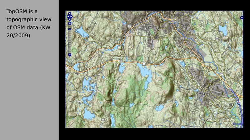
from the OSM wiki: Featured Image of week 20/2009 as part of a slideshow

OSM slideshow

Posted by malenki on 15 April 2012 in English.

Since yesterday there is a nice slideshow at the OSM-SVN. Last year in September Frederik Ramm asked at talk-de for photos to show as slideshow at the Intergeo. From the donated photos and a lot of the Featured Images of the OSM-wiki he created the slideshow.

For the this year’s conference of the Chemnitzer Linuxtage I asked Frederik Ramm for the show which he was happy to share. I added some of my own photos.

At the Chemnitzer Linuxtage was to observe that a lot of passersby were attracted by the show projected by a beamer and stopped to watch. Some also mentioned directly that they were impressed by it. So now it is there for all of you. :)

from the OSM wiki: Featured Image of week 20/2009 as part of a slideshow