
Almost 3 years ago, we did a rough import of coastlines for the Philippines. The data came from the 90m pixelled SRTM converted to vector lines. Since this data came from a raster source, outlines appear jagged like a staircase, which we called as saw-tooth coasts.
The objective then is to provide a small-scale outline of the coasts and allow mappers to improve them (by using LANDSAT or PGS data). The problem persists to this day because, editing coastlines is too tedious and in some cases, dangerous.
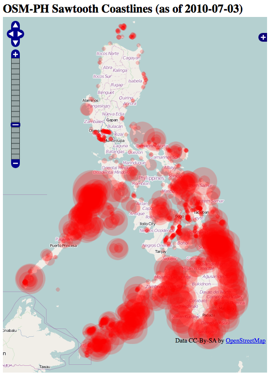
In order to easily identify where the sawtooth problem occur, we created a simple webmap .
Large circles means more jagged steps.
More mappers are needed to nuke the sawtooths. If anyone wants to help, see details here: osm.wiki/WikiProject_Philippines/Coastline_Corrections
Discussion
Coment di maning ai 19 di July 2010 a lis 11:26
Thank you to all those helping out. We nearly nuked 25% of the sawtooth segments. Less the 1,000 segments to go!
Coment di maning ai 24 di July 2010 a lis 01:20
here's how to use the sawtooth webpage and josm
http://vimeo.com/13546210