
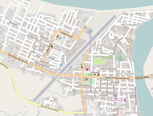
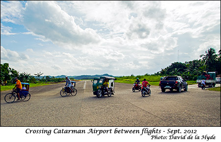
The first time I saw this in the map, I’ve always thought it was an editing mistake. This is Catarman Airport in Northern Samar, Philippines. What looks to me as a bug is the secondary road intersecting with the airport’s runway! Surely an editing mistake. But since I haven’t been there and the satellite image is too coarse, I cannot verify if this is indeed the case.
Yesterday, I had a chance to talk to locals familiar in the area and they indeed verified that this is correct. The airport services one or two flights a day. Vehicles are allowed to cross the runway in between flights similar to a railway level crossing. Aerial shots from wikipedia and from another website confirms this as well.

My question is, how do I tag this? Surely, there are similar situations in other areas.
討論
由 TomH 於 2015年05月15日 10時07分 發表的評論
It’s not the only one by a long shot - have a look at Gibralter or Sumburgh to see how it’s done there.
由 Larry0ua 於 2015年05月15日 12時25分 發表的評論
Should be a level_crossing :) Anyway it should be tagged somehow with a note=yes, it’s really a highway crossing a runway