maning's Comments
| Post | When | Comment |
|---|---|---|
| RoboSat ❤️ Tanzania | Following this guide, I got the following results. Hard negative mining helped a lot.
|
|
| Nodes in Asian cities in the last 10 years | @planemad, @SimonPoole, Thanks! This make sense now. Re: charts, I use the basic charting of matplotlib, will share code later. |
|
| Bogo OpenStreetMap Workshop | Awesome work! Its so nice to see that we continue remote mapping + fieldwork + local participation in all our OSM training. Love the bibingka approach! |
|
| Batangas City: Big changes | Great work! The jeepney routes looks really nice. Hit me if you have questions. Keep on mapping! |
|
| Passive data for OSMing | @Sunfishtommy , Strava heatmap are available in iD and JOSM as background layer. See this entry in the wiki: osm.wiki/Strava#Data_Permission_-_Allowed_for_tracing.21 |
|
| Why am I against wholesale import of administrative boundaries from any 3rd party source for the Philippines |
@Simon, thanks for the link.
@Rovastar, that image is actually one of the “best” ;). In other areas it is worse, as Eugene mentioned in his reply, this is not a consistent offset issue. The second image in my post of Burauen, Leyte has a boundary offset by as much as 3km from the farthest village south. The imported boundary of this area closely resembles the GADM data although it might not come directly from GADM. As I said, there maybe other sources but all of these data are similar to GADM in terms of quality.
In most cases, I agree with the “roughly/nearly/high percentage correct instead of nothing at all” mantra except for admin boundaries. There are various factors in play such as maintaining relations integrity, too few mappers, etc., but more importantly, unlike a road or a building, mappers cannot easily correct them through satellite imagery or field surveys with a GPS. |
|
| Mapping Party in Butuan, Agusan del Norte | @Alan Bragg, thanks every node/way contributed helps. |
|
| Experimented on Mapping By Photo-geotagging | Hey! Really glad another Marikina mapper here! For photomapping, I suggest you also look at mapillary. Lately, I’ve been uploading my Marikina photos in mapillary: http://www.mapillary.com/profile/maning Interested to meet sometime? |
|
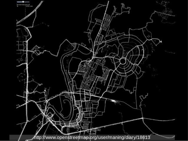
| What's your OpenStreetMap story? |
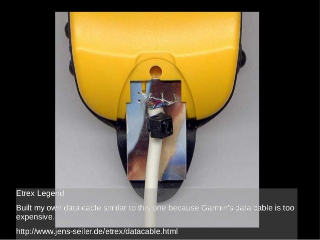
Here’s my patch as GPS tracks. I started mapping late 2006. Back then, OSM in the Philippines was completely blank. Maybe I made the first node? At first I struggled with everything, from borrowing GPSr to understanding the tools. I even tried to create a Garmin data cable since it is very expensive to buy a new one.
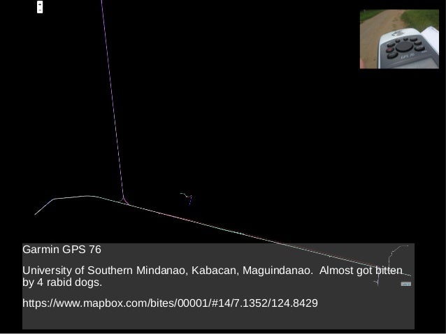
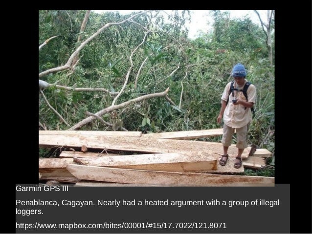
Perhaps the most stupid thing I did when I was starting was, without understanding any of the schema and API, I hand edited an OSM file because I had difficulty uploading with my flaky dial-up connection. I turned out that I completely messed up the map because I unintentionally removed negative ID values to the original data upload using JOSM! Fortunately, the talk list back then was very friendly and helped me fix it. ;) Here’s a few other mapping stories. I was nearly attacked by 4 dogs trying to map an private residential area.
Nearly got into a heated argument with a group of illegal loggers while mapping the forests of Sierra Madre.
|
|
| Mapillary trials | I’m getting the same issue sometimes (I’m blaming my ISP). Just try clicking the blue line to see photos. You can also file a bug report at mapillary’s github account. |
|
| Water in OpenStreetMap | This is nice challenge. However, I can’t see it in the list of challenges in MapRoulette. |
|
| Iligan street map update | Great! Deteiled mapping in Iligan started after Sendong. Its good to know that there are more locals contributing. Hope you find the data useful. |
|
| Iligan street map update | Keep it up! Is this a local mapping initiative in Iligan? If you have questions, just ask. Keep on mapping! Maning OpenStreetMap-Philippines |
|
| @OsmThis: Twitter to OSM |
Fixed! |
|
| Moabi at State of the Map US | Cool! Any plans for open sourcing the code? I’m particularly interested in the iD presets. |
|
| Mapping the Gran Cordillera Central | Good luck with your docu entry! And its nice you do mapping on the side. ;) |
|
| Hello, OSM! | Hi Ken, I reported your issue in iD’s github repo, please update if the problem persists. Thanks! |
|
| We need to look at consistency of coverage in the Philippines. Let's target LOD1 first. | @/al, I updated the entry for the location of the images. If that is what you mean. |
|
| Hello, OSM! | Welcom to the “tribe”. :) |
|
| Bagong Simula | Lester, Welcome din. Sana maging makabuluhan din ang iyong pagiging contributor dito sa OSM. |