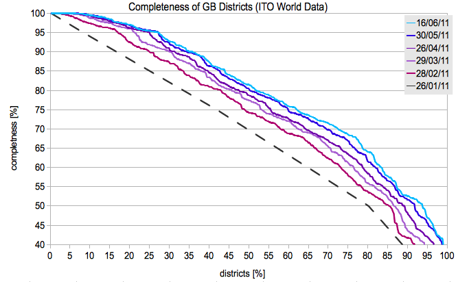
Statistic: Completeness of Roads in GB
Апублікавана карыстальнікам mannequinZOD 29 Сакавік 2011 на мове Englishosm.wiki/w/images/0/02/GB_complete.png
also check out the Completeness of Roads and the changes in single districts
osm.wiki/w/images/f/f8/GB_stats.png
-------------
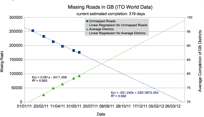
Historic overview of the data from ITO World
http://www.itoworld.com/product/data/osm_analysis/main
also see their blog entry from January
http://itoworld.blogspot.com/2011/01/some-graphs-relating-to-openstreetmap.html
Абмеркаванне