
OK, if you want to know where in the country has good pubs, how do you do it? Well, here’s what I do: download a data extract of all the pubs in the UK/Eire from OpenStreetMap, and use density estimation to look at the distribution of pub attributes such as whether it serves real ale, or food, or has wifi. That’s the normal way, right?
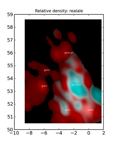
In my blog article about pubs in UK & Eire I’ve posted more plots, as well as the source code and some extra info.
Discussion