
Animated dataviz of OpenStreetMap edits per year
ایہہ 17؍January 2013ء English وچ «mcld» لیکھ چھپیا گیا سی۔Another iteration of my visualisation of OpenStreetMap edits - here’s an animation showing, for each year 2005-2012, the density of edits according to their geographic location:
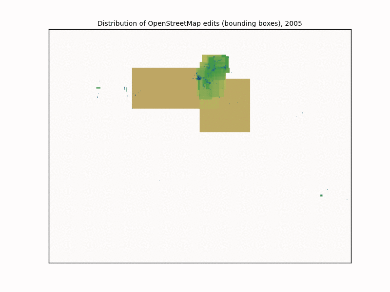
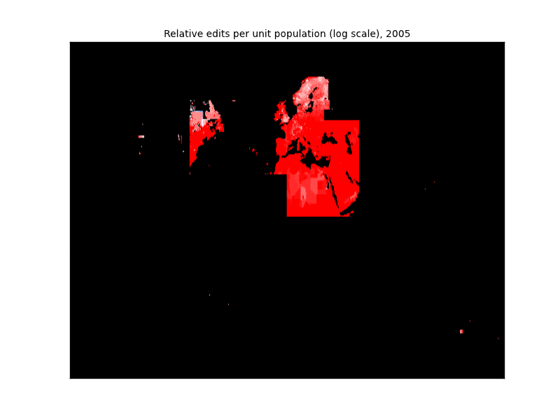
The upper plot is the raw edit density. The lower one (which I think is more illuminating) is the edit density per unit population, as described in a previous post (with source code).
So what can you see? Well, both of them show the humble London-centred beginnings in 2005, followed by solid growth until the whole world is filled out. I think the lower plot more clearly shows when the “filling out” happens. 2007 is the year OpenStreetMap “goes global” but 2009 is the year it levels out. Before 2009, the edits-per-population are very variable, but from 2009 onwards the picture is much whiter and there’s not much annual change in the colouring. This means the distribution of edits much more closely fits the population distribution, though (as noted last time) central Africa and around China are relatively underrepresented.
(This is cross-posted from my blog)
Discussion
ایہہ 17؍January 2013ء 21:04 تے «tmcw» ٹپݨی کیتی گئی سی۔
Very cool, this does a great job of highlighting where we need to focus outreach. Thanks for doing this.
ایہہ 22؍January 2013ء 20:15 تے «!i!» ٹپݨی کیتی گئی سی۔
I like :) Would see this in Youtube and HD!