
I am collaborating with agencies in Texas to update both OSM and Texas data. The pilot project deals with cemeteries. I received a file with almost 7000 cemetery locations. (Even if the idea that there are more people living today than have died thus far in human history turns out to be a myth, I think that is quite a lot!).
The first phase of this collaboration is to see which cemeteries in the Texas data actually exist. We will use MapRoulette for that. Simply go to the Cemetery challenge at maproulette.org and start looking at tasks.
If you see a cemetery in the aerial image, click ‘skip’ to go to the next one. If you don’t see a cemetery, click ‘False Positive’. If you are in doubt, click ‘skip’.
How can you tell if there is a cemetery? Sometimes it is hard. Look for fine patterns defining the plots, and usually there will be a service road connecting the cemetery to the road network. Sometimes, in larger cemeteries, you may also see paths inside the cemetery. Finally, the marker may not be right on the cemetery, so look around a bit as well. Below are some examples of cemeteries and non-cemeteries.
Once we complete stage 1, we will turn to mapping all the cemeteries that are not yet in OSM yet!

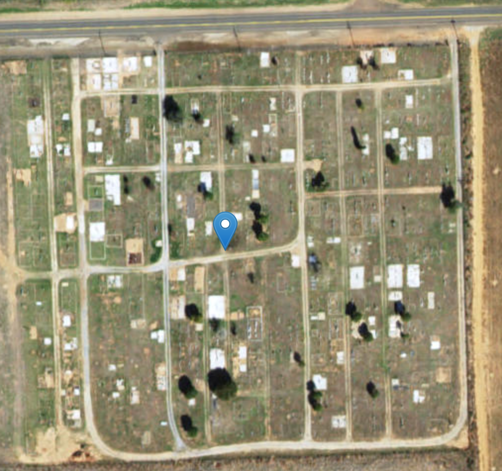
There is a cemetery here: fine regular pattern indicating plots, some paths.
There is a cemetery here also.

No cemetery here, just some grass.
討論
由 lyx 於 2016年08月23日 21時54分 發表的評論
In cases where you don’t see a cemetery at the location, it is often a good idea to zoom out a bit and look at USGS Topo maps for the area. At least the small cemeteries imported from GNIS are frequently off by a few yards, sometimes quite a bit more (I have seen up to half a mile in a few cases).
由 maxerickson 於 2016年08月24日 17時29分 發表的評論
I wouldn’t rule out the patch of grass being a cemetery. An older cemetery may have only had small or temporary markers and they often go untended.
由 mvexel 於 2016年08月24日 18時16分 發表的評論
Hmm, interesting point. Do you think it’s at all possible to resolve this ‘cemetery or not’ question from the aerial imagery we have available?
由 maxerickson 於 2016年08月24日 21時54分 發表的評論
Not with much certainty. I guess marking the locations where a cemetery is clearly visible would work well.
I looked at a few of the locations in the challenge. This one:
http://maproulette.org/map/85/84564
Doesn’t really look like a cemetery, but I think it is quite likely that the untilled area by the junction just to the southwest is a cemetery (there’s also a hint of a fence).
由 Chris Bardash 於 2016年10月18日 15時41分 發表的評論
You’re right maxerickson . That is a cemetery (based some investigations using other sources), although it definitely doesn’t appear to be from the aerials. But I’m not sure how much in-depth investigation we can expect. At any rate, since this challenge is broken into stages, perhaps we can identify the obvious ones for stage one, digitize those in the second stage, then circle back to the false positives later for another review.
Thanks for your interest!
由 mvexel 於 2016年10月20日 21時17分 發表的評論
I am writing a follow up blog to clarify and update with new details and imagery!