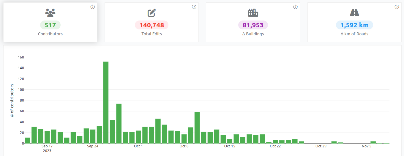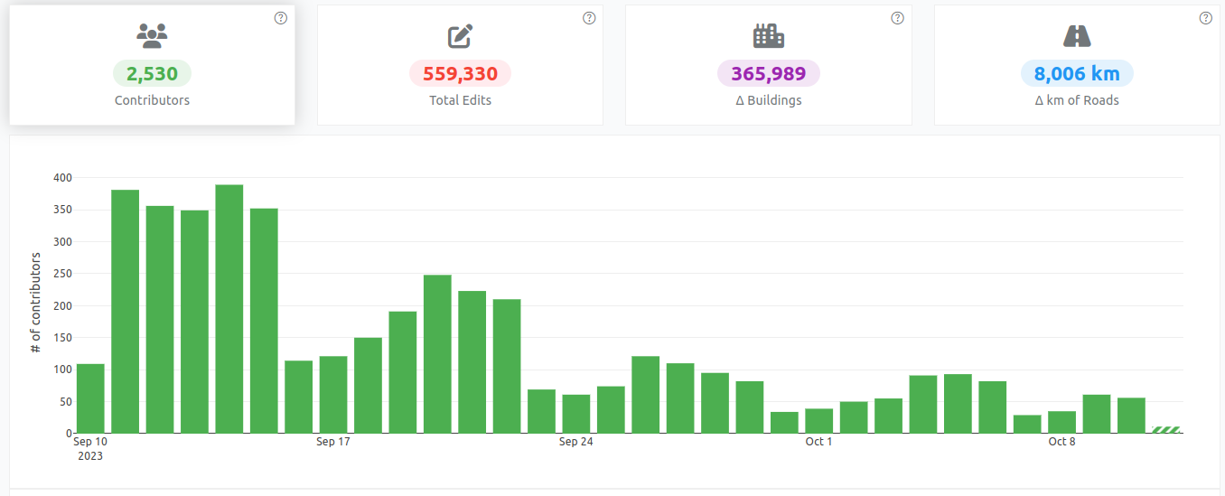
Some stats and facts on drone imagery in OpenAerialMap
Posted by pedrito1414 on 29 October 2024 in English.I was putting together some facts and stats* on OpenAerialMap and the open drone imagery it hosts and thought it might be interesting / useful for OSM peeps as a key user group…

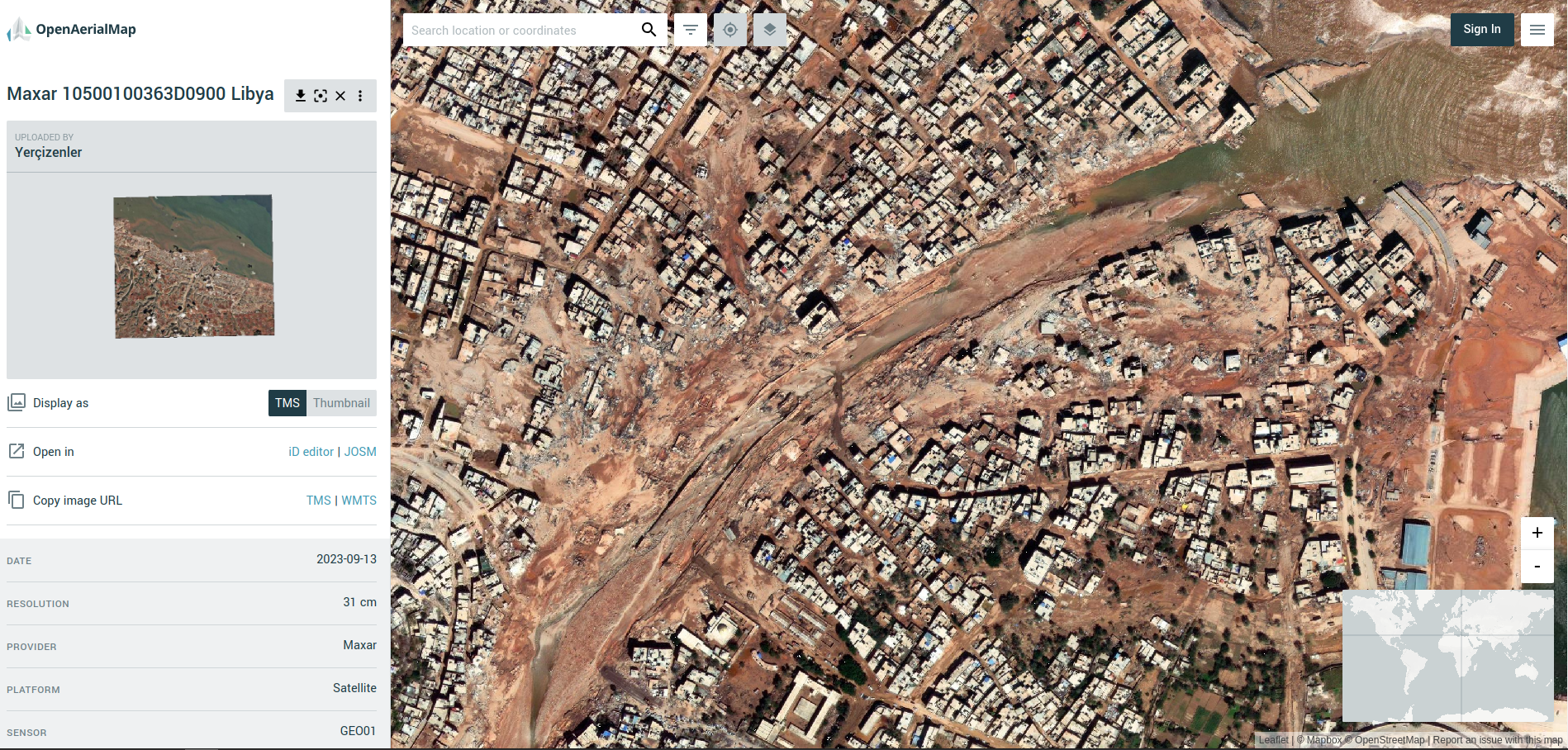
In case you don’t know, OpenAerialMap is a platform for making open imagery available to people that need it.