OpenStreetMap logo OpenStreetMap

pedrito1414's Diary

Recent diary entries

I want to share a community investment initiative HOT Is piloting in collaboration with OMDTZ (OpenMap Development Tanzania).

Over the next five years, HOT aims to support a movement of individuals and communities who create and use OpenStreetMap data to improve local lives and livelihoods in places vulnerable to crisis or experiencing multidimensional poverty. The strategy for using the Audacious project funds to achieve this centres around moving decision-making, resource allocation, support and engagement closer to these places. Partly, this is through the launch of four regional mapping hubs, but we also want to try and innovate in other ways.

HOT’s microgrants programme has proved successful over the years but we know that our reach in many places is limited and that, despite a diverse community panel for selecting winners, we cannot have a deep understanding of the context (and therefore the challenges, opportunities and constraints) in every one of 94 countries.

For this reason, we are piloting a devolved community investment programme, where we can pass on the budget for multiple grants to a trusted partner (in this case, OMDTZ) to design and implement a programme at a national level. With a few caveats (around principles, objectives, diligence and reporting requirements), we want OMDTZ to be free in designing a programme of community support and investment that works for Tanzanian contributors, communities and organisations.

We hope that by doing this the funds will be more accessible and have greater local reach, that the funded work will have greater local relevance and impact and that we (HOT) and others can learn from OMDTZ’s successes and failures and improve our own programme.

We also hope that, if the pilot is successful, we are able to replicate or adapt a similar strategy in other countries with strong OSM community organisations. In fact, if you think this is something that could work where you are, we’d love to hear from you.

See full entry

The humanitarian OpenStreetMap Community Working Group has taken the decision to revisit our scope and purpose.

We want to better serve…

  • OSM communities in places vulnerable to humanitarian crisis or experiencing multidimensional poverty
  • Communities or orgs that use (or want to use) OSM for social impact
  • People that want to show solidarity with these communities through collaboration and support.

…and be less focused on the Humanitarian OpenStreetMap Team (HOT) specifically.

Draft community definitions

In order to work out how to evolve, we would like to invite interested people to join us in one hour workshops to try and understand what scope, principles and objectives will serve this new purpose. We would love to have a diversity of people and perspectives inform this work.

The insights from these workshops will be used to inform a draft of the working group’s new terms of reference, which will be published in advance for consultation.

See full entry

The humanitarian OpenStreetMap community working group is looking for interesting panellists for a webinar mini-series on Colonialism in Open Data and Mapping. Do you have any suggestions?

This is the explainer for the webinar:

“And while maps may be missing from digital platforms and social networks, we are still here.”- David Garcia, 2020

Maps and digital data have played crucial roles in humanitarian aid eg. disaster response. Although it is of best interest to help local communities through generating data and features on the map, humanitarian actors and mappers should take note that we are not only mapping features (houses, roads, waterways, etc), but also mapping the land, oceans, and communities who live and are stewards of that space. With this webinar, we want to examine and discuss this balance (community <> digital information), decolonising open data and open mapping, and representation and power in humanitarian mapping, among others.

There will be two events in this series that hopefully accommodate interested people in different timezones : 26 Feb 2021 at 06:00 & 16:00 UTC.

Our panel so far for the 06:00 UTC event are:

And, for the 16:00 UTC event:

We are looking for one more panellist for each event. If you would like to suggest someone, please feel free to get in touch via the comments or the community-wg slack channel or via email at pete.masters @ hotosm.org

For more info on the webinars that the WG organises, there is a wiki page, here.

For more info on the working group, there is a wiki page, here.

Esta entrada del diario se publicó por primera vez en inglés y se tituló: Potential HOT tasking manager improvements to help new and existing contributors collaborate more effectively.

En los últimos meses, he hablado con algunas personas diferentes sobre la fricción que puede existir cuando grupos de nuevos colaboradores se comprometen con OpenStreetMap en áreas donde ya existe una comunidad activa. Si bien el impulso para escribir esta entrada del diario ha sido temas recientes en Panamá (entre un capítulo local de YouthMappers (YM) y un pequeño grupo de mapeadores locales activos), el contenido no es específico sólo de esa situación y ha sido informado por múltiples personas en múltiples continentes (así como mi propia experiencia).

El tema en sí mismo tampoco es en absoluto nuevo - si bien recuerdo, a partir de 2014, cuando iniciamos el proyecto de Missing Maps. Lo que es nuevo es que ahora trabajo en el equipo de la comunidad de Humanitarian OpenStreetMap Team (HOT) y en realidad es mi trabajo tratar de averiguar cómo hacer crecer la comunidad de OSM de una manera que respete el pasado y el futuro del proyecto y de la comunidad.

Se preguntarán qué tiene que ver la situación en Panamá con HOT y creo que hay dos respuestas a esto.

En primer lugar, llevamos la instancia HOT del Tasking Manager (TM). Vemos al TM como un activo de la comunidad y, aunque no originamos todos los proyectos que hay allí (por ejemplo, en 2020, HOT originó el 17% de todos los proyectos publicados), sí desarrollamos y mantenemos la tecnología, así como proporcionamos los flujos de trabajo y la incorporación de personas que quieren crear y gestionar proyectos específicos. Por ejemplo, la mayoría de los capítulos de YM (YouthMappers) contribuyen mediante el mapeo a través de el TM (incluido el capítulo de Panamá que organizó proyectos locales que se establecieron en colaboración con el equipo mundial de YM).

See full entry

Over the past months, I have spoken to a few different people about the friction that can exist when groups of new contributors engage with OpenStreetMap in areas where there is already existing and active community. Whilst the prompt for writing this diary entry has been recent issues in Panama (between a local YouthMappers chapter and a small group of active local mappers), the content isn’t specific only to that situation and has been informed by multiple people across multiple continents (as well as my own experience).

The issue in itself is also not at all new - I remember if from 2014 when we started the Missing Maps project. What is new is that I now work in HOT’s community team and it’s actually my job to try and work out how to grow the OSM community in a way that respects the past and the future of the project and the community.

You may wonder what the situation in Panama has to do with HOT and I think there are two answers to this.

Firstly, we run the HOT instance of the tasking manager (TM). We see the TM as a community asset and, whilst we don’t originate every project on there (for example, in 2020, HOT originated 17% of all published projects), we do develop and maintain the technology as well as providing the workflows and onboarding for people that want to create and manage specific projects. For example, a majority of YM chapters contribute by mapping through the TM (including the Panama chapter who organised local projects to be set up in collaboration with the global YM team).

Secondly, it is HOT’s mission to radically increase quality local map contributions and contributors from across 94 countries in Africa, Asia and Latin America / Caribbean over the next five years as part of the Audacious project. We need to be good at making sure that new mappers build on what already exists in collaboration with people and communities already actively engaged in the OSM project and that they are welcomed into those same communities.

See full entry

A group of HOT voting members, from across four continents) met on Tuesday evening as part of the HOT board’s strategy committee to discuss perspectives on community definitions and what we mean when we talk about community sustainability. These conversations are really pertinent at the moment as HOT begins to develop and implement the Audacious project, which provides a real opportunity to support local communities to power up as well as generate high quality OSM data in 94 countries.

The first question: What is HOT?

It was acknowledged that HOT is many different things to different people. It was thought to both be a network or community (including volunteers and contributors, staff, humanitarian data users) and a node in other networks (where it was felt that HOT sometimes plays an important facilitation role). It was also suggested to be a (niche) social network, used for finding and developing information, knowledge, tools and relationships.

It was also perceived as a sub-community of the OpenStreetMap and as an NGO.

Whilst there were many positive attributes associated with HOT (diverse, collaborative, oriented to social good), it was also felt that HOT was sometimes a label applied too easily to contributors and communities in its networks, without thought for how they might define themselves. For example, the use of the phrase ‘HOT community’ to encompass any group doing humanitarian work involving OSM (or ‘HOT edits’ for any OSM contributions through the Tasking Manager) can be perceived as HOT staking an undeserved claim over the work of others and not indicative of a collaborative node in a network.

See full entry

Running for the HOT board again - Pete Masters candidate statement

Posted by pedrito1414 on 19 June 2019 in English. Last updated on 30 June 2019.

I am just finishing my first two-year board term for the Humanitarian OpenStreetMap Team and am running for another two years. This diary is written to tell HOT voting members why, so that they can decide whether to vote for me or not…

Priorities for another term

Having spent the last couple of years meeting and talking to people, reading documentation, attending board meetings and discussing ideas and issues, I have a much better understanding of where we are strong as an organisation and should double down and where we are weak and perhaps need to focus more. These perspectives have some very pragmatic implications in terms of where I would prioritise my time if I were re-elected… I would like to take you through the top two of those priorities…

Firstly, I’d like to make sure that HOT strengthens the expertise and skills necessary at board level for an organisation of its size and ambition. Secondly, I’d like to contribute to a movement within HOT to reconnect the organisation with its members, creating more opportunities for meaningful contribution from the diverse communities they represent.

Strengthening our governance

On the priority number one, we have already started to take concrete steps towards recruiting an advisory board. This idea was first floated years ago and when I joined the board I was actually against it. I thought that it would move HOT away from its model of community governance. Now, I don’t - I think having a strong advisory board will allow our community-elected board to be more focused on leveraging data and mapping to support people in crisis and the HOT community itself.

See full entry

Running for the HOT board

Posted by pedrito1414 on 29 March 2017 in English.

Hi all, my name is Pete Masters and I am the outgoing Missing Maps coordinator at MSF UK (I change jobs in a few weeks).

I would like to be considered as a HOT board member because I have a lot of respect and admiration for what HOT does in the humanitarian sphere and I think my skills, experience and networks can be of value to HOT on a strategic level. For me, it represents a chance to contribute to a community that I have come to be very proud of in a different way. This would be my first board position and I am eager to prove to myself and to the community that I can operate at this level and help to take HOT forward.

In my eyes, the future of HOT is very interesting. On the one hand, local communities are growing strong in places where previously HOT would have been only mapping remotely. The size and diversity of the community behind the first State of the Map Africa this year is testament to this growth. On the other hand, NGOs, large and small, are coming to rely more and more on OSM data and HOT through activations, and initiatives like Missing Maps. These are serious organisations with short timelines and specific needs. In my opinion, HOT must continue to walk the line between these two vital elements; the bottom-up, grassroots communities and the top-down, humanitarian actors. I do not have the answers to how HOT does this, but I believe I have some good ideas.

The most important in my eyes, and the one I would like to discuss here, is credibility, and this works both ways.

See full entry

Feedback from MSF in Chad

Posted by pedrito1414 on 21 July 2016 in English.

Just a quick post as I got some nice feedback from an MSF epidemiologist in Chad for everyone who took part in mapping of HOT project 2015 (Missing Maps / Hadjer Lamis).

Hi Pete,

I have gone through the maps and they are really detailed, thanks a lot! We are basically doing a nutritional survey with local surveyors that probably have never used a smartphone or GPS technology before. So these maps will really allow them to more easily locate the randomly generated GPS points corresponding to the households they need to include in the survey. Please thank on my behalf the people who have produced the maps!! I’ll let you know how it goes!

Best regards, Susana

She has also requested the mapping of three more villages, so if you have any time to help, it would be much appreciated. The new project for these villages is #2036

London mapathons: switching the emphasis to JOSM

Posted by pedrito1414 on 12 May 2016 in English. Last updated on 14 May 2016.

There has been a lot of chat on the HOT list about validation and a lot of that has focused around tools that new mappers use. It is obviously tiresome for validators to be squaring buildings endlessly or dealing with validation issues that would have been picked up by the original mapper at the touch of a button in JOSM, but that are invisible for those using iD.

In response, we have decided to start trying to work out better and quicker ways of moving people to JOSM at the London Missing Maps mapathons.

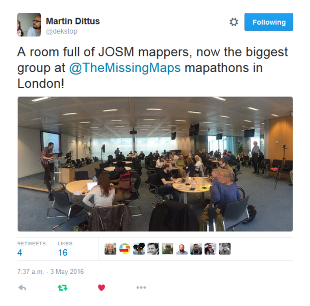
Tweet from dekstop

The first try at this happened in May. Using the eventbrite system to register participants to certain categories of ability has been our modus operandi for a while, so we simply upped the percentage of places available to those who wanted to learn JOSM and reduced the iD places. We also emailed ahead to our JOSM-experienced mappers to ask if they would mind making an effort to sit with, and support, the newbies.

See full entry

This diary is dedicated to all the people who have organised mapping parties on behalf of the Missing Maps project this year.

When I started working on Missing Maps for MSF (before it even had a name), I was nervous that the idea wouldn’t take off in the way we needed it to - after all, we have some pretty lofty ambitions! The first Missing Maps mapping party had me worried - would we fill a room that could hold fifty people?

A few short months later and we are complaining because we can’t find London venues big enough to meet the demand of people wanting to map!

First Missing Maps London party

So, then I started to worry that other people wouldn’t want to organise their own mapathons. We needed the mapping parties to take off globally in order to tackle tasks of the magnitude of South Kivu in Congo (DRC). And, here is where my job has been a real pleasure this past year.

See full entry

It is the monthly London Missing Maps / HOT mapping party tonight.

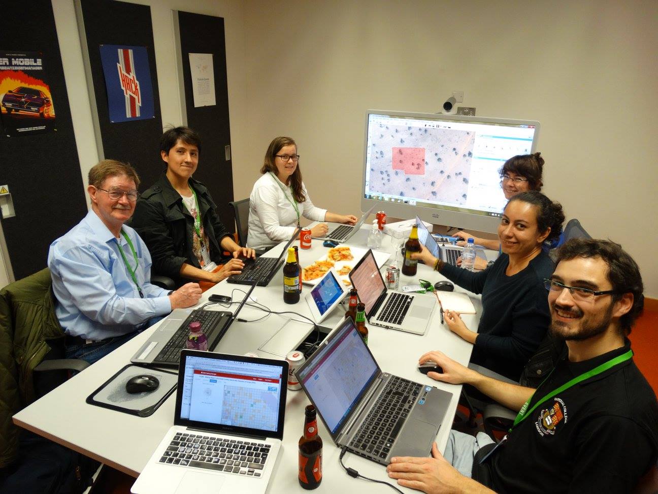
For a while now, we have had a table or two at each mapathon where people can sit if they want to learn to validate. And, with much thanks to the HOT / OSM stalwarts who have sat with them each month, we now have a gang of new validators.

Some of the London validator community

We identified validation early on as something we would have to address with the mapping parties in London. We are bringing a lot of new mappers to the table and they aren’t necessarily coming via HOT or OSM. They are, essentially, humanitarians, who have a desire to do something, rather than just donate something. HOT and Missing Maps is a perfect fit, but they are mapping novices.

Our community of validators are now doing great stuff helping guide the newbies and ensure some quality control.

See full entry

Feedback from MSF in Doro Refugee Camp

Posted by pedrito1414 on 11 September 2015 in English.

Just wanted to feed back on the remote mapping that HOT / Missing Maps volunteers did in response to an MSF team based in Doro refugee camp in South Sudan (see the map on reliefweb, here). The message below arrived this week from Guido, an MSF epidemiologist who has just returned from South Sudan.

I don’t think I have anything to add other than well done and thank you! It’s great to see your work at work for NGOs in the field….

Dear Pete, this is Guido, MSF epidemiologist in South Sudan. Greetings from Juba!

We don’t know each other but I realize we have been recently in the same loop of communications about MSF project in Doro Refugee Camp, Maban.

Actually, I am just back from Doro where I have been conducting a multi-antigen vaccination coverage survey.

I am writing today because I lately understood that the map that I received in preparation of my survey was actually developed by you and the Missing Map Project Team.

So, I would like to let you know a bit about the survey, and, above all, thank you for your job, since the map was really valuable to us. Actually, I used the map as a basis to prepare the survey: to locate villages (they call “villages” the different parts of the camp, since they relate to the villages of origin in Sudan), to understand the real distribution and presence of people together with the Health Promotion team and to allocate clusters to villages. Basically, it served for the first stage of clustering and it allowed us to save a lot of time in getting a clear picture of the setting; moreover, I felt it was good to let HP team to visualize what they already knew by heart.

See full entry

Microtasking from Disaster Mappers - help needed

Posted by pedrito1414 on 17 July 2015 in English. Last updated on 3 August 2015.

As part of the planning for mapping South Kivu, the Disaster Mappers (and particularly a guy called Benni) have been developing a new microtasking platform for identifying human settlements and road networks before we go anywhere near the tasking manager.

This has been designed for two reasons. Firstly, so mappers don’t have to spend hours scanning through the many, many, many square kilometres of jungle that exist in the province. The second is that, by using a much simpler tool for recognition of features, we hope to be able to engage a whole new audience of collaborators. People that might not want to learn iD - or might only have five minutes to spend. If they can do this painstaking work in a relatively easy (and fun?) way, it leaves mappers to… well, map.

Benni’s first try at this was great, but we knew it could be better. We sent it out to the Humanitarian OpenStreetMap Team list and got some great feedback.

screenshot of the v2 pybossa microtasking platform

See full entry

Yesterday’s Missing Maps party in London looked like it was going to be completely chaotic. Both Astrid (who organises the mapping parties) and I had been on holiday til the day before and the new MSF office (which we only moved into a little while ago) was only ready for us to move around about ten minutes before we started.

But, by 1820 (twenty minutes after start time) all that could be heard was the clicking of mice and the low level buzz of excited, whispered conversations…

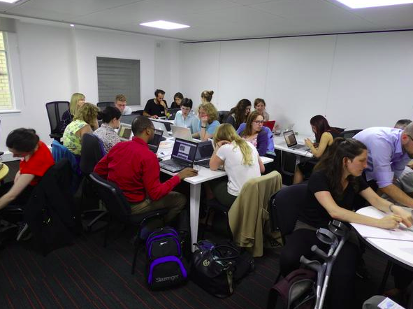
The iD room. Photo by Harry Wood

How did it go so smoothly when the opposite was looming?

Chatting with Astrid later, we came to the following conclusions, which I want to share here…

See full entry

Tasking manager for field data

Posted by pedrito1414 on 15 June 2015 in English.

Just a musing on a tasking manager software, but for field data instead of tracing.

With the amount of data we are expecting to come back from the Soputh Kivu mapping, we need better tools and processes for getting it into OSM

If this rings bells with anyone, please feel free to get in touch…

Field data tasking manager concept

The need:

So far Missing Maps field data editing and uploading is fairly randomly done, using a combination of wiki pages, data in dropbox folders, scanned field papers.

On a small scale, this can be effective (and has been). However, as we start to get more and more data back from the field, and as field data becomes a normal part of mapathons / armchair mapping, this model doesn’t scale well.

It relies far too much on the person managing the project being present to explain the data and the system for uploading it. It also relies on individuals to carefully document how much of the data they took responsibility for they actually edited / uploaded.

The / One solution:

The HOT tasking manager is a great example of how software can solve problems in a crowdsourcing / microtasking environment. Whilst there is always room for improvement, its fundamental raison d’etre means that large tasks can be worked on collaboratively by many individuals at the same time.

One solution to the scaling of editing of field data is a task manager for field data that chunks up geographical areas and then presents data relevant to that area, whilst providing instructions on purpose and process.

What would this look like?

The user signs in and elects a task. The task displays with instructions and purpose. The user chooses a square from a grid. The TM displays the types of data availabkle in that square. The user then confirms their choice and locks it or chooses an alternative square.

One the square is confirmed the current OSM data for that area is displayed on the screen.

See full entry

Missing Maps London: June mapping party

Posted by pedrito1414 on 3 June 2015 in English. Last updated on 4 June 2015.

Just wanted to share some thoughts from the mapping party at Imperial College in London last night.

The London mapathons have always been a place of excellent collaboration and idea exchange and for that reason this is where we try to meet anyone who wants to collaborate with us. I just wanted to share some of the conversations I had or overheard.

Imperial College students in the iD room (different rooms for iD and JOSM users this month) were discussing how they thought they could help Missing Maps and HOT automate some our processes.

Matt from Accenture, who had volunteered at the Accenture corporate mapathon, dropped by to discuss how he and his colleagues might be able to collaborate on helping us quantify the contribution of our mappers, to better plan our tasking and develop tools.

Ny came down from Loughborough, where he is doing a masters, to discuss Missing Maps collaboration on his thesis.

Carmen from MSF recruited some of our JOSM users to support her remotely when she goes field mapping in Bangladesh in July.

Joseph from Reuters was there talking to the HOTties for a story he is planning to write on Missing Maps.

These are just some examples, but it was clear last night that the Missing Maps London mapping parties are becoming so much more than a group of people mapping. The project is coming alive and growing legs and wings (and possibly other bits).

It’s beautiful to see and a privilege to be a part of (and we did loads of mapping!)

See full entry

Location: The Boltons, Brompton, Royal Borough of Kensington and Chelsea, London, Greater London, England, SW10 9TB, United Kingdom

So, a friend invites you to a mapping party…

Or, an NGO you really respect asks for help mapping the area they are working in….

Or, you see an article calling for mapping volunteers and sign up…

But, you’ve never mapped before!

What do you do?

It’s easy. Just remember this catchy acronym: HPSSU

on flickr

Firstly, get your HARDWARE ready. This is a posh way of saying make sure your laptop is working and, if you have one, your mouse is in your bag (a wheelie one is best)

Secondly, create your Open Street Map (OSM) PROFILE (do that here - it takes almost no time at all)

See full entry