OpenStreetMap logo OpenStreetMap

pedrito1414's Diary

Recent diary entries

At HOT, we are working on a collaboration with communities in informal settlements in Sierra Leone as part of the Know Your City project led by Slum Dwellers International.

The remote mapping of the settlements is hard, even with the excellent drone imagery flown by OpenStreetMap Sierra Leone. The environment is really dense, roofs overlap at different heights and structures that look like one from the sky actually include multiple buildings.

However, we have found the use of 3d and 2d imagery renders in parallel to be a bit of a game changer for this mapping activity. The mesh produced from the drone images allows us to angle and tilt in a way that we can better see how roofs interact with each other, what height they are and even sometimes how buildings are divided inside. We think this has vastly improved the accuracy of what we are able to do remotely.

3d mesh of Kolleh Town, Freetown, Sierra Leone

3d mesh of Kolleh Town, Freetown, Sierra Leone

See full entry

Location: Kolleh Town, Kingtom, Freetown, Western Area Urban, Western Area, Sierra Leone

The devastating events in Morocco (earthquake) and Libya (floods) happened within two days of each other on the 08 & 10 September 2023. Both have meant large scale destruction of infrastructure and thousands of tragic deaths and injuries.

OSM communities in both countries (OSM Maroc and OSM Libya), alongside partners, have responded and with huge support from mappers from the OSM community across the world.

The following diary entry is an update on a similar one from 18 September.


The latest…

The open mapping community response

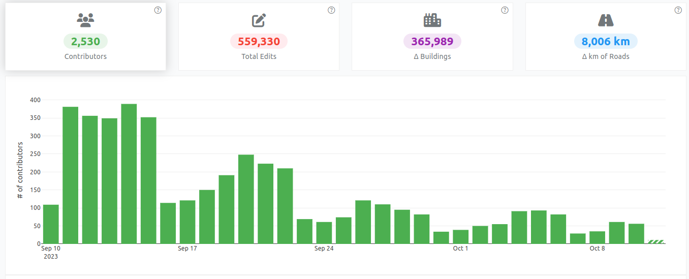
More than 2,500 OSM mappers have added data to support responders in Morocco. Two projects on the HOT Tasking Manager has so far been completed (mapped and validated) and there are four more available for mapping.

Contribution statistics for the Morocco earthquake response

Contribution statistics for the Morocco earthquake response

See full entry

The devastating events in Morocco (earthquake) and Libya (floods) happened within two days of each other on the 08 & 10 September 2023. Both have meant large scale destruction of infrastructure and thousands of tragic deaths and injuries.

OSM communities in both countries (OSM Maroc and OSM Libya), alongside partners, have responded and with huge support from mappers from the OSM community across the world.

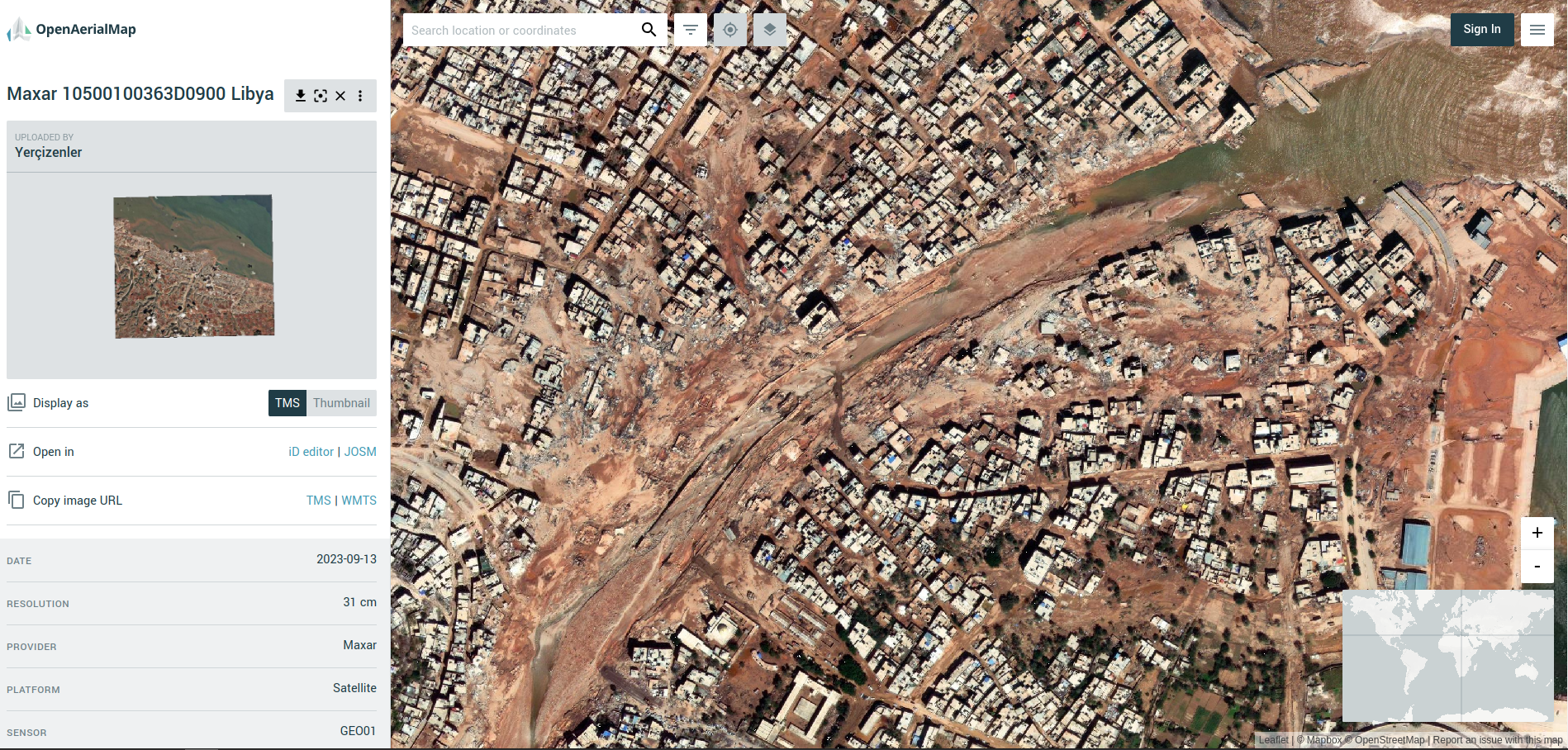
Screenshot from OpenAerialMap (Libya Floods)

A screenshot from OpenAerialMap showing the devastation to the city of Darnah in Libya (imagery courtesy of Maxar)


The latest…

The OSM community response

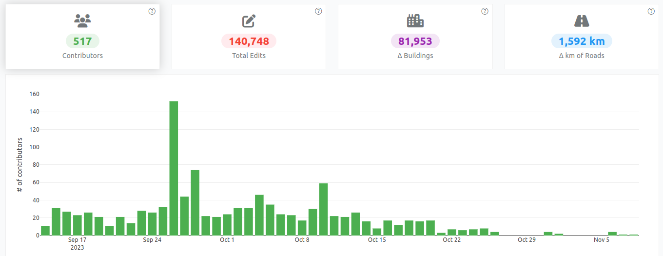
Approximately 1,600 mappers have so far contributed to both campaigns, creating ~220,000 buildings and ~5,000km of roads.

Validation teams at HOT and UN Mappers have been busy providing quality control and trying to keep up with the rapid pace of the mapping.

See full entry