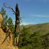
So, after messing around mapping Uganda I was inspired to try and make the area around home as close to 100% mapped as possible. Not necessarily addresses, etc. but 100% land-cover (not zoning/administrative) but looking at imagery and creating a ‘raw’ “this is what is on the ground” map. I started with simple/small polygons for ‘heavily’ forested areas basically coming off the administrative boundary for Pike National Forest, but that didn’t really work the way I imagined and also would have been extremely tedious, so I started over with a larger polygon delineated by 285, 126 and the South Platte River - made this landuse=forest and then used relations to ‘insert’ meadows, rocks, etc. I tried doing a complex relationship where the aforementioned forest was the outer polygon with residential as an inner polygon hoping to make forest/meadow/etc. inside the residential areas part of the outer polygon - didn’t work, not sure why; seemed a multi-multi-polygon relationship isn’t behaving intuitively. Anyway, just finished up Burland, so please feel free to check it out and give me feedback.
Umræða
Athugasemd eftir Dr Kludge sett inn 8. september 2012 kl. 02:12
I came across Sun City West while out driving one day. It was a real intense effort to clean it up. First I had to align most of the TIGER imported roads before I could get to the landuse mapping. At first I did want to use a relationship for the golf courses. I mapped around this issue but it did not look right. It sounds like what you want to do. A golf course was created as the “larger polygon”. I then created two smaller polygons. I created the relationship with one outer and two inner polygons. I then whet back and traced both of the smaller polygons again to add the residential landuses. I did this because JOSM would complain about no tags on the inner polygons of a relationship. This produced the desired rendering that I was looking for but I was not as happy with the level of complexity that I left for additional mappers that may want to touch the area.
I hope this helps, Greg
Athugasemd eftir russdeffner sett inn 10. september 2012 kl. 20:44
Thanks Greg, I too worry a bit about the complexity of the area now that I’ve added all these relationships, etc.
Athugasemd eftir russdeffner sett inn 2. júlí 2013 kl. 17:16
So I have since learned somethings about landuse vs. natural keys, and have (or am working on) changing all landuse=forest/meadow/etc. to the more appropriate natural=* tagging scheme (and not worrying so much about landuse and natural polygons overlapping - they are different/should not be considered the same ‘layer’)