
Do I call out Toronto Police Service over their lack of OSM attribution?
Sett inn af scruss 8. ágúst 2022 á English.Toronto Police Service has major, systemic problems. But they also have this one:
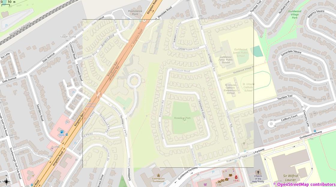
This is my hastily-georeferenced version of the image from this Toronto Police Operations tweet over OSM tiles in QGis. Note the extreme similarity between the streets and building detail. But also note the complete lack of OSM attribution on TPS’s map …
Umræða
Athugasemd eftir Kovoschiz sett inn 9. ágúst 2022 kl. 08:47
More of a they don’t know where their maps are from case. Applications have a part in informing credits to ask for attribution.