
Detailed rendering of bicycle lanes and junctions as part of the OSM "Straßenraumkarte"
Sett inn af tordans 1. janúar 2022 á English.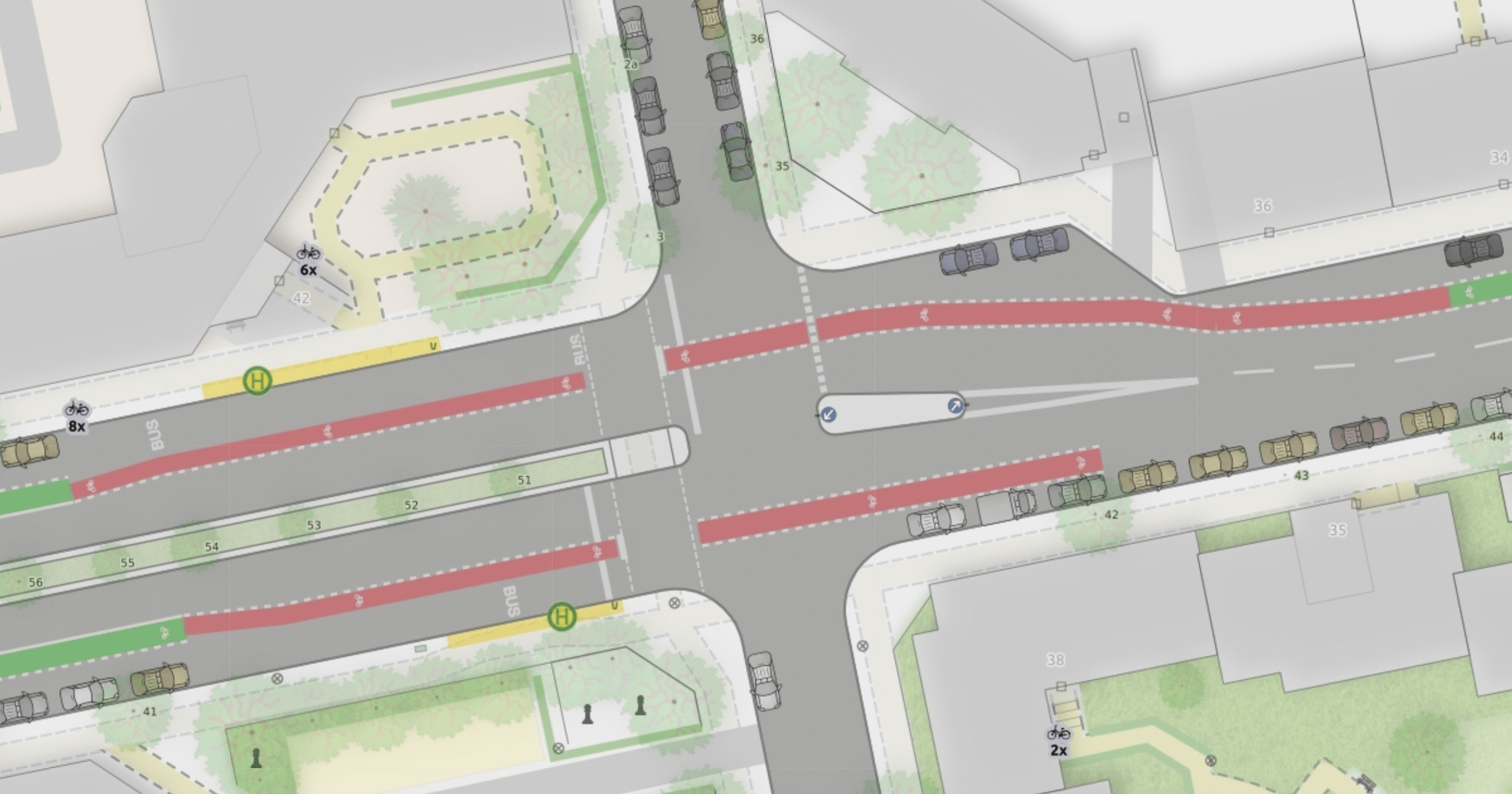
I wrote a blog post to show and explain the many improvements to the “Straßenraumkarte” that Alex @Supaplex030 worked on for the last few month: https://supaplexosm.github.io/strassenraumkarte-neukoelln/posts/2021-12-31-micromap-update
With this public space map for Neukölln, Berlin Alex continues to push the boundaries of the level of detail that can be rendered based on OSM data.
The blogpost shows many interesting details like cycleways, turn lanes and junctions and explains how the data is processed to allow this rendering.
One conclusion is, that a collaboration on pre-processed OSM data for streets would be a huge benefit.
Please use this place here to comment on the blog post.
Umræða
Athugasemd eftir G1asshouse sett inn 9. janúar 2022 kl. 15:31
This looks very good. Nice work.
Athugasemd eftir kocio sett inn 9. janúar 2022 kl. 21:48
Hi, this project is great, thanks for the article which made me aware of it! We lack such a research in OSM, wish you luck.
I made a short description on English wiki:
osm.wiki/Micromapping#Stra.C3.9Fenraumkarte_Neuk.C3.B6lln
Feel free to edit it and maybe add some info about it on German wiki too.