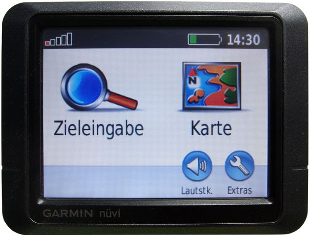
Preparing a map for the Garmin nüvi 205t
פורסם על־ידי utack ב־ 8 בפברואר 2016 בEnglish. עודכן לאחרונה ב־24 באוקטובר 2016.In search for a dedicated car-GPS, 15€ for a used Garmin nüvi 205t seemed like a steal.
 There is a lot of documentation how to get map data running on Garmin devices, but the maps made by Computerteddy and frikart.no were not playing too nicely with this device. (Update: Computerteddy should work now)
From the beginning:
First concern: Will it read a 32GB microSD. Oddly enough, it worked.
What is next: We get some well established OSM based map data, and good to go. In theory…
Let’s see what isn’t going so smoothly.
Say, we want to search for an adress, how about Lothstraße in München? After all, it is in the map data:

Turns out: no results when searching for it. Why? I can’t tell you, really, but we can solve it.
Let’s convert some maps in a way that works, tested specifically for the nüvi 205t (Update: And the etrex 20x) :
- Get a map, for example germany-latest.osm.pbf from Geofabrik
- Convert the .osm.pbf to .o5m using osmconvert
osmconvert germany-latest.osm.pbf -o=germany-latest.o5m - Filter with osmfilter to keep only boundaries in this new o5m file
osmfilter germany-latest.o5m --keep-nodes= --keep-ways-relations="boundary=administrative =postal_code postal_code=" -o=germany-latest-bnd.o5m - Generate boundary files with mkgmap. We need these, because without them, there would be countless duplicates of the same city and the streets would be split into all these different “virtual” cities on the device. Streets without a city tag would not be assigned to any city at all, making it almost impossible to search for adresses
java -cp ./mkgmap/mkgmap.jar uk.me.parabola.mkgmap.reader.osm.boundary.BoundaryPreprocessor germany-latest-bnd.o5m bnd - Now we need to split the map with splitter, so it can be processed for the device
java -jar ./splitter/splitter.jar --output-dir=./splitmap/ germany-latest.osm.pbf - And in the end, we convert the map for the device, using mkgmap again (The options –tdbfile and –make-poi-index might very well be useless, but this is the exact commandline i tested with success)
java -jar ./mkgmap/mkgmap.jar --gmapsupp --country-name=Deutschland --country-abbr=DEU --bounds=bnd --drive-on=right --max-jobs=4 --check-roundabouts --process-destination --process-exits --housenumbers --latin1 --index --location-autofill=is_in --make-poi-index --poi-address --link-pois-to-ways --add-pois-to-lines --add-pois-to-areas --tdbfile --verbose --route ./splitmap/*osm.pbf - Copy the resulting gmapsupp.img to a folder called “Garmin” on a FAT32 formatted microSD
There were still two duplicates of some cities, but the one using the format “Cityname, State” contained >99% of the streets, and the one using “Cityname, Country” almost none, so it is easy to use the correct one when searching for adresses.
I am stil confused why there were no other reports about problems with the maps made by computerteddy and frikart.no yet, but if they show up, mkgmap is your friend.
דיון
תגובה מאת andy mackey על 8 בפברואר 2016 בשעה 23:51
If the map is routable but searching does not work, i do this on my nuvi 1310T. It will navigate to a lat lon, you may have to set your Nuvi to DD.ddd instead of DMS, you can then use the openstreetmap map page for searching, the centre co ords of the map in shown in the URL, put that into your Nuvi, I hope that helps. I have been looking at the pinns website that explains how typ files change the look of Garmin maps.
תגובה מאת andy mackey על 8 בפברואר 2016 בשעה 23:54
Here is the link http://pinns.co.uk/osm/
תגובה מאת utack על 9 בפברואר 2016 בשעה 00:27
Thanks, I will keep that in mind, if i ever need to plan a route on my PC and quickly enter the Points into the device.
For now I am glad the search is working again
תגובה מאת andy mackey על 9 בפברואר 2016 בשעה 10:48
I’m sure you know that openstreetmap use minus values of lat and long for West of zero (Greenwich Meridian) and South of the Equator. On my Garmin menu: Where to: Coordinates then format= h ddd.ddd not ddd mmm.mmm or ddd mmm sss. then enter minus lats as South Negative- longitudes as West. I like the fact you are using cheap but good old kit. If i see old stuff for sale i do a quick bit of internet research including finding the makers PDF. i recently started using a five year old laptop that was e2000 when new and then had a 3 year makers guarantee, which gives some indication of build quality. Happy mapping and recycling.
תגובה מאת utack על 9 בפברואר 2016 בשעה 11:40
The latest Firmware update for the device is from 2015 (kudos Garmin) and the route calculation is incredibly fast, even faster than the maps.me app with Open Source Routing Machine on a phone from 2013
תגובה מאת MarkusHD על 10 בפברואר 2016 בשעה 23:20
I use Lambertus’ maps on Garmin Dakota 20 and Nüvi 300.
Just tested the address search, which I don’t need often: Streets can be found without problem, but house numbers only if the street does not contain umlauts.
Does it work for you with maps from Computerteddy or frikart.no when using a street without umlauts instead of “Lothstraße”? Or maybe “München” already is the problem here.
תגובה מאת utack על 11 בפברואר 2016 בשעה 10:43
Hi Markus, I will give Lambertus maps a try. As far as the Umlauts go, the same problem existed in other cities like Dresden too, that was not the issue.