
Plotted several footpaths along the Otter, south of Ottery St Mary trying to establish where a Viscount G-ARBY crash landed after running out of fuel in July 1980. I've only got one old BW photograph to help me narrow down the location but of course it happened over 20 yrs ago... - does any body know?
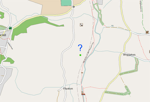
Possible location marked below:
討論
由 RichardB 於 2009年09月18日 20時21分 發表的評論
From the description in this link, you are in about the right rough area;
http://www.aaib.gov.uk/cms_resources.cfm?file=/9-1981%20G-ARBY.pdf
The description of the landing site says;
"The crash site was a large, essentially flat, grass field approx. 1 mile south of Ottery St Mary, bounded on its eastern edge by a disused railway and the River Otter, and on its west side by Fluxton Rd. The field was some 700 yards in length - North/South"
"The Viscount's port wing had struck a large tree on the line of the northern boundary of this field...before the first ground contact some 200yds south of this tree on a bearing of 190º...The propellor assembly (less 1 blade found beside a dead sheep) was found detached and adjacent to a tree located some 170yds beyond the initial fuselage contact mark. THe tree showed marked evidence of contact on its trunk, and the outboard section of the port wing and outboard aileron section were nearby...The 2nd tree impact caused G-ARBY to yaw to port as it slid across the remainder of the field, coming to rest on a heading of 074º adjacent to the eastern boundary fence of the field"
Might be enough to go on there??
由 RichardB 於 2009年09月18日 20時22分 發表的評論
In the first line, the "1 mile south of Ottery St Mary" should have been south-west