Amazing, bing seems to be completely up to date in the south west of UK - bridges that were only built last year show up

บันทึกของ wilpin
รายการบันทึกล่าสุด
Interesting how caravan_sites are rendered when placed on top of forests. Not seen this before.
looks like highway=ford is now rendered (at a high zoom level).
Anything else 'new'?
For those interested:
For those interested:
Orchards are now rendered but at a higher zoom level, it seems
Looks like Donner and Blitzen got lost and settled in this somewhat remote part of Devon.
It's not very often you come across reindeer when mapping for OSM.
man_made:masts now seem to be rendered in Mapnik; anything else newish?
It looks like abandoned railway lines are at long last rendered.
Anything else 'new'?
Manage to do a lot of mapping of Uffculme and surrounding area before the rain. Coldharbour Mill is definitely worth visiting.
Some years ago its Fireworks factory went up in smoke - I remember this quite well ; does any oney know where it was located?
tagging
landuse:orchard
trees:apple_trees
seems to be rendered showing a light brown background in Mapnik.
However,no green dots yet.
Perhaps,all the apples have been harvested...
Having mapped many of the streets of Teignmouth today I hadn't realised I'd performed a miracle - see map.
There are possibly three explanations:
1) my gps was giving me false readings
I checked it against Garmins GB map and the track more or less was spot on.
2) the tide was out
Could be, but it has been out ever since I moved to Devon (35 yrs)
3) the osm coastal data is not 100% accurate or up to date.
I wonder...
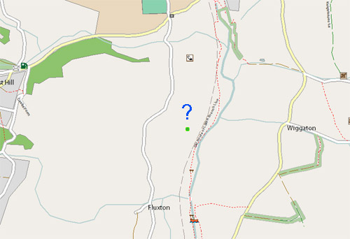
Plotted several footpaths along the Otter, south of Ottery St Mary trying to establish where a Viscount G-ARBY crash landed after running out of fuel in July 1980. I've only got one old BW photograph to help me narrow down the location but of course it happened over 20 yrs ago... - does any body know?
Possible location marked below:
Brilliant sunshine and glorious views of the Teign helped me map a bit more of Bishopsteignton. I've never seen a place where as you walk up - and I mean Up - a street unexpectedly changes its name.
Previously, Bishopsteignton has been labelled as a village, but it felt more like a town - admittedly there are appear to be only 2 shops. I wonder what the locals will call it.
Plotted the footpath from Woodbury to Exton and the Lympstone to Exton projected cycle path . Looks like it will be finished in Spring 2010 - then the final bit between Exton and Topsham,one day...