OpenStreetMap logo OpenStreetMap

Diary Entries in English

Recent diary entries

Posted by Rick Rupp on 11 November 2022 in English.

I recently discovered that the county assessor has put a version of the parcel database online, searchable by a web map interface. Most of the parcel entries in the database have address information that can be entered into OSM.

My workflow is to use a split screen. On one side I have a browser window open to the assessor’s web map interface. On the other I have JOSM running. I use the address tool to manually fill in the information.

While Whitman County is a little larger than the state of Delaware in area, it only has a population of around 50,000. I plan to start with the small communities and rural areas of the county then progress to the city of Pullman.
Location: Colton, Whitman County, Washington, 99113, United States

This was my original question on the Wiki :

The OpenStreetMap Foundation ("OSMF") already had discussions and even a committee on takeover mitigation and this question focuses on this topic. The Humanitarian OpenStreetMap Team United States Inc ("HOTUSI"), which it's grow up over 100x OSMF budget (using 2020 as year, 26,562,141 USD vs 226,273 GBP), on its board minutes date 2022-01-24 (archived version here) already admitted interest on trademark agreement "with clear, irrevocable rights to the name" as option to "Ensure that the HOT Brand name is not in danger and is formerly in HOT’s hands", however this explicitly require OpenStreetMap Foundation approval at least once in its history. Already before this election, the new discourse community, which is public know have receive support from HOTUSI, had a paid HOTUSI employee closing a discussion about HOTUSI which also asked why the site redesign still being delayed to a point of know to not happens before the OpenStreetMap Foundation election, even if this already was asked on OSMF mail lists, and the incident sparked a discussion on handling conflict of interest on moderation channels. At this very moment of the history of OpenStreetMap, majority of candidates in this election do have links with HOTUSI, so it is viable that the result will allow a single corporation to make decisions in self interest against OSMF, in which you hopefully will win as a candidate. So the question to you is: how will you handle conflicts of interest in the OpenStreetMap Foundation board itself under this challenging context?

Regardless of this, I’m actually very okay with the set of official questions proposed for candidates to be asked to answer, since common themes were grouped. And the fact to point to the Trademark Policy was better than the ones I used to contextualize. Fantastic!

New absurd events

See full entry

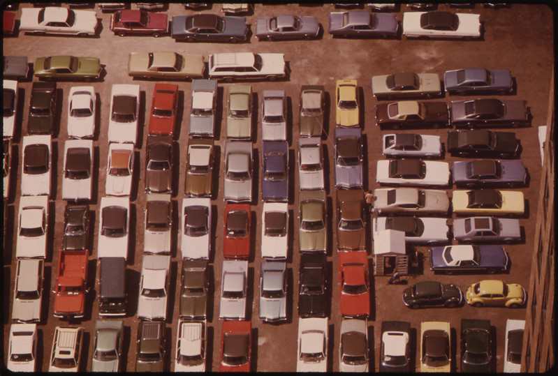
Americans love cars. More than 90% of households own one, more than 20% of households own 3 or more. Cars stand still most of the time and for that, we need huge amounts of parking.

picture of parked cars

Image source: Flickr Commons

The simplest way to map a parking area in OSM is to draw an area and mark it amenity=parking. It will then show up on the map as a grey area with a blue “P”. In the United States, almost a million areas exist with the amenity=parking tag.

See full entry

Location: East Liberty Park, Salt Lake City, Salt Lake County, Utah, 84105, United States
Posted by Vina Kita on 7 November 2022 in English.

Are You Alive ?

I’m looking for an oasis in the desert

but i can’t find

All I found was a dusty stretch of sand

who seems to laugh at my despair

I’m feeling dehydrated now

throat tightening

as if I can no longer walk this leg

stepping on the dusty grains of sand

can’t feel anymore

I will continue this journey

I’m tired and tired

I can no longer endure

in this barren and arid field

I can no longer endure

in this absence

in this helplessness

I hope that a traveler will come

bring a drop of water that will cool this soul

a soul that hurts because of love

Location: Cikole, West Bandung, West Java, Java, 40931, Indonesia
Posted by Graptemys on 7 November 2022 in English. Last updated on 16 November 2022.

I often use apps using OSM data to find nearby restaurants to go to. However I noticed that most restaurants in my area do not have cuisine information, and many that do have typos or other non-standard values that can’t be processed by the apps I use. This makes it harder to find a place to eat. So I cleaned up all the cuisines in my country to improve the usability of the data that is already there.

Using JOSM I was able to do this at scale. I would do it for more places but it requires some knowledge of local cuisines. I left instructions at the bottom of this post so you can do it for your area if you like.

Process

First I researched all the existing uses (mostly using taginfo) and updated the Key:cuisine wiki to reflect current usage. With a clearer picture of what tags are in use and which are duplicates, I felt confident in sorting through thousands of tags and determining which ones had issues that needed to be fixed.

JOSM allows me to easily download and filter objects. The Tag Editor plugin allows me to easily edit a large list of objects. With these tools I was able to focus on making edits and not on repetitive tasks or on sorting through objects I don’t need to see. The exact steps and filters I used are below.

I want to be clear that I’m specifically trying to avoid making decisions about which tags should or should not be used, and I’m not making any decisions about what cuisines a restaurant serves. I’m merely matching the original mapper’s intent with current tagging standards. Mostly this means fixing typos and syntax, and occasionally moving the information to a different tag.

Examples

See full entry

Posted by jidanni on 5 November 2022 in English. Last updated on 26 November 2022.

I made this “brilliant essay” about the US/Canada flag positions on Rainbow Bridge, Niagara Falls.

What does it have to do with OpenStreetMaps?

Well it turns out OpenStreetMaps’ version of the US/Canada boundary is different than that of the International Boundary Commission’s.

Sure hope somebody here will fix it one day, updating OpenStreetMaps’ version with that of the Commission’s.

It’s a series of “turning points” in a river. Sorry about Ground Truth. You’ll just have to trust them.

But if you can’t trust them, who can you trust?

Location: Chippawa, Niagara Falls, Niagara Region, Golden Horseshoe, Ontario, L2G 6A8, Canada
Posted by WARUMICHRADFAHRE on 3 November 2022 in English.

After a slight nudge from another user, I changed the attributes of the ghost bikes I had entered the day before. And also the attributes of the ghost bike on the outskirts of Pulheim on the border with Cologne. Also, I uploaded a track through Ehrenfeld yesterday.

osm.org/user/warumichRadfahre/traces/5262583

Übersetzt mit DeepL https://www.deepl.com/app/?utm_source=android&utm_medium=app&utm_campaign=share-translation

Posted by alexkemp on 2 November 2022 in English. Last updated on 4 December 2022.

26 November 2022
The last page in this sequence of diary entries used to be “1800 to current”. It became so large as to become unreasonable, so I have broken it up into two pages: the original first half is now “1800 to 1899” (this page), whilst the second is now 1900 to current.

Details:– 1800 to 1899

  • 1800 July 2: Twin Acts of Union are enacted by the Parliaments of Great Britain and of Ireland to create the United Kingdom of Great Britain and Ireland (this was all of Ireland; previously the union was a Personal Union due to having the same monarch — see 1541). These Acts came into force on 1 January 1801, and the 1ˢᵗ joint Parliament was on 22 January 1801.
     
    This was the moment when the modern UK Flag came into being (used as a “Union Jack” on UK ships). It is the 1707 Great Britain flag united with the red saltire of Ireland. Interestingly, the GB flag is symmetrical, whilst the UK flag is not (meaning that it should NOT be hung upside-down nor reversed).

See full entry

Location: Lace Market, St Ann's, Nottingham, East Midlands, England, NG1 1PR, United Kingdom
Posted by alexkemp on 2 November 2022 in English. Last updated on 12 December 2022.
  • Foreword + Summary
     
    (What followed the original Foreword + Summary was a single, complete list of dates & significant events on those dates. I should have realised — but did not — how easily that would become long & unwieldy for a single post. So, whilst it is simpler for searching to keep everything on one page, for ease of loading I’ve split everything into 5 x 200-year chunks.)

Details:– Early to 1199

This first post covers way more than 200 years, and Nottingham barely features at all (the first direct mention is at 800). However, each army that travelled in the East of England from south to north (or the reverse) would have had to travel by either Nottingham or Derby due to the barrier posed by the Trent + Humber (these rivers cannot be forded below West Bridgford).

[There is one caveat to offer to the last sentence above: the roman road Ermine Street travelled from London to Lincoln to York, and the Humber Bridge did not exist at that time. That suggests that the Roman Army waded across the Humber. Graham Boanas also did that on August 21, 2005, but as someone born in Hull I would not advise it to anyone else.]

See full entry

Location: Lace Market, St Ann's, Nottingham, East Midlands, England, NG1 1PR, United Kingdom

Version française ci-dessous / Versão portuguesa abaixo / Versión en español a continuación

Sharing here the results and finding of the Project: [Language] Localization as an Inclusion and Participatory Enabler that I shared last year: English / French / Portuguese and was able to present remotely at State of the Map 2022.

You can watch the recording here (in English): SotM 2022 page (with link to English slide presentation / Youtube (with English captions)

Conclusion

The findings of this project are not sufficient to create a self-sustainable localization strategy. The next section highlights key takeaways - challenges, opportunities and recommendation that can be put into action for future localization projects.

Key takeaways
Challenges Opportunities
No known accurate machine for certain languages. e.g. Tiếng Việt Collaborate with existing network - e.g. Community <> Industry
We were not able to provide a list of available resources Maintain a list of available resources to translate to help contributors target resources that will be valuable to translate for their communities.
We translated a resource that cannot be used in the future e.g. Open Mapping Grants Focus on evergreen or evolving resources
Technical Barrier Provide onboarding on the use of the translation tools
Time Commitment Provide value and recognition to contributors
No concrete plan on how to measure impact of localized translation to the communities. The project should have a more robust approach to evaluating impact plans (i.e. how to monitor, measure and evaluate impact) and should be aligned with your organization’s MERL approach.
Translation workflow

See full entry

Got an email today informing me that I have been selected as a travel grant recipient for the Pista ng Mapa - State of the Map Asia 2022. Excited to go to Legazpi, Albay to meet the OSM and FOSS4G community!

Location: Rizal Monument, District 18, Central Business District, Baguio, Cordillera Administrative Region, 2600, Philippines
Posted by WARUMICHRADFAHRE on 1 November 2022 in English. Last updated on 2 November 2022.

What did I do on OSM in October? First of all, I reactivated my user account and orientated myself a bit. Then I started uploading special cycling tours of mine as gpx. I recorded the tours before with the OSMAND+ app and then uploaded them, as well as some POIs.

That’s just a start.

Besides the OSMAND+ app, I use UMAP on the net, which is also based on OSM. You can find my tracks here:

osm.org/user/warumichRadfahre/traces

I have been cycling very actively since 2010 and record all my rides and keep detailed statistics. You can find my last monthly report here:

https://sway.office.com/qEbb1HRwoK3SfWDy

Posted by Cristoffs on 1 November 2022 in English.

At the request of OpenStreetMap Ireland, I am sharing the lessons learnt from collecting AED data in Poland. I hope to also help other local OpenStreetMap communities with this type of project.

Instead of an introduction.

There is no official record system for these devices in Poland. Both of these databases are closed and the locations of AEDs they contain are highly imprecise, with descriptions missing in many places and the accuracy leaving much to be desired. Our initial analysis has shown that there is little or no usefulness of this data for rescuers.

For this reason, we have decided to start collecting this data and, in order to facilitate this process, to prepare a portal that will support us in this task and, at the same time, display the devices already entered in order to motivate non-OSMP editors to search for and enter their locations into OpenStreetMap. I will try my best to describe the process we have arrived at by trial and error during this project.

Make a plan!

A necessary step was to adopt a minimum usability label for the location of the devices by talking to colleagues involved professionally or voluntarily in the emergency services, and to turn their comments and experiences into a uniform way of labelling AEDs. The fruits of this work can be found on the Polish wiki page: osm.wiki/Pl:Tag:emergency%3Ddefibrillator.

Thanks to the team who created the dedicated AED portal. And is currently working on its international version openaedmap.org, we have had a much easier process of gathering information and greater reliability. Thanks are especially due Tomek, Ancymon, Filip and many others.

We took the tags access and defibrillator:location as key. The following table describes exactly how we standardised the tags for access:

See full entry