Questions
- Does OSM track the last time a user made an diary entry?
- Does the last map edit timestamp on a user’s profile indicate only the edits made to maps or diaries and notes as well?
Most of our mapping parties, if not all, start with a brief introduction. The newbies are informed about the various benefits of using and contributing to OpenStreetMap, such as massive improvements to the individual’s privacy and an easy mechanism to correct data.
However, I have been wondering if this approach is the optimal path. This doubt started nagging me after I picked up The Theory of the Leisure Class by Thorstein Veblen. If class distinctions are really so pervasive as theorized in the book, shouldn’t we try to incorporate these findings in our promotion of OSM in mapping parties and everywhere else?
A clear description of the context would be in order. Though our existing method of extolling the benefits of OSM is good, I don’t think it is the best one for India. India has, unfortunately, one of the lowest proportion of people contributing to social activities. In conversation with my friends, I often find them considering the idea of “doing something for free” repugnant. Maybe its due to the oppressive nature of the Indian classes, where people’s aspirations are mostly reduced to the singular objective of rising above their current class. Whatever is the reason, we can at least conclude that the current system of promoting OSM is unsatisfactory in the context of India.
We can, for instance, try to frame OSM as a hobby and actively compare the intensity of mapping activity with other mappers (say, by focusing on the heat map that is displayed on the OSM profile page). Setting aside the moral considerations this entails, I believe this approach is likely to bring some interesting results. People may or may not be excited by the idea of increasing their reputation by performing conspicuous leisure in the form of contributions. However, it must be tested on field before we derive any conclusions.
This diary entry was first posted on my website under CC BY-NC-SA 4.0.
Revert/tag correction operations
Map verification
Suspicious OSM Changesets It is recommended to change the parameters!
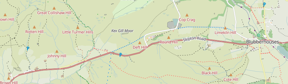
Kex Gill (humorously named the “Côte de Blubberhouses” for a stage of the 2014 Tour de France) is a road in Yorkshire between Harrogate and Skipton. Part of it is gradually sliding down the valley that it is built half-way up the side of and is being rebuilt; it was the access tags on bridleways there that caught my eye in the first place.
The twenty-fourth development diary marks the most significant milestone in OpenStreetMap-NG’s journey to date: the launch of our public test instance. After months of intensive development, we’re finally excited to show it all off! This isn’t just a technical achievement—it’s a pivotal moment in our mission to revolutionize open-source mapping.
🔖 You can read other development diaries here:
https://www.openstreetmap.org/user/NorthCrab/diary/
⭐ This project is open-source — join us today:
https://github.com/openstreetmap-ng/openstreetmap-ng
🛈 This initiative is not affiliated with the OpenStreetMap Foundation.
OpenStreetMap-NG is now live for public testing at osm.ng. This milestone represents months of intensive development, optimization, and preparation to create a stable testing environment for the community. Every mapper, developer, and OpenStreetMap enthusiast can now experience what we’ve been envisioning as the next generation of mapping platforms.
The test environment runs completely independently from the main OpenStreetMap infrastructure. It features the complete OpenStreetMap dataset while providing a safe playground for experimentation and feedback. You can explore all the functionality without worrying about affecting live data—perfect for giving the platform a thorough evaluation.
Liftoff! We have a liftoff, 32 minutes past the hour. Liftoff on Apollo 11.
OpenStreetMap went viral! Well, sort of.

A recent Instagram video highlighted an area where Pokémon Go had better trail coverage than Google Maps. You can see for yourself:
Currently, the video has over 12.6 million views and 733 thousand likes!
As you probably know, Pokémon Go uses OSM for its map data. So it’s cool seeing it acknowledged that OSM data performed better, even if it was misguided as a compliment towards Pokémon Go/Niantic.
With a little bit of searching, I found the path that they were on: Way #518694188. Added 8 years ago by BikeRoad.
Working independently to help plot missing areas but conscious of the current geopolitical situation. Can anyone recommend if there’s any areas to be mapped out of urgency? For instance Texas with the current floods, Gaza or Ukraine etc for the humanitarian issues and destruction of war. I want my work to have as much positive impact and possible and consequentially don’t want to be plotting somewhere remote in say Africa for instance when actually somewhere else is in a much more urgent and desperate need. Many thanks.
The actual event numbers are:
To keep contact: ivides@ivides.org

I notice all across China that bots have destroyed powerlines and now they are missing many segments that were previously complete.
Activities Performed
Skills Applied
Today’s tasks deepened my understanding of how surveying and cartographic techniques drive transmission infrastructure planning. The integration of GIS with field activities reaffirmed the importance of spatial accuracy in energy distribution networks. I was particularly engaged with the line diversion analysis, which challenged both technical reasoning and spatial decision-making. I continue to learn from my mentors and refine my approach to precision mapping and collaborative survey documentation.
Part 1: osm.org/user/Negreheb/diary/405306
Part 2: osm.org/user/Negreheb/diary/406030
Hello OSM Community,
I’m continuing my effort to capture 360° images of the city of Salzburg for use in Mapillary and Panoramax. The goal remains the same: improve OpenStreetMap data, especially in areas with unresolved notes where better visual context can help.
Here’s the current state of coverage from my 360° image collection:

To plan my routes, I’ve been using OSMAnd’s built-in GPX recording and map display. This allows me to see where I’ve already been and make instant decisions on which streets to cover next - without having a router trying to direct me back on track constantly.
I can also choose freely whether to ride on streets, paths, or cycleways depending on conditions. This flexibility has proven much more practical than relying on pre-planned routes.
Dear OSM Community and Team, Is there any possibility of accessing a newer imagery layer, such as Maxar? The current Bing Maps Aerial imagery appears to be significantly outdated, which makes it challenging to accurately update or edit map content.
I see many diaries on OSM, but unfortunately the good ones are hard to find, if they can be found at all.
In this diary, I offer some perspectives, without any technical pretensions, but just for the thinking of “what it might look like” in the vein of “Reimagining the OSM.org” or “Better-osm-org” but without the technical side.
This diary is a proposal, a reflection. Its aim is to offer a vision of what diaries might look like in the future.
Many diaries published by the community are interesting, not all of them are, but those that are would benefit from being discovered and promoted to a wider audience.
Diaries are not discoverable from osm.org. When a diary is discovered, it is almost exclusively through direct sharing via an OSM communication channel (forum, Telegram, Discord, etc.).
The aim is to offer ways to find interesting diaries more easily, to know which ones the community values or finds interesting.
Allowing diaries to be categorised offers several advantages:
A category would group together several diaries addressing the same theme.
This categorisation might be done in the form of keywords, for example: #tutorial #josm #streetcomplete #sotm #telecom #esri.
To enable the community to highlight the diaries that have generated the most interest and that they found most useful, it would be possible to add a like (or a downvote or an emoji reaction) to a diary.
The same options for comments might be used to highlight the comments most appreciated by the community.
This system would be very similar to GitLab for issues, or Reddit for content.
This is my my second day into the field of OSM, i went back and edited my home grown plce, yuh my home village and and waiting to welcome any reviews because i believe it is the right think to do and am welcoming any mistakes and am hoping to add many more places on the OSM today I went ahead and edited my villages by adding the various buildings and trees that haven’t been mapped yet
This project began with my own steps — capturing street-level imagery from Daffodil International University to Eastern University, Dhaka, Savar. Using Mapillary, I documented the road to support open mapping.
These images aren’t just photos — they’re vital pieces that will directly support and enhance OpenStreetMap. Every frame contributes to a bigger, collaborative mission: building a better, more accurate map for everyone.
The journey is still ongoing, day by day. Feel free to share any powerful screenshots — let’s map the future, together. 🌍
are eligible for free unlimited map downloads and live updates. To qualify: Enable the OpenStreetMap Editing plugin. Log in with your OSM username. Maintain at least 30 edits over the last two months.
?_highlight=live#free-for-osm-mappers


