OpenStreetMap logo OpenStreetMap

Diary Entries in English

Recent diary entries

Posted by brinnnnnn on 26 August 2025 in English.

A few bike lanes were added in the part of town I live in (yay!) and I’d like to add them.

However, I’ve mostly been using these apps to map things: * everydoor * map complete website * go map !! (rarely)

I cant find any way in map compete to add bike lanes – they added on the street, so effectively making the space for the cars narrower. Is there any simple way of going about and adding these types of lanes?

Thanks!

I’d like to share a simple method I’ve devised to map unfamiliar areas outdoors. Suppose you’d like create a GPX track of a park under the following constraints:

  • GPS data is inherently inaccurate, so you’d like to walk each path exactly twice to improve accuracy.
  • You’d like to finish an the exact point you started.
  • You’re in the field, so you want to keep things simple and not use something too complicated.

Since the diary does not allow posting GIFs, the full post is in the community forum.

Posted by Archit Rathod on 25 August 2025 in English. Last updated on 31 August 2025.

🎉 GSoC 2025 Final: Temporary Road Closures Database and API

Google Summer of Code 2025 • OpenStreetMap Foundation • Archit Rathod

After 15 weeks of intensive development, I’m thrilled to announce the successful completion of my Google Summer of Code 2025 project: Temporary Road Closures Database and API for the OpenStreetMap Foundation! 🎯

🚀 Live Demo - Try It Now!

Frontend: https://closures.osm.ch/
Backend API: https://api.closures.osm.ch/
GitHub: https://github.com/Archit1706/temporary-road-closures
GSoC Project: summerofcode.withgoogle.com

🎯 Problem Solved

OSM provides excellent static map data, but temporary road closures (construction, accidents, events) aren’t captured quickly enough for navigation apps. This project creates an open platform where communities can report closures in real-time and navigation apps can calculate closure-aware routes.

What We Built

Complete Backend System

  • FastAPI + PostgreSQL + PostGIS - Production-ready API with 25+ endpoints
  • OpenLR integration - Universal location referencing for cross-platform compatibility
  • OAuth2 + JWT authentication - Secure user management with Google/GitHub login
  • Advanced spatial queries - Bounding box searches, proximity filtering, route analysis

Modern Frontend Application

  • Next.js 15 + TypeScript - Interactive web interface with mobile optimization
  • Leaflet maps - Real-time closure visualization with OpenStreetMap tiles
  • Multi-step reporting - Guided forms for accurate closure submission
  • Demo mode - Full functionality without registration for immediate testing

Closure-Aware Routing Innovation

  • Valhalla API integration - Calculate routes that avoid relevant closures
  • Transportation filtering - Car, bicycle, and pedestrian-specific closure relevance
  • Route comparison - Direct vs. closure-aware route analysis
  • Real-time optimization - Live route calculation considering current conditions

🌟 Key Innovations

OpenLR Integration

See full entry

Location: Near West Side, Chicago, West Chicago Township, Cook County, Illinois, United States
Posted by SomeoneElse on 23 August 2025 in English. Last updated on 31 August 2025.

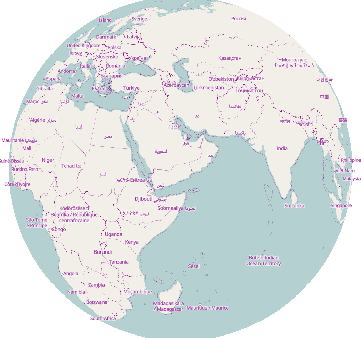
A globe view centred on the Indian Ocean

tl;dr: slightly less than an hour.

This was prompted initially by a forum comment (I can’t actually remember exactly where or by whom) that creating maps based on OSM was for “developers” and not “normal people” (not in those exact words), and by the thread here. The “slightly less than an hour” actually includes setting up a development environment from scratch on a new PC.

On that new PC I’ve already installed a text editor and a web server (“apache2”).

cd ~/src
git clone https://github.com/SomeoneElseOSM/SomeoneElse-vector-web-display
git clone https://github.com/systemed/tilemaker

In the first of those repositories there are a selection of map styles, including one that uses the OSMF demo vector tiles. Let’s first test that that works:

See full entry

Location: 2.470, 17.690

(english translation by OpenAI/chatgpt)

RETEX: Tagging Choices for My Urban Recycling Trekking

Hesitations, discussions, collisions with other contributors, changes, hesitations… but convergence.

to be continued maybe:

  • journal entry (upcoming): Existential questions about my encounter with Panoramax

At first, tagging the operator since it’s the target of the trekking.

The operator is known here as GPSEO, or GPS\&O, or Grand Paris Seine and/& Oise… Which name to choose? Likewise, I encountered clothing containers from Le Relais or Emmaüs, and again, which names should be used?

my encounter with Wikidata

Thanks to the forum, I was guided towards Wikidata, which allows assigning a unique code to a large number of resources (companies, operators, municipalities, associations, widely known people, …).

Once the resource in question is given a Wikidata code, its Wikidata entry contains important data (name, website, Wikipedia reference, revenue, …) and thus allows all Wikipedia collaborative applications to access these elements in a common way. So it is enough to reference the operator’s Wikidata code in OSM tags to identify it uniquely and stably. From this code, it’s easy to retrieve the operator’s website, its Wikipedia reference, and other useful information without having to explicitly add them as OSM tags (which would require updating OSM every time the data changes).

A single concession seems necessary: I retrieved the operator’s official name from its Wikidata entry and added it as an OSM tag for readability.

And therefore:

operator=GRAND PARIS SEINE ET OISE operator:wikidata=Q19945071

Tags deliberately omitted because the information is evolving and can be found in the operator’s Wikidata article:

operator:wikipedia, operator:website, operator:short

And similarly:

operator=Emmaüs operator:wikidata=Q989437

operator=Le Relais operator:wikidata=Q16654240

ref or operator:ref

See full entry

Posted by WilburSunflower on 21 August 2025 in English.

Greetings whoever is reading this, including my future self who may be the only audience.

I was invited earlier this year to take part in an exhibit called [“Compass Roses”] (https://www.compassroses.art/), which will be on view at Opalka Gallery in Albany, NY this Fall.

“Compass Roses: Maps by Artists is a national artwork co-curated by Nadine Wasserman and Renee Piechocki. The project offers a selection of maps created by visual, literary, and performing artists. “

I chose to make a map of Gun Violence Memorials in Albany. I was inspired by a memorial called Chyna’s World, a mural in memory of an 18-year old high school senior named Chyna Forney. Chyna was killed in crossfire in an incident when her boyfriend fired over 30 rounds at another man. The mural is painted at the location where the incident took place. After seeing this mural, I wondered if there were others like it.

I have been aware of the problem of gun violence for this entire century. I have perceived it from three aspects that touch but are distinct: school shootings, the eclipse of streetfighting, and police murder. I might say more about those three in this diary over the next few months, but for now I will just say that these have been buried the past five years by the sheer numbers of tragic gun deaths in this country, in my city, in my neighborhood, on my street. There were 10 shootings on my street when the world broke down during New York Pause, from April 27 2020 a few weeks into the pandemic through December 19, 2021. The nadir was the late night murder of 15-year old Destiny Greene, on a magical little street called Wilbur. I remembered the temporary monument that Destiny’s family had set up on Wilbur Street, and the attempts by some neighbors to set up a permanent memorial for shooting victims.

See full entry

Location: Mansion District, City of Albany, Albany County, New York, 12223, United States
Posted by pnorman on 20 August 2025 in English.

Vector Tile styles require icons are served in a sprite sheet. This contains all of the icons in one file. Years ago there were a few options for these, none of them great. These days, there are three common options: spreet, @basemaps/sprites, and sprite-one. The first is written in Rust while the other two are written in Javascript.

All have the same basic functionality of turning a folder of SVGs into a json+png spritesheet, and doing so at multiple resolutions. Spreet has the additional option of de-duplicating icons. If two icons are identical it will only put one copy in the PNG and reference the same image twice.

I benchmarked all three options with two sets of sprites: all the SVGs from OpenStreetMap Carto, and the OpenStreetMap Americana icons. The former is 973 icons and the latter is 248 icons. These are larger than a typical set of icons but are a good test.

  Test spreet sprite-one @basemaps/sprites
osm-carto SVGs @1x pixels 4194304 4078074 8339456
osm-carto SVGs @1x bytes 513159 763531 837792
osm-carto SVGs @1x bytes after oxipng 474750 649894 706845
osm-carto SVGs @2x bytes 1442588 2176457 2411489
osm-carto SVGs @2x bytes after oxipng 1325707 1896784 2088729
osm-americana @1x pixels 128265 122400 151760
osm-americana @1x bytes 75749 91870 92066
osm-americana @1x bytes after oxipng 75497 84986 85828
osm-americana @2x bytes 136177 213876 210650
osm-americana @2x bytes after oxipng 132462 197687 194950

See full entry

I’m importing boundaries in Croatia, and I’m almost done. So I wanted to describe my process so that someone else maybe doesn’t have to rediscover this process. Maybe there is a better one, but I didn’t find it.

Croatia in OpenStreetMap had admin_level=7 borders imported, but the borders were not precise. So my job was to import admin_level=8 into these. I had the data in .osm format, and a license that is compatible. I wanted to keep the history of the old boundaries, so deleting everything and just copying inside wasn’t a choice.

First we need JOSM, and some experience with it. We turn on the Expert Mode in View. We need to install the plugin “utilsplugin2”. Then we go to Map Paint Styles in Preferences, and turn on the “Admin Boundaries” style.

So the process goes like this. In JOSM I open the .osm file with all the admin_level=8 boundaries. Then I download the area where I intend to work, but I use “Download from Overpass API” feature. In it I add the next Overpass query:

[out:xml][timeout:90][bbox:{{bbox}}];
(
relation["boundary"="administrative"];
)-> .adminrelations;
(  .adminrelations;
  way(r);
) -> .ways;
(
  node(w.ways);
)-> .nodes;

way(bn.nodes);
(._;<;); (._;>;);
out meta;

What this query does is it downloads all the boundary relations, and all the ways that are connected to them.

1. Disconnecting

Next step I did was to disconnect all the roads, forests, rivers and anything that is not a boundary from the existing boundaries. I upload that, and later download a cleaner situation.

2. Splitting

See full entry

When using OSM’s iD editor in New South Wales, Australia, there are multiple background layers you can enable that show aerial/satellite imagery. Different imagery sources can vary greatly in terms of how recent and/or blurry they are. Here I’ll discuss my experience using them.

OpenStreetMap's background layers for NSW, Australia

DCS NSW Imagery

This is my preferred imagery source, primarily because it’s very clear even at high zoom levels. You can see lots of detail which makes it great for mapping.

Unfortunately it’s also the oldest of the imagery sources for NSW. In Armidale it’s dated 2018, but other towns can be as old as 2009! You can enable the “DCS NSW Imagery Dates” overlay to see what date the imagery for a given area was taken.

Esri World Imagery

See full entry

Hello, I would like to ask if in your country there are officially designated areas designated by local authorities (such as municipalities, civil protection agencies, emergency services, etc.) for:

Short-term population management (assembly points, waiting areas, temporary gathering places after an event). Long-term population management (tent camps, temporary housing sites, large shelters). Management of external rescue operations in response to the call (logistics bases, areas dedicated to external rescuers arriving from elsewhere, equipment sorting areas). These areas would be part of civil protection / emergency management planning, mapped and designated in advance, not improvised during the event.

Do such areas exist in your country? And if so, are they publicly available (e.g., through official maps, open data, local plans)?

Thanks in advance for your feedback!

https://community.openstreetmap.org/t/existence-of-designed-civil-protection-areas-in-your-country/134249

I had the privilege of presenting about weeklyOSM at COSCUP 2025, Taiwan’s largest open source conference, held on August 9–10, 2025, at the National Taiwan University of Science and Technology (NTUST) in Taipei. This year also marked COSCUP’s 20th anniversary, making it an especially meaningful event to join in celebrating open source.

About My Presentation

My talk, titled “Behind the Scenes of weeklyOSM: How We Share OSM News Every Week,” focused on the inner workings of our community-driven newsletter.

For those unfamiliar, weeklyOSM is an independent, multilingual publication that has summarized developments in the OpenStreetMap (OSM) world every week for more than a decade—now surpassing 780 editions.

Key Topics

During the session, I highlighted:

  • weeklyOSM’s Mission – Connecting mappers worldwide by bringing local stories to a global audience. We aim to be the heartbeat of the OSM community, delivering the pulse of mapping activities around the globe.
  • Independence – weeklyOSM operates as an independent media platform, unaffiliated with any organization (including OSMF), and delivers news in over 15 languages to ensure accessibility for everyone.
  • Our Toolchain – A closer look at OSMBC (OpenStreetMap Blog Collector), the open-source platform we use for collecting, authoring, translating, reviewing, and publishing news.
  • How We Collect News – From OSM diaries, community channels, and social media, to direct submissions, ensuring comprehensive and balanced coverage.
  • Taiwan’s Role – Taiwan’s active mapping scene and unique events, such as night market mapping parties, which exemplify how local stories can inspire and educate a global audience.

Why COSCUP Was the Right Place

See full entry

Background

I’ve mapped in OSM for many years now, but more of my work and been Bike-Pedestrian related, and I’ve only just come back around to mapping streets their widths and their number of lanes as a means to start evaluating crossings in our area. This means, despite my many years of mapping, I’m pretty terrible at getting the number of lanes forward/backward/both_ways and the corresponding turns associated with them correct. It’s just not that intuitive, although I can’t think of a better option.

My solution

A while back I discovered the JOSM ‘map paint styles’ specifically the lanes and enhances lane styles and combined with some tagging presets I’ve gotten acceptable at mapping major roads and the ability to visualize if I’m doing things right is a huge benefit.

The 12m (39’) of road that once visualized, haunts me.

See full entry

Location: Bentonville, Benton County, Arkansas, United States

Five years ago, I started mapping on OpenStreetMap, and I have to say that I have never had problems with my Italian community, especially because opinions are expressed in a detailed and cordial manner, even when they differ.

Since I discovered that there were recommended guidelines in the wiki for managing bounding boxes, I have tried to remind all users—whether beginners or experienced—about them, to make it easier for us locals to verify edits.

Unfortunately, I have encountered non-Italian users who have expressed their disapproval through teasing, humiliation, and everything associated with bullying.

This contrast between the Italian community (where people reason seriously) and the noisy part of the international community (where responses come in the form of provocations) has struck me deeply, leaving me sad and hurt.

At this point, I asked myself whether it really makes sense to continue improving the mapping of the territory where I live if I am surrounded by users who do not respect me…

The answer is yes, because OpenStreetMap is an open system, in need of data and people who try to do their best, also helping “younger” users. The more of us maintain a healthy environment, the healthier the community becomes, and the fewer those who ruin it will be.

Regarding the insults and teasing I have received, I have already taken all possible actions. The most effective measure has been to block, wherever possible, on all known social platforms the people who publicly and privately mocked me.

Posted by rphyrin on 15 August 2025 in English.

As a passenger in a moving car, I like to do OSM field mapping, constantly scanning the view outside and noting every detail I can spot. The catch is, I need to do it fast. Too fast to worry about proper tagging or structured data entry. What I really want is an app that shows my current location on a basemap, lets me tap anywhere on it to drop a point, and attach a rough plaintext note. Later, once I’m back home, I could export all those coordinates and notes as a GeoJSON file, import it into iD Editor or JOSM, and take the time to think about proper tags.

A few weeks ago, while traveling to Bandung, I tried doing “quick, live mapping on the road” with Vespucci. It turned out to be a bit of a nightmare. Each time I spotted something, I had to stop the GPS autofollow, download OSM data, add a node, pick a tagging preset, fill out the details, upload, and then repeat the whole cycle. By the time I was done with one object, I’d already missed several others. That constant stop-and-go completely killed the flow of observation.

What I wanted instead was a much simpler loop: keep the GPS autofollow running, spot something interesting, click on the map, type a quick note, and move on. No tagging, no data downloads, no breaking the momentum. Just rapid-fire, location-anchored note-taking while the car keeps moving.

At first, I tried building a dedicated Android app to do this. Unfortunately, my Gradle setup was corrupted, and fixing it meant re-downloading everything, which would have taken far too long. That’s when I remembered a small web app I had built three years ago for a similar purpose, although back then it didn’t have GPS tracking. So instead of starting from scratch, I decided to just add the GPS feature to that old app.

The result is now live at http://altilunium.github.io/sakumaps/v2.

See full entry

Posted by Juncus on 15 August 2025 in English.

Eastern Road Travels

I’ve been continuing an anti clock-wise journey around Grenada.

Other Projects

Yeah there have been a month or two when work here stops. Often its just other projects but sometimes it’s a but like my day job.

Progress

I think this period started with Egmont, where I have family, through Calivigny, Fort Jeudy then all the Westerhalls. A lot of coastal details too at times. I did go inland but do not recall how far. Had fun doing the river along La Sagesse Beach Road and all the associated buildings. Loved doing Felix Park Rd. I met Dr G and spent an afternoon with him there. Very nice to meet a local botanist that I could learn from.

So now in August I’m nearing the end of Hope. From then on it’s all North and into 2026.

Location: Marquis, Saint Andrew, Grenada

Good afternoon from sunny, hot, and muggy northeast Florida!

I am still learning OSM, who is not, and having a blast doing it. It is increadibly fun and incredibly fascinating. Always see and find something new every single day! Love it!

Right now I decided to make the jump to JOSM. I know it is a little or a lot complicated. Best way to learn is jump and start going. When I downloaded it the current version, 19423, was not active I down loaded a earlier version and needed to update. I was literally looking at help files, Googling it, asking questions, a lot. But, and don’t ask me how, I eventually landed the current version, 19423, on my computer. It was one of those moments that you have no clue how you did something but who cares its finally done.

To get started I did the LearnOSM again. I sometimes have to do it over and over to get the idea. Its a good refresher as well. For someone like me who has multiple challenges the fact OSM allows for going back and being able to go over is really good. I saw some updates that and changes that need to be done based on the new JOSM version. I need to figure out who to send those to. Now I am on working on the LearnOSM JOSM - Detailed Editing. Thank you also for OSM having the ability to work on a mock community. That is tremendous and helps so so much.

I do wish that some of the tutorials were more accessible for people with challenges. I think that will allow for a entirely new population of folks to get mapping. We that are disabled and something like OSM for a lot of us is a pair made for each other. Its quiet and you can do it any place and in any environment. It really is a awesome combination. I have a lot of suggestions to make this happen. Need to find out whom to talk to about this as well.

Here are a few….

See full entry

Location: San Marco, Jacksonville, Duval County, Florida, United States