OpenStreetMap logo OpenStreetMap

Users' Diaries

Recent diary entries

台灣華語版本翻譯,原作者 s8321414

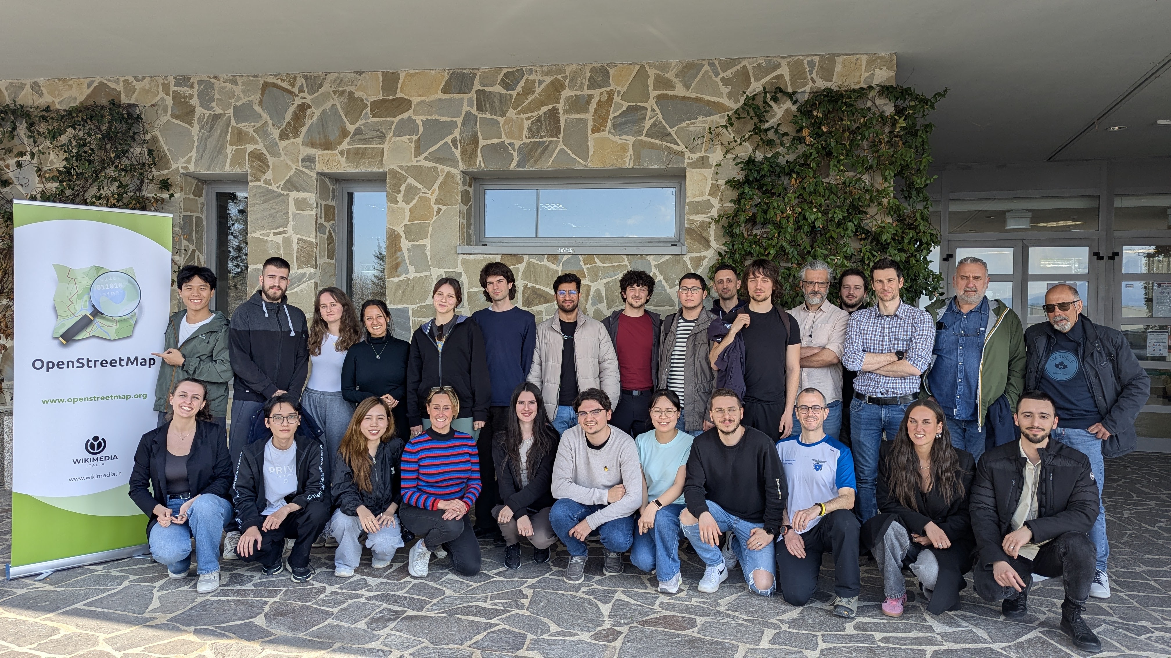
開放街圖臺灣社群2025年又閣開始佮 Wikidata 臺灣社群合作舉辦街景踏查團,這改4月份是到雲林縣的虎尾鎮佮土庫鎮踏查,踏查團的經費來源是對台灣維基媒體協會來的,兩工(4/26、4/27)的中晝頓由 TomTom 公司贊助。

這改踏查團佇4/26早起對雲林高鐵站外集合,隨就出發前往虎尾鎮佮土庫鎮和六房天上聖母信仰相關的廟宇拍攝照片,雖罔講是街景踏查團,毋過這改360相機問題袂少🫠,囥佇筆者所駕駛的車頂的這台是定定當機(傷熱?),另外一台車頂的是一直無法度予手機連使用。雖綱按呢,這改猶是有上傳 53,854 張街景照到 Mapillary(同時間包含平面相片片佮360環景照片,對筆者撰寫這篇日記的時,猶閣有部份的照片猶末上傳)。

Supaplex 講述 OpenStreetMap

第二工 (4/27) 是這改踏查團的編輯工作坊,佇本年度的六房天上聖母 紅壇舉辦,和本次踏查團相關的開放街圖編輯攏有 #tt_event 主題標籤(可能會當直接寫佇變更集的註記當中,或抑是寫佇變更集的 hashtags 標籤當中),欲看維基媒體計畫的編輯會當佇 [Dashboard] 中來檢視。

關於 OpenStreetMap 臺灣

OpenStreetMap 臺灣是由台灣關心投入 OpenStreetMap 的編輯者所組成,自從 2010 年開始由個孤一个人獨自編輯變成集結閣較濟人參與的共編地圖專案的在地社群。目前佇台灣有仃台北佮 Wikidata 社群共同舉行的 OpenStreetMap x Wikidata 月聚,閣有無定期的踏查活動。

本文用姓名標示-相仝方式分享 4.0 國際授權

Location: 過港, 越港里, 土庫鎮, 雲林縣, 633001, 臺灣

本文章同時也提供 English version台文版本


開放街圖臺灣社群2025年又開始跟 Wikidata 臺灣社群合作舉辦街景踏查團,而4月份是到雲林縣的虎尾鎮與土庫鎮踏查,本次踏查團的經費來源為台灣維基媒體協會,而兩天(4/26、4/27)的午餐則由 TomTom 公司贊助。

本次踏查團在4/26早上於雲林高鐵站外集合,隨後就出發前往虎尾鎮與土庫鎮各個與六房天上聖母信仰相關的廟宇拍攝照片,雖說是街景踏查團,不過這次360相機問題不少🫠,架在筆者所駕駛的車上的是經常當機(過熱?),而另一台車上的則是始終無法使用手機連上,話雖如此,這次仍上傳了 53,854 張街景照至 Mapillary(同時包含了平面照片與360環景照片,截至筆者撰寫這篇日記時,仍有部份照片尚未上傳)。

Supaplex 講述 OpenStreetMap

第二天 (4/27) 則是本次踏查團的編輯工作坊,在本年度的六房天上聖母 紅壇舉辦,與本次踏查團相關的開放街圖編輯均有 #tt_event 主題標籤(可能會直接寫在變更集的註記中,或是寫在變更集的 hashtags 標籤中),而維基媒體計畫的編輯則可在其 Dashboard 中檢視。

關於 OpenStreetMap 臺灣

OpenStreetMap 臺灣由台灣關心投入 OpenStreetMap 的編輯者構成,自從 2010 年開始由個人獨自編輯變成集結更多人參與的共編地圖專案的在地社群。目前在台灣有在台北與 Wikidata 社群共同舉行 OpenStreetMap x Wikidata 月聚,以及不定期的踏查活動。

本文以姓名標示-相同方式分享 4.0 國際授權。

I want to talk about how to name the trails in Catoctin Mountain Park, a US national park in Maryland. The available information about trail names is a bit inconsistent. This post serves as a way for me to organize my thoughts and document the conclusions I’ve reached.

Background

Catoctin Mountain Park, as I mentioned, is part of the US National Park system. It’s located in Maryland, at the northern end of the Blue Ridge Mountains and the outer perimeter of the Appalachian Mountains. It has a number of hiking trails. The trails are split between the east and west sides of the park; each side’s trails are interconnected, but the two sides don’t connect directly to each other.

I recently hiked most of the east side trails. It’s those trails I’m primarily focused on. I haven’t (yet) been to the west side, so I don’t personally know the ground truth there.

Ground Truth

On the ground, trails are designated by colored blazes on trees. The blazes use a number of different colors and several different shapes. Some distinct trails use the same colors as each other, but use different blaze shapes. There are sections where two trails overlap; those sections uses blazes that are half the color of one trail and half the color of the other trail.

There are no trail names posted, with one exception. A trail between the visitor center and the Lewis Property part of the park is both blazed with white rectangles and has regularly-placed signs saying “Gateway Trail”.

The park generally uses rectangular blazes for longer trails that form the core of the east side’s trail network. Triangular and circular blazes are used for shorter trails that either form shorter connections or have a specific purpose. For example, there’s a short nature trail with signs pointing out local plant species. That trail is blazed with triangles.

See full entry

Location: Frederick County, Maryland, United States

🌳 Como mapear uma árvore no iD Editor

  1. Acesse o iD Editor Vá para https://lnkd.in/ggMaf_2 Faça login e clique em “Editar” (abre o iD Editor)

  2. Adicione um ponto Clique no botão “Ponto” (ícone com um marcador) Clique exatamente onde está a árvore no mapa

  3. Classifique como Árvore No painel lateral, digite “Árvore” ou “Tree” Selecione a opção que diz “Árvore” (com a tag natural=tree)

  4. Adicione informações (opcional)

Você pode preencher outros detalhes:

species = Nome científico (ex: Mangifera indica)

leaf_type = broadleaved (folhas largas) ou needleleaved (aciculadas)

leaf_cycle = deciduous (caduca) ou evergreen (perene)

height = altura aproximada (ex: 5)

diameter_crown = diâmetro da copa

  1. Salve suas edições

Clique em “Salvar” Escreva um resumo como: Adicionei árvore em praça pública

Clique em “Carregar” para enviar a edição OpenStreetMap Umbraosm hashtag#naturaltree hashtag#tag hashtag#id hashtag#editorid

🏘️ Projeto de Inserção Assistida de Edificações no Brasil

O Projeto de Inserção Assistida de Edificações tem como objetivo ampliar significativamente a cobertura de edificações no OpenStreetMap (OSM) em território brasileiro, com foco especial em áreas urbanas ainda pouco mapeadas.

A iniciativa utiliza como base os dados do Google Open Buildings, disponibilizados sob uma licença compatível com a ODbL do OSM, conforme explicitado no site oficial da Google: 🔗 https://sites.research.google/gr/open-buildings/

Desde 2024, o mapeador Santamariense, membro ativo da comunidade OSM Brasil, vem trabalhando na correção e aprimoramento desses dados com o objetivo de adaptá-los às diretrizes da comunidade e garantir sua qualidade. Esse esforço culmina, agora, na proposta oficial à comunidade OSM Brasil, convidando todos os mapeadores a analisarem e participarem do projeto, sugerindo também áreas prioritárias para mapeamento.

See full entry

Location: Plano Piloto, Região Geográfica Imediata do Distrito Federal, Região Integrada de Desenvolvimento do Distrito Federal e Entorno, Região Geográfica Intermediária do Distrito Federal, Distrito Federal, Região Centro-Oeste, Brasil

SOCIALIZANDO O CONHECIMENTO: CHAMADA PARA MOSTRA DE PROJETOS DE MAPEAMENTO


O III Workshop Mapeamento Participativo e Cartografia Social - MPCS 2025, em sua terceira edição, visa reunir pesquisadores de países lusófonos(*), que adotam as metodologias de mapeamento participativo ou colaborativo, além do público interessado.
O evento é uma iniciativa do IVIDES.org, em parceria com o Laboratório de Cartografia - GeoCart-UFRJ. Agradecemos aos parceiros, Laboratório Integrado de Geografia Física Aplicada - LiGA-UFRRJ, Laboratório de Geotecnologias - Lageot-UFF Campos, Associação de Geógrafos Brasileiros - AGB- Seção Campinas/SP, Programa de Pós-graduação em Geografia - PPGG-UFRJ; e pelo patrocínio da FAPERJ e da empresa IVIDES DATA.

Página oficial
https://ivides.org/workshopmpcs2025

MOSTRA DE PROJETOS

Está sendo organizada uma Mostra de projetos de mapeamento, para apresentação online de projetos individuais (completos ou já com resultados). Para participar, basta preencher o formulário de inscrição até 20 MAIO 2025, informando os dados básicos da submissão.
https://ee.kobotoolbox.org/x/Gn3xTsd8
A equipe entrará em contato adiante, a fim de informar sobre o aceite e alinhar os detalhes. Conheça os critérios de avaliação na página oficial do evento.
Serão emitidos certificados de participação como palestrante para aqueles(as) autores(as) de projetos apresentados. O formulário necessita que autorize o armazenamento de cookies para funcionar a contento.
Para contato, por gentileza, enviar mensagem para: ivides@ivides.org.
(*) Países lusófonos: Angola, Brasil, Cabo Verde, Guiné-Bissau, Guiné Equatorial, Moçambique, Portugal, São Tomé e Príncipe e Timor Leste.

See full entry

Cross-posted from https://odeco-research.eu/?p=4999

On Thursday, the 10th of April 2025, we celebrated the event “OpenStreetMap: Mapping & Hiking” at the University of Camerino, Italy. After two months of preparation, the event was well-received and had a diverse and satisfied crowd.

Group photo

OpenStreetMap (OSM) is a collaborative geographical database of the world. Millions of people use its data, and also millions contribute to it in various ways. However, there are still places where there is no strong local community, where its villages and rural areas are heavily undermapped. Camerino, while the town itself is well mapped, has some incredible nature and cultural spots nearby, which needed an update. As well, being a university town with students coming from all corners of Italy and the world, makes it a prime location for engaging in outreach activities and kickstarting a community.

See full entry

Location: San Paolo, Camerino, Macerata, 62032, Italy

How complete are addresses in OpenStreetMap in Belgium? After several status these previous years (see September 2022, in May 2023, and in May 2024, November 24), I finally adapt the process to analyse addresses completeness for all Belgium!

The aim of this small article is to assess the completeness of addresses in Belgium for OSM, compared to official data. Basically we count the address points in OSM and in official data by municipalities. We don’t check the address quality here, we know there can be errors in OSM data, and even in official data.

How I proceeded

Using QGIS, I gathered OSM addresses and official ones. OSM data is imported in a PostgreSQL database using osm2pgsql based on a pbf file for Belgium from the 24th of April. Official data is coming from BEST address csv files, that gathers Belgian addresses for the 3 regions of the country.

Addresses in OSM can be mapped on buildings (most of the cases), hence on a way, or on a node. I consider only objects with the “addr:housenumber” tag. First, I made a single layer of addresses points from OSM data by merging the centroids of buildings with this tag and the points with these tags, by excluding the places where these two layers overlaps (typically points with an address inside a building where there is already an address). The method is far from perfect: I don’t consider relations, I miss some way objects with addresses but without the building tag (typically some schools), and probably a lot of other edge cases due to the “joyeux bordel” of the OSM data model.

Official data considers several address points for each building unit, or box number. It means that there are often several points at the same place, especially in cities, accounting for each box number. Since the mapping of box number is often not so used in OSM, I merged all points at the same place (given a buffer of 1 meter) as a first step. This reduces the number of official address from 7,004,321 to 4,454,017.

See full entry

Location: Quartier Saint-Jacques - Sint-Jacobswijk, Quartier du Centre - Centrumwijk, Pentagon, Brussels, Brussels-Capital, 1000, Belgium

A UMBRAOSM está no Mastodon!

Agora a União dos Mapeadores Brasileiros do OpenStreetMap (UMBRAOSM) também faz parte do Mastodon, a rede social livre e descentralizada! A comunidade OpenStreetMap em todo o mundo utiliza o Mastodon para compartilhar atualizações, divulgar eventos, projetos de mapeamento e trocar experiências.

Siga a UMBRAOSM e fique por dentro das novidades do mapeamento colaborativo brasileiro!

Acesse: https://en.osm.town/@umbraosm

Ich haben einen Track hochgeladen. Der Import hat geklappt steht in der Bestätigungs-email und bei meinen Tracks wird angezeigt:

” 2025_04_27_2195689183_bsjw_all_tracks_openmaps.gpx.gz 5330 Punkte IDENTIFIZIERBAR

vor 16 Minuten von angela_bsjw

Braunschweiger Jakobsweg ist ein Pilgerweg. Er beginnt in Magdeburg am Dom. Dort zweigt er vom Jakobusweg Sachsen-Anhalt ab. In Hildesheim-Marienrode trifft er auf den Jakobsweg Via Scandinavica und endet nach 275 km am Kloster/Schloß Corvey bei Höxter . “

Aber der Track wird in der Karte nicht angezeigt. Was ist falsch??

Location: Gartenstadt, Westliches Ringgebiet, Braunschweig, Niedersachsen, 38122, Deutschland

EN version below

Ce post a été initialement publié ici.

Le 14 décembre 2024, Mayotte était frappée par le cyclone Chido, le plus violent qu’elle ait connu depuis plus de 50 ans. Rapidement, l’IGN a diffusé des imageries Pléiades prises les 17, 18, 20, 21 et 24 décembre et a confirmé le 25 décembre que la communauté OSM pouvaient les utiliser comme source dans ses éditions. De suite, j’ai eu l’envie de les utiliser pour évaluer les dommages du bâti. Pourquoi le bâti ? Du point de vue cartographique, parce que les dommages sont plus visibles sur des infrastructures polygonales que ponctuelles ou linéaires. Du point de vue de la réponse de crise, parce que les dégâts étaient particulièrement importants, ayant fait disparaître ou rendu impraticables les foyers de beaucoup d’habitants.

Trois mois après, ce billet revient sur les grandes étapes de cette cartographie toujours en cours, organisée bénévolement sur du temps libre.

Revue et choix méthodologique

La cartographie des dommages du bâti à l’aide d’imagerie post-désastre n’a évidemment pas été inventée dans OpenStreetMap et des expériences similaires ont déjà été menées par le passé dans OSM.

Après le passage du cyclone Haiyan sur les Philippines en novembre 2013, une cartographie des dommages du bâti avait été réalisée sur la région autour de Tacloban. Par ailleurs, des chercheurs du Harvard Humanitarian Initiative (HHI) avaient publié en mars 2016 un article détaillant une méthodologie qui avait été de suite adaptée à OSM sous la forme de modèles de préréglages et d’un style cartographique pour JOSM, et appliqués notamment à Haïti après le passage du cyclone Mathieu en octobre 2016.

See full entry

Location: Combani, Tsingoni, Mayotte, 97680, France

OpenStreetMap Indonesia, in partnership with TomTom, organised a Community Mapping Party at GoWork Plaza Indonesia in Jakarta on Saturday, 26 April 2025.


Planning

January 23, 2025 – 17:05 WIB

“For those living in the Jabotabek area, how about we hold our first offline monthly talk next time and align it with the TomTom Mapping Party event?”

Initial discussions about hosting an offline gathering began among members in the Greater Jakarta area. A suggestion was made to align the monthly community meeting (usually held online, but in this proposal, it will be held offline for the first time) with an upcoming Mapping Party event organized by TomTom. The idea was presented in an open-ended way, inviting members to consider the possibility when time allowed.

January 30, 2025 – 08:34 WIB

“It might be better to hold it before Ramadan.”

The conversation picked up pace, with another participant suggesting that it would be preferable to hold the event before the fasting month (Ramadan) began. The comment hinted at the logistical advantages of scheduling it earlier.

February 3, 2025 – 11:01 WIB

“If it is held before Ramadan, preparation time would be very tight. It has been proposed to schedule it after Eid, possibly in mid or late April, and a response is still awaited.”

It was mentioned that holding the event before Ramadan might be too rushed given the short preparation time. As a result, a new proposal was introduced: to hold the Mapping Party after the Eid al-Fitr holiday, possibly in mid to late April. Final confirmation was still pending at that point.

March 23, 2025 – 14:28 WIB

“If we hold an offline mapping party and meetup at the end of April 2025 somewhere around Jabodetabek, would participants be able to attend?”

See full entry

Posted by Ed48152 on 26 April 2025 in English.

I have added a pin for my house, which is at 38150 N Vista Dr in Livonia! From here, I have encountered tons of wildlife, including fish, and generally been treated pretty well. There are parks nearby, riparian zones, old-growth forests, modern civilization including a hotel with swimming pool, and plenty of transportation opportunities. You can even walk here. There’s water, a lawn, and interesting people here. My basement is the coolest!

Location: The Villas Condos, Livonia, Wayne County, Michigan, United States

UMBRAOSM: A União dos Mapeadores Brasileiros do OpenStreetMap

A União dos Mapeadores Brasileiros do OpenStreetMap (UMBRAOSM) é uma organização comunitária que reúne voluntários de todo o Brasil comprometidos com o mapeamento colaborativo, livre e aberto. Nascida da paixão de diversos mapeadores pela construção coletiva do conhecimento geográfico, a UMBRAOSM tem como missão fortalecer a presença do OpenStreetMap (OSM) no Brasil e fomentar práticas de mapeamento inclusivas, acessíveis e de alta qualidade.

O que é o OpenStreetMap?

O OpenStreetMap é um projeto colaborativo que visa criar um mapa mundial livre, editado por qualquer pessoa, a qualquer momento. Ele é usado por milhões de pessoas, empresas, organizações humanitárias e governos que necessitam de dados geoespaciais atualizados e abertos.

No Brasil, o OSM desempenha um papel vital no apoio a ações de emergência, planejamento urbano, pesquisas acadêmicas, projetos ambientais e iniciativas sociais.

A Origem da UMBRAOSM

See full entry

Posted by Jaiden1254 on 26 April 2025 in English.

Por que usar ferramentas de mapeamento colaborativo como o OpenStreetMap?

Uma visão da UMBRAOSM – União dos Mapeadores Brasileiros do OpenStreetMap

Em um país com dimensões continentais como o Brasil, o acesso a informações geográficas abertas, atualizadas e confiáveis é essencial para promover o desenvolvimento social, a inclusão territorial e a justiça espacial. Nesse contexto, a UMBRAOSM acredita no poder transformador das ferramentas de mapeamento colaborativo, especialmente o OpenStreetMap (OSM) — o mapa livre do mundo.

Desde sua criação, a UMBRAOSM atua para fortalecer a cultura cartográfica aberta e inclusiva no Brasil, promovendo oficinas, capacitações, eventos e ações comunitárias em diversas regiões. Neste artigo, explicamos por que o uso do OpenStreetMap é uma escolha estratégica para indivíduos, coletivos, instituições públicas e privadas. O que é o OpenStreetMap?

See full entry

🇧🇷 UMBraOSM – União dos Mapeadores Brasileiros do OpenStreetMap

A UMBraOSM é a associação brasileira que reúne pessoas apaixonadas por mapas livres e colaborativos, com base no projeto OpenStreetMap (OSM) — o “Wikipedia dos mapas”.

Criada por e para mapeadores, a UMBraOSM promove:

🗺 Mapeamento colaborativo em todo o Brasil

👥 Formação de comunidades locais e temáticas

📚 Cursos, eventos e oficinas sobre cartografia livre

🤝 Parcerias com escolas, universidades, ONGs e governos

🌍 Defesa do conhecimento livre e da soberania dos dados geográficos

A associação foi registrada oficialmente em 2023 e tem como missão fortalecer a cultura do mapeamento aberto no Brasil, conectando pessoas, causas e territórios.

Se você acredita no poder dos mapas feitos por e para as pessoas, a UMBraOSM é o seu lugar!

🔗 Junte-se à gente no Telegram: https://t.me/grupoumbraosm

UMBraOSM #OpenStreetMap #MapeamentoColaborativo #DadosAbertos #GeografiaLivre #CartografiaColaborativa

Location: Ilha do Leite, Recife, Região Geográfica Imediata do Recife, Região Metropolitana do Recife, Região Geográfica Intermediária do Recife, Pernambuco, Região Nordeste, Brasil