Beddhist's Comments
| Changeset | When | Comment |
|---|---|---|
| 5105525 | over 1 year ago | It was all from my own GPS logs, which I put into Polish format for an ambitious project to produce a Garmin world map. When the project didn't get off the ground I found a script to translate it all it to OSM. |
| 5105525 | over 1 year ago | You are correct. However, as these were mass imports, there are thousands of them. Only someone with db level access can delete them all. You may want to contact the data working group for this. Otherwise, feel free to delete them whenever you find them. |
| 5231765 | over 1 year ago | Hi, The data used at the time was imported from Garmin maps I had created, using a script, which created these entries. It stands for Polish map format and the code used for that feature in the original map. I don't think they serve any purpose, so feel free to delete them anywhere. |
| 6187422 | over 2 years ago | Hi Haris, although this was 10 years ago I remember visiting this place. I have since learned that this was the old highway 2, replaced by the big road further East. The NE end is pretty much permanently under water, depending on the water level in the reservoir, so it's now a road to nowhere. Cheers,
|
| 78364171 | over 5 years ago | Hi, you have not only added tracks, but also streets. Only, they are all dirt and should be marked as such. Regards,
|
| 72674174 | over 5 years ago | Hi, you have added a whole lot of rectangles to the map, representing buildings. Only, the outline and orientation of the buildings does not correspond to what exists in reality. The map should represent what we find in the real world. Would you mind correcting this, please? If you don't want to spend the time required to map the buildings correctly may I suggest you delete them. Kind regards,
|
| 62470100 | over 6 years ago | In response to my comments 5 months ago Jeff Underwood changed it to unpaved track. Now you change it to a paved residential street. Why? Reverting it now. |
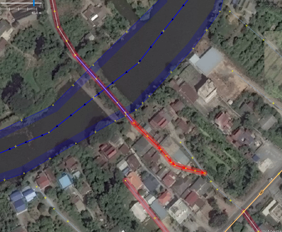
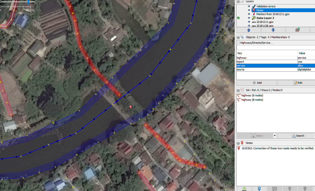
| 52392246 | over 6 years ago | Ways 527906916 & 527906918: You made that a residential road, but it connects to a highway via a pre-existing alley. Normally, you don't make a connection like this through a lower class road. (There are exceptions; I have seen stranger things in Thailand.) So, you should look at all available images and either upgrade the existing connection to residential, or draw your new road the same, i.e. as an alley. The road looks like a very narrow single lane, so I believe alley is appropriate here. A nice bridge you have drawn across the river here. But, switch off the OSM layer and I have to ask: when was the last time you saw trees and other vegetation cover most of a bridge? Looking at Bing, it looks very much like a dam to me. If you zoom out you can see that this is an old river bed here. To the West you can clearly see a weir and lock gates, so a dam is not just possible here, but very likely. Looking at the dam on DGS I can't see clearly, but on Bing there is a way of some sort on top of the dam, so it's not unreasonable to draw an alley here. Clearly, there are a lot of people living on this river island. For them this would be the shortest way to get to the highway in the East. Clearly, this road is too small to carry this kind of traffic, which leads me to believe that it is not open to the public. We have to be extra careful when drawing such shortcuts, as they can get people stuck with their vehicles in back alleys. In summary, I'm going to replace the bridge with a dam, make the road an alley and for now I'm also breaking the road here, until I can get there myself to have a look. Before:
After:
Thanks for your time,
|
| 52397964 | over 6 years ago | Way 527960878: another unclassified road that in reality is a muddy, bumpy goat track. When will Facebook start to review all these old edits? |
| 55689626 | over 6 years ago | Way 527960909: it is clearly visible that this is not an unclassified road, but a farm track. Fixed. |
| 52049391 | over 6 years ago | Dear Michael, Way 524747135: A nice bridge you have drawn over the canal here, although it's at a funny angle. The only real problem is that it does not exist in any of the imagery available to me. For now I'm marking it as 'road', which will at least make it un-routable. If you have more recent imagery and there is in fact a bridge, please change it to track. The two roads connected to it in the W, running parallel to the canal are in reality farm tracks. I'm fixing this now. Regards,
|
| 57861828 | over 6 years ago | Hi Tom,
|
| 52053617 | over 6 years ago | Hi Jeff, That looks good now. Thanks for taking the time to respond and edit. Regards,
|
| 52053617 | over 6 years ago | Way 524779149: this is a single-lane road, so should be residential, not unclass. (I rode it the other day and it's so small I would have mapped it as a track, although that is debatable, as it serves a bunch of houses.) What I can't see in the images is that the middle section is unpaved. For that reason, I have split it in 3. Please continue looking S along the 2 'new' sections, where there is a T junction. I can see a 2-lane asphalt road, which you have correctly mapped as unclass. But why did you put a zig-zag in there, when all I can see is a gentle curve? |
| 52185748 | over 6 years ago | Ways 525947505, 525947507, 525947502, 525947506 & 525947503 are all unpaved, clearly visible on Bing. The last one starts where an existing street ends, source=GPS. Even if you cannot clearly make out the road surface, the fact that somebody stopped mapping there on the ground should give you pause to think. |
| 52185748 | over 6 years ago | I have removed the E portion of way 525947507. It went through a vege garden. |
| 55394936 | over 6 years ago | Way 525947499: your colleague almost drew this correctly, apart from the dirt surface. Why, oh why did you have to extend it and connect it to the highway? I can clearly see on both Bing and DGS that this is not a road, but a ditch. Look here: https://www.mapillary.com/map/im/RcoEP7WfZxvNA3fU8XkcPg |
| 52362918 | over 6 years ago | Way 527609422: another long dirt track mapped as unclassified road. (fixed) |
| 52153207 | over 6 years ago | 525686285, 525686289: more tiny tracks drawn unclassified. |
| 52185748 | over 6 years ago | Way 294789763 was a residential street, leading off into the paddies. Why did you change it to unclassified? source-GPS usually means the mapper was actually there. Reverting... |