Bexhill-OSM's Comments
| Changeset | When | Comment |
|---|---|---|
| 70418808 | about 6 years ago | A fair judgement.
|
| 70418808 | about 6 years ago | Sorry, I should be referencing your previous changeset, here's the two nodes in question:
|
| 70418808 | about 6 years ago | Hi Nathan, I noticed you have deleted some unmarked crossings with tacktile_paving which is important for our accessibility. Any reason? Should I be marking these in a different way?
|
| 68902560 | over 6 years ago | I'm just reverting your changeset as there were some tagging issues, but will resurvey and update your location tomorrow. |
| 67944421 | over 6 years ago | Hi thanks for your help - adding surfaces is great. However, PLEASE, PLEASE be careful, you have moved a number of nodes (shops and cash machines) to other parts of the map and I'm having to revert those changes. A better map editor to avoid these mistakes is JOSM.
|
| 66647446 | over 6 years ago | Hey Ageing Rocker,
|
| 66647446 | over 6 years ago | Duplicating some places: osm.org/node/6237273788 |
| 65505542 | over 6 years ago | Thanks, I fixed the couple of construction tags that were still on there. It'll show as open now.
|
| 65247950 | over 6 years ago | You're late - it's been demolished! |
| 62086387 | almost 7 years ago | Nice to see a fellow mapper in the area, enjoy Bexhill :) |
| 62063994 | almost 7 years ago | Nice to see a fellow mapper in the area, hope you enjoyed Bexhill :) |
| 61234901 | about 7 years ago | Should this tag have been changed to 'wikimedia_commons'? |
| 49102483 | about 7 years ago | Oops thanks for spotting that mistake. I'll fix it now. |
| 57939650 | over 7 years ago | Thanks Jan, that one slipped through the net. I appreciate your time to check. Done. |
| 54933572 | over 7 years ago | I made a mistake with the tagging on this. I'd accidentally set this building to a house when it was a garage. Fixed now, thanks! |
| 53882597 | over 7 years ago | Hey there, I think it may be better practice to use the 'width' key rather than the 'lanes' key for narrow lanes- osm.wiki/Key:lanes#Narrow_roads
|
| 53164508 | almost 8 years ago | Hi Mike, yes it's been an invaluable asset to finding paths around my neighbourhood to survey. They also supply a wms overlay (https://data.gov.uk/dataset/rights-of-way-not-definitive-for-east-sussex) which works great with josm.
|
| 53164508 | almost 8 years ago | Mike,
|
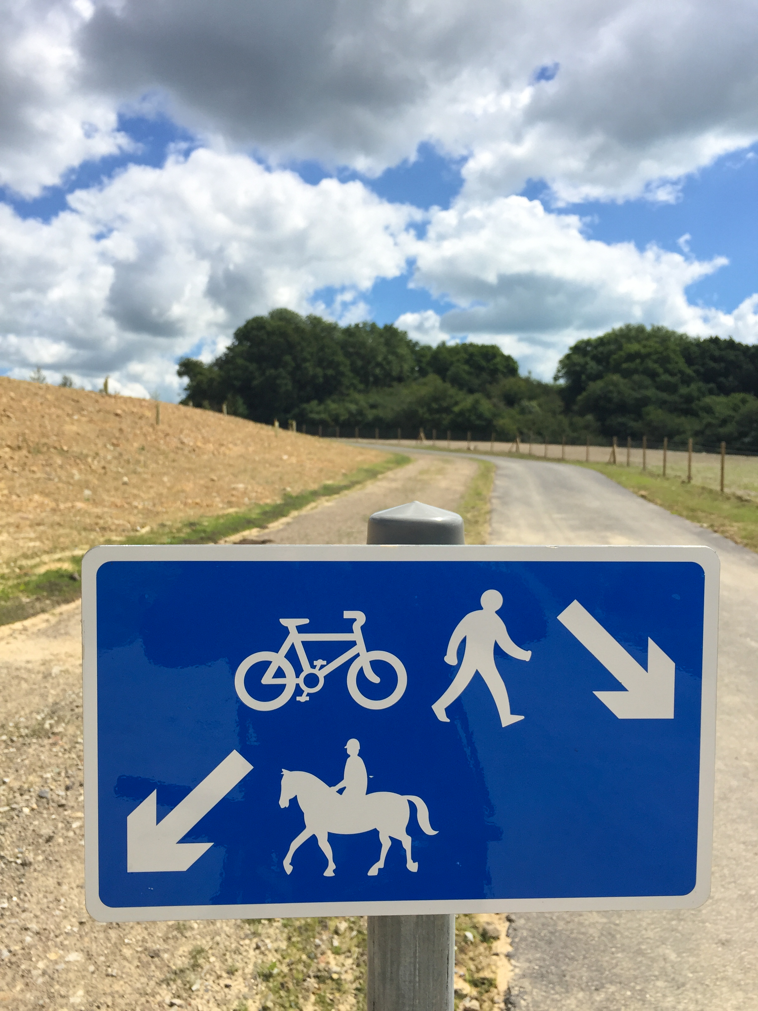
| 53164508 | almost 8 years ago | Hi Mike, yes foot and bike traffic is split with horses at this point with a sign similar to this (http://news.eastsussex.gov.uk/wp-content/uploads/sites/4/2016/07/Greenways-2.jpg).
|
| 52032658 | almost 8 years ago | Do you need help with editing? This church does not exist. |