I asked myself, how to map the new built SPAR (Supermarket), which is mostly overgrown. Below is the concept picture of the building:
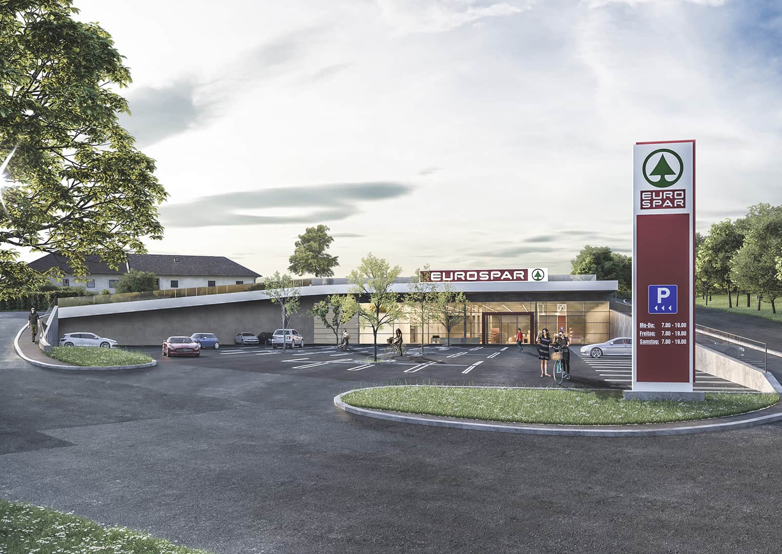 It pretty much looks like this in reallife and you can (can’t) see, that there is a field, respectively a meadow on the roof. Mapping the building as “underground” wouldn’t make much sense to me, but “overground” does neither. Maybe I should just map the Supermarked as a single point (like it is right now, temporarily)?
What would you suggest?
討論
由andy mackey於2021年11月17日08:49發表的評論
I posted a question that points to your interesting question. see https://help.openstreetmap.org/questions/82606/mapping-under-ground-or-earth-covered-building
由Rovastar於2021年11月19日06:29發表的評論
Map the roof as surface=grass