JeroenHoek's Comments
| Changeset | When | Comment |
|---|---|---|
| 109021011 | almost 4 years ago | Bedankt voor tip, ik heb het gepoogd toe te lichten. |
| 109870470 | almost 4 years ago | Klopt; die zit er ook omheen: Dat is nu nog een multipolygon-vlak, maar dat is nu parking=street_side een geformaliseerde tag is niet meer nodig. Ik zal in Leeuwarden de resterende amenity=parking met parking=street_side waar ik dit zo gedaan heb aanpassen naar de uiteindeijke taggingmethode: osm.wiki/Tag:parking%3Dstreet_side Dit is een voorbeeld van hoe het eigenlijk hoort: |
| 109870470 | almost 4 years ago | Ja voor amenity=parking_space kun je die negeren: osm.wiki/Tag:amenity%3Dparking_space Het is niet fout, maar overbodig omdat een parkeervak bijna altijd voor 1 auto is. De waarde van capacity=1 is dan impliciet als hij ontbreekt. |
| 109870470 | almost 4 years ago | Bij een amenity=parking_space is capacity niet nodig als die 1 is (en dat is meestal zo bij een parkeervak). Op een amenity=parking (die om de amenity=parking_space heen ligt) is die wel op zijn plaats. |
| 89779838 | about 4 years ago | You tagged an amenity=parking with fee=yes and charge=0 €. What does that mean? Should that be fee=no? |
| 109724670 | about 4 years ago | Having the option to ignore changesets with bounding boxes that fall outside of the area I'm viewing would be very helpful. People shouldn't map a pub in London and a parking garage in Shanghai in the same changeset, but for these janitorial edits with a limited number of entities worldwide it makes perfect sense to do it in one changeset, because it also gives people the opportunity to address any concerns about it in one place. Could you post a link to the issue if you open one SekeRob? I can't imagine this wouldn't have been reported before though. |
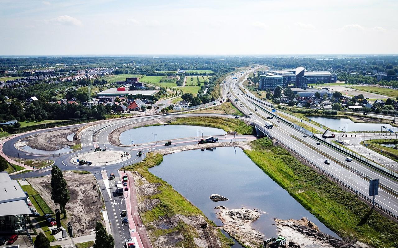
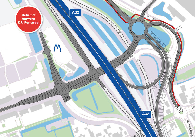
| 103957364 | about 4 years ago | Was je toevallig van plan de nieuwe situatie bij afrit 12 verder in te tekenen? Het is een turborotonde geworden: En: https://heerenveenbeterbereikbaar.nl/previews/2020/5/18/media_629_530882_w800_h800_fit.jpg Hij gaat 23 augustus open. De oude oprit is al weg. Mocht je er niet aan toekomen deze week dan wil ik hem ook wel doen; geef maar even aan. |
| 109733461 | about 4 years ago | I agree with you 快乐的老鼠宝宝. While payment:debit_cards may be vague; it is a valid tag. The one you replaced is simply a misspelling. Thanks! |
| 109724670 | about 4 years ago | Tip: for these kind of global edits it helps if you use a title like this: "Fix tag value typo: payment:debit_card → payment:debit_cards" That makes it clear that you are performing a common sense maintenance task. In these cases you can helpfully add this link as the source for your changeset: |
| 109107899 | about 4 years ago | Thanks! |
| 92128070 | about 4 years ago | Even ter controle: je had in deze changeset de Bachstraat doorgetrokken naar de hoofdrijbaan (primary) van de Valeriusstraat, maar die aansluiting is er bij de herinrichting uitgehaald (er ligt een fysieke afscheiding). Nu zie ik dat ook op de beelden uit 2020, en ik meen dat ik dit ook dit voorjaar nog gezien heb op de fiets. Klopt dit of is die aansluiting toch nog gemaakt in het najaar van 2020? |
| 109107899 | about 4 years ago | In fact, Lange Marktstraat 28 does not exist. |
| 109107899 | about 4 years ago | Nice work adding those murals! The address information should not be there though. These buildings have several addresses, but these are all assigned to discrete parts of the building (apartments, offices), not the building itself. |
| 108980734 | about 4 years ago | The seamark-tags will need to be updated in any case. The bridge is now being rebuild at the same place though (although the bridge supports may move towards one shore or the other). |
| 108713170 | about 4 years ago | For such cases you could consider foot=use_sidepath, but that may depend on local laws and mapping custom. Often pedestrians are legally compelled to use the footpath if it runs parallel to the road or cycleway. foot=use_sidepath is fairly well supported in routers these days. Keep in mind that footway=* really only provides a way to further specify the type of a highway=footway (e.g., footway=crossing, footway=sidewalk, footway=access_aisle in addition to highway=footway); it's not really suited to be used to say something about any mapped parallel footway (well, you can of course, but it goes against documentation and common usage patterns). Routers are thus unlikely to support it. foot=use_sidepath may be worth looking into though. |
| 99472424 | about 4 years ago | Thanks! |
| 108764124 | about 4 years ago | Thanks. You can use sidewalk=separate instead though, if you wish to keep that data. |
| 99472424 | about 4 years ago | Why are you adding footway=separate as well as sidewalk=separate? Only the latter is needed to indicate the sidewalk is mapped separately. |
| 108713170 | about 4 years ago | Hello, you've used footway=separate (way 313596139 for example) in this changeset, replacing the documented and common sidewalk=separate: Was that intentional or a mistake? |
| 108764124 | about 4 years ago | Hello, you've used footway=separate (way 829265224 for example) in this changeset. You probably meant to use sidewalk=separate though. |