
Just to brag a little about the the work done so far ;-)
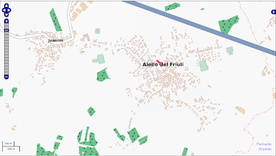
Sett inn af Klenje 3. nóvember 2010 á English.When I registered in OpenStreetMap, my village was poorly mapped:
Now, thanks to:
1) regional data
2) national satellite picture (PCN)
3) local knowledge ;-)
the map look like this:
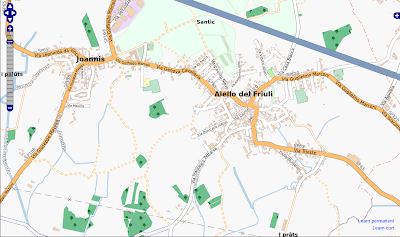
And it's better than Google Maps which hasn't been updated recently and contains subtle mistakes. Thanks to everyone who made this possible!
Umræða
Athugasemd eftir ColinMarquardt sett inn 3. nóvember 2010 kl. 23:01
You are part of the team, so everyone else also has to thank *you* for your work. :) Thanks!
Athugasemd eftir marscot sett inn 4. nóvember 2010 kl. 14:17
great stuff