
Just to brag a little about the the work done so far ;-)
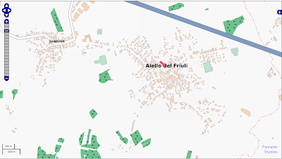
ߊ߬ ߟߊߦߟߍ߬ߣߍ߲߬ ߦߋ߫ Klenje ߓߟߏ߫ 3 November 2010 ߦߋ߫ English ߟߋ߬ ߘߐ߫When I registered in OpenStreetMap, my village was poorly mapped:
Now, thanks to:
1) regional data
2) national satellite picture (PCN)
3) local knowledge ;-)
the map look like this:
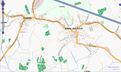
And it's better than Google Maps which hasn't been updated recently and contains subtle mistakes. Thanks to everyone who made this possible!
Discussion
ߡߙߌߣߊ߲ ߞߊ߬ ߝߘߊ߫ ColinMarquardt ߟߊ߫ 3 November 2010 at 23:01 ߘߐ߫
You are part of the team, so everyone else also has to thank *you* for your work. :) Thanks!
ߡߙߌߣߊ߲ ߞߊ߬ ߝߘߊ߫ marscot ߟߊ߫ 4 November 2010 at 14:17 ߘߐ߫
great stuff