OpenStreetMap logo OpenStreetMap

Mapanauta's Diary

Recent diary entries

Dear HOT Voting members, HOT staff, HOT volunteers and people interested in HOT, Humanitarian and Open Mapping,

I hope this message finds you and your loved ones well and healthy. I would like to present to you my end of term report as President of the Board. On 10 February 2021 I shared a detailed annual report for 2020. In this new report I would like to focus on challenges, ongoing efforts, key learnings and achievements.

Challenges

Of all the anticipated challenges while participating as a Board Member, a global pandemic was not on our list. It was a difficult and challenging time for Voting members and staff and the Board members were not an exception. Board members, like many other people, were facing difficult situations with loved ones getting infected, trying to find a balance between working from home and taking care of their families, among many other difficult situations.

This could be one of the reasons why not every Board member was contributing equally. Being part of a Board requires certain commitments such as time and asynchronous participation to be able to be part of the decision making process, often outside of Board meetings. Some Board members were not responsive or slow on providing feedback in discussions, this caused delays in progress and decision making.

My suggestion to future Board participants is to review in advance the Board Procedures and other relevant documentation to make sure you can commit to this two year period.

See full entry

Hi to all,

I would like to introduce myself and share my interest of being part of HOTOSM board.

I have had the privilege to participate in various projects involving Humanitarian Mapping. As a volunteer I have been representing OpenStreetMap and HOTOSM in different forums and I am Co-Founder of the Geochicas initiative in the one we want to impulse more female presence in Geospatial technologies and increase the number of women adding Open Data in OpenStreetMap.

Most recently I participated as HOT volunteer in Guatemala. HOTOSM Team was supporting the Clinton Health Access Initiative and the Guatemala Ministry of Health to assist local technicians who are in the field all year fighting diseases such as Dengue, Zika, Chingkonkuña, and Malaria in the area of Escuintla. HOT arrived in Guatemala to support the Ministry of Health with the use of Open Data Kit (ODK) and OpenMapKit (OMK) in order to have a more detailed census and action plan using open source tools so the goal to eliminate malaria can be tracked and achieved by 2020. I participated in the training activities with the HOTOSM team.

Since 2014 I became fascinated with HOTOSM and OSM when I realized all the potential it could have to change people realities and how we can improve their lives so I started getting involved in the Open Data and Open Mapping world. In 2016 on behalf of HOTOSM I received the honor of being one of the 50 Digital Leaders of Mexico and last year INEGI (after a few years of exchanging communication with them) invited OpenStreetMap Mexico to be part of the Consulting Council to be able to review their strategy and tools before launching to the public.

See full entry

Hi to all,

As some of you might know I am candidate for the OSMF Board election 2018. There is diverse group of candidates and I am sure every single one will be doing a great job if they are elected. Please find the information and manifiestos here. I was not able to complete all my answers by the deadline so please find the pending answers below:

The values and goals of the OpenStreetMap project

I agree with the core value and goals covered in the mission of the OSMF website but I consider specifically regarding the goals we need to find a way to measure the achievements and set up statistics to be able to know if we are going in the right way or where are we failing to achieve the objectives.

Your opinion on Term limits for board members?

I agree with having limited term limits, I don’t thing it is healthy for any organization having the same people in a Board for a long period. More people should  have the opportunity to be part of the board and provide diverse and fresh ideas. When a person knows they have a limited period to cause impact I believe they can be more efficient.

Your opinion on Organized editing

I believe this is a good start and this is a good way to enforce the quality of the data in OSM. In my own experience I helped to coordinate mapathons in Universities where the largest audience we had was eighty eight mappers, of course this was with the help of the professors in the Universities, so we have to make sure the guidelines do not discourage community events and the excitement of organizing  events (which is already a lot of work). For the companies it will be good because that way a standard about what is expected from them will be open an available. Regarding small organization or enthusiatic groups I will say mentioning examples in a wiki will help understand the scope of the guidelines.

Due diligence reverting edits

See full entry

Happy mapping with OpenStreetCam in Guadalajara!

Posted by Mapanauta on 28 September 2018 in English. Last updated on 29 September 2018.

[English] As many of you know today is my last day in Telenav, I already wrote a blogpost sharing with you this journey, please find it here. I also would like to share with you the latest city I helped to coordinate adding images in OpenStreetCam, the beautiful city of Guadalajara (also called the mexican Silicon Valley ;) ). There are more tan 7,500 kms full of images just for you! Please join the efforts adding POIs, Street names and more details to this wonderful city!

Happy mapping!

[Español] Como muchos de ustedes saben el día de hoy termino mi periodo laboral con Telenav, escribí un blog compartiendo esta etapa que podrán encontrar aquí. Me gustaría también compartir con ustedes más de 7,500kms de calles y carreteras llenas de imágenes de la hermosa ciudad de Guadalajara que encontrarán en OpenStreetCam. Imágenes que espero les sirvan para mejorar los datos abiertos de la ciudad. Pueden ayudar agregando POIs, nombres de calles y más detalles a esta increíble ciudad.

¡Feliz mapping!

See full entry

Traducción del Diary de Martijn osm.org/user/mvexel/diary/43767

ImproveOSM is mi esfuerzo como empleado de Telenav para procesar billones de puntos GPS de nuestros usuarios y socios para convertirlos en tareas procesables para mappers. Actualmente estamos detectando restricciones de vueltas faltantes, caminos faltantes o con sentidos de circulación equivocados. La forma más fácil para trabajar es esas tareas es instalando el plugin JOSM

Ahora que tenemos la nueva versión de MapRoulette, pensé que sería bueno hacer algunas de esas tareas disponibles también a través de MapRoulette. Esto las hace un poso más manejable debido a que tenemos 80,000 calles con sentido único faltante o equivocadas, casi 300,000 restricciones de vueltas y casi 1.6 millones de mosaicos con calles faltantes. Para dividir esas cifras, empecemos con un esfuerzo de país-a-país para agregar caminos faltantes. Creé un desafío para Colombia que puedes encontrar aquí. Déjame llevarte por el proceso de resolver una tarea de caminos faltantes. Utilicé JOSM para mi ejemplo. También puedes usar ID, así podrás brincarte los pasos que involucran los plugins JOSM.

1. Instala el plugin de JOSM

Si estás usando JOSM, abre las preferencias en el plugin y busca ImproveOSM. Instala y reinicia JOSM. Esto te dará tres capas del mapa de los diferentes tipos de tareas. Establecí la opacidad de la capa de caminos faltantes más baja debido a que los mosaicos pueden dificultar ver las imágenes.

See full entry

Nuevo MapRoulette beta

Posted by Mapanauta on 4 April 2018 in Spanish (Español).

Traduccion de la versión de Martijn publicado aquí ttps://www.openstreetmap.org/user/mvexel/diary/43596

Hola a todos, me gustaría presentarles la nueva versión de MapRoulette e invitarlos a probarla. Actualmente está en beta y su retroalimentación e ideas para mejora son bienvenidas. Esta información también aparece en la sección Wiki del repositorio de GitHub. No duden en ingresar problemas que hayan notado ahí ¡me gustaría escuchar sus comentarios!

MapRoulette es una herramienta web para llevar a cabo micro tareas en OpenStreetMap. Te proporciona tareas pequeñas de menos de un minuto para mejorar OpenStreetMap. Cualquiera puede crear un grupo de tareas, llamadas Desafíos, que la comunidad puede completar juntos.

Esta es la tercera version de MapRoulette. El sitio web has sido rediseñado completamente y contiene muchas nuevas características comparado con el último gran reléase.

Comparando MapRoulette 2 y 3

Aquí encontrarán algunas de las características más visibles

See full entry

Mapeo Humanitario Libre y Abierto en respuesta a los terremotos de México

Posted by Mapanauta on 14 October 2017 in Spanish (Español). Last updated on 15 October 2017.

A principios de septiembre nos estábamos enfrentando a algunos de los huracanes más fuertes del Caribe en las últimas décadas, el equipo de mapeo humanitario [HOTOSM] (https://www.hotosm.org/projects/hot_activates_for_multiple_disasters_hurricane_irma_and_maria_mexico_earthquakes_and?utm_source=Bolet%C3%ADn+Mensual+de+SocialTIC&utm_campaign=2f37c5d580-EMAIL_CAMPAIGN_2017_04_27&utm_medium=email&utm_term=0_ade63aa0ff-2f37c5d580-139103741) ya estaba colaborando a toda velocidad para ayudar a crear mapas en las áreas donde los datos eran limitados o inexistentes. Pocos días después los estados del sur de México estaban siendo golpeados por el primer terremoto, Oaxaca y Chiapas son conocidos por ser estados con una gran población marginada, en la comunidad de OpenStreetMap hemos estado discutiendo anteriormente sobre la necesidad de crear mapas detallados para estos estados que carecen de datos libres y abiertos de sus poblaciones. Los voluntarios de la comunidad de OpenStreetMap México solicitaron ayuda a HOTOSM para crear tareas y así agregar datos valiosos como edificaciones y carreteras en las ciudades y localidades donde la ayuda era más urgente. Una de las ciudades más afectadas fue Juchitán

See full entry

Open Humanitarian Mapping in response of Mexico earthquakes

Posted by Mapanauta on 14 October 2017 in English. Last updated on 15 October 2017.

—English Version—

Early September we were facing some of the strongest hurricanes in the Caribbean ocean over the past decades, the humanitarian mapping team [HOTOSM] (https://www.hotosm.org/projects/hot_activates_for_multiple_disasters_hurricane_irma_and_maria_mexico_earthquakes_and?utm_source=Bolet%C3%ADn+Mensual+de+SocialTIC&utm_campaign=2f37c5d580-EMAIL_CAMPAIGN_2017_04_27&utm_medium=email&utm_term=0_ade63aa0ff-2f37c5d580-139103741) was already collaborating full speed to help creating maps in the areas were data was limited or nonexistent. Suddenly the Southern states of Mexico were hit by the first earthquake, Oaxaca and Chiapas are well know for being states with a large marginalized population, in the OpenStreetMap community we have been discussing in the past the need of creating detailed maps for these states among others who lack of this data. Volunteers in the Mexico community requested help to HOTOSM to create tasks to map valuable data for buildings and roads in the towns where help was needed the most. One of the cities more affected was Juchitan

See full entry

Why I would like to join HOTOSM

Posted by Mapanauta on 7 February 2017 in English.

Note: English version [EN]- Versión en Español abajo [SP]- Version Française ci-dessous [FR]

[EN] Why I would like to join HOTOSM

It was short time after Nepal earthquake when I understood and measured the power of mapping, what it could do to support people in need and how open mapping could be saving lives. I start gathering with a small group of mappers is Mexico City who got together every Wednesday evening, I wanted to learn and see what else could be done. In State of the Map US 2015 with my colleague Andres Ortiz we presented [“When will Mexico be navigable on OpenStreetMap”] (https://youtu.be/JIZD0xtRRFA) working in a technology company, [Telenav] (http://www.telenav.com/), helped us to get resources to start improving the map from the roots, we started an import project to improve the Administrative boundaries of the country going from 69 valid boundaries to 2,457 . After that conference in New York everything started moving faster. In September 2015 the 30th anniversary of Mexico city earthquake took place, the National Digital Strategy Office of the Government of Mexico in the one Rodolfo Wilhelmy was Open Data Director at that time invited me to help with part of the coordination having a Earthquake drill and making different Government entities to understand the value of Open Mapping. Thanks to the experience we gained as a community with the Earthquake simulation, at the time Hurricane Patricia was about to hit the Pacific Coast of Mexico, more than 500 mappers helped to map the area in less than 48 hours following the example from Nepal. All this community efforts were mentioned in the Internet day by the President of Mexico mentioning how HOTOSM volunteers supported this national emergency.

See full entry

Note: English [EN] please find the Spanish version below [SP]

[EN] Last week some members of the OSM Mexico Community had the chance to participate in the first OSM Training focused in Geography professors from High Schools located in municipalities close to the State Capital, Toluca. It was a four day event in the University of the State of Mexico. First Day It was the opening day and Edgar Lemus gave the Talk “Democratization of GIS OSM for high school education” making the professors aware about the importance of open source GeoTechnologies to get more involvement from the students and benefits in the societies. The second part of the event Edgar Lemus and myself gave the following topics to do a full immersion of the professors in the OSM world:

  1. What is Open Data? What is OpenStreetMap? What are the benefits of using OpenStreetMap?
  2. Humanitarian OpenStreetMap
  3. Mapping with ID Editor
  4. Mapping with HOTOSM Tasking Manager

Edgar Lemus presentando

See full entry

Versión en Español del Blog creado por Martijn Van Exel 15 de Noviembre 2016

Con la ayuda de ImproveOSM, el proyecto de Telenav para analizar billones de puntos GPS para detectar Missing Roads (caminos faltantes), sentidos de una sola dirección, restricciones de vuelta, ya han visto 60,000 mosaicos de caminos faltantes, 15,000 sugerencias para caminos de un solo sentido y 2,000 restricciones de vueltas desde que el proyecto se lanzó en Septiembre 2015.

Hoy, el equipo de Telenav ha liberado una nueva versión del sitio web ImproveOSM. ImproveOSM.org es ahora basado totalmente en el conocido iD Editor de OpenStreetMap. El nuevo ImproveOSM combina los beneficios de la herramienta con la que estamos familiarizados y fácil de usar con el poder de las detecciones de ImproveOSM.

El nuevo sitio web ImproveOSM mostrando Missing Roads (caminos faltantes)

El nuevo sitio web ImproveOSM mostrando Missing Roads (caminos faltantes)

See full entry

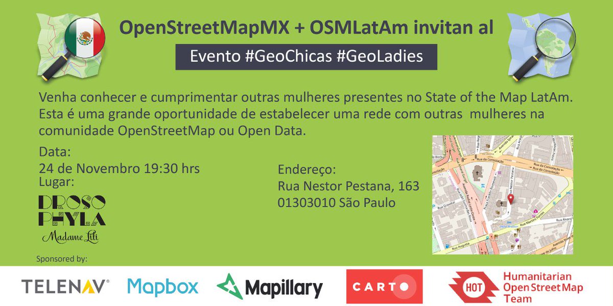
Results and new initiatives after #GeoChicas #Geoladies event in Sao Paulo, Brazil

Posted by Mapanauta on 1 December 2016 in English. Last updated on 12 December 2016.

English Version (Spanish version below)

Last week on November 24th, one day before starting the 2nd State of the Map LatAm (#SOTMlatam2016) taking place in the vibrant city of Sao Paulo, a group of women interested in Open Data and Open Mapping, decided to gather and to start a discussion to make OpenStreetMap more integrate and increase the female presence. According to some statistics from VGI only 3% of all editions is made from women in the community. Having the largest data base in the world with not enough diverse groups will give not enough data and will be representing only one reality.

See full entry

Location: Rincón Verde, Naucalpan de Juárez, State of Mexico, 53126, Mexico

Presentando OpenStreetView

Posted by Mapanauta on 17 August 2016 in Spanish (Español).

Post Original: Martijn Van Exel

Traducción: Mapanauta

Después de casi un año de estar pensando, desarrollando y hacer pruebas ¡el equipo de OSM de Telenav está listo para presentar OpenStreetView a todos los mappers de OSM! OpenStreetview (OSV) es la plataforma libre y abierta de imágenes a nivel de calle diseñado 100% con OSM y teniendo en mente a los mappers.

Presentamos oficialmente OSV a la comunidad OSM en State of the Map US, donde tuvimos una charla de 20 minutos y un stand donde dimos cochecitos a control remoto para todos los que se habían registrado :). Los coches se acabaron rápidamente - ¡casi la mitad de las personas de SOTM US se habían registrado! -Pero todavía puedes ver la sesión gracias a los grandes organizadores de SOTM US que hicieron grabaciones de todas las sesiones profesionalmente. Si tienes 20 minutos y no te gusta leer, ver el video va a ser la mejor manera de entender qué es OSV y cómo se puede utilizar para mejorar OSM. O si vienes a SOTM en Bruselas, puedes conocer a nuestro equipo allí (¿más cochecitos a control remoto? ¡Quién sabe!) Y puedes asistir al workshop.

See full entry

**Versión en Español: Reconocimiento a HOTOSM por el Presidente de México en el Día del Internet 2016 — Short Link: http://bit.ly/hotosm_mx_es **

On the Internet Day, May 17 2016 the President of Mexico Enrique Peña Nieto invited fifty citizens who called Digital Leaders (#LideresDigitales) to have a dialogue on the future of technology and Internet in Mexico, I had the opportunity of being among these group of citizens. The President talked about various related topics but especially appreciated the efforts of humanitarian mapping conducted by Humanitarian OpenStreetMap in Hurricane Patricia.

 Day of Internet 2016- Dialogue with the President of Mexico

See full entry

This blog was originally posted in the Blog from Improve-OSM, if you want to see the complete Blog please click http://blog.improve-osm.org/en/happy-mapping-hour-presentation-import-project-inegi-mgn-national-geostatistical-reference/

Last April 6th 100% of the Mexico Telenav’s team (Andrés Ortiz 50% and Miriam Gonzalez 50% 😀 ) presented the results of Import Project INEGI National Geostatistical Framework. The meeting point was the Felina bar on the edge of Condesa and Escandon neighborhood.

See full entry

Originalmente este Blog fue compartido en el Blog de Improve-OSM, si desean ver todos los link mencionados favor de dar clic en el link: http://blog.improve-osm.org/es/happy-mapping-hour-presentacion-proyecto-importacion-mgn-marco-geoestadistico-nacional-del-inegi/

El pasado 6 de Abril nos reunimos 100% del equipo Telenav México (Andrés Ortiz 50% y Miriam Gonzalez 50% 😀 ) para presentar los resultados del Proyecto de Importación del Marco Geoestadístico Nacional del INEGI. El punto de reunión fue el Felina bar en los límites del barrio Condesa con Escandón. Más de 20 personas reservaron y llegaron a la cita.

Andrés presenting in Happy Mapping Hour

Andrés presenting in Happy Mapping Hour

See full entry

Last February 26th and 27th the UAEMX and the OpenStreetMap Mexico community hosted a 2 day OpenStreetMap Conference and Workshop event in Toluca, State of Mexico. This events aims to increase the awareness of OpenStreetmap and the mapping community in the country. Another objective is to improve the base geospatial data coverage in different areas of Mexico and maintain an active mapping community that can be ready in cases of disaster responses and support other humanitarian initiatives. The attendees were students and graduated students of the University but the invitation was open to people interested in Open Data initiatives.

Day 1. Introduction to OpenStreetmap and Start Editing with ID Editor

The First day we started in the afternoon at 4pm with an audience of 87 people. An introduction of OpenStreetmap was given including how Humanitarian OpenStreetMap works and how events such as the 30th commemoration of the earthquakes of 1985 and earthquake simulation in the Zocalo of Mexico City helped to organized the mapping of the area Hurricaine Patricia could had affected last October.

After the conference a more interactive part took place in the one the participants in advance had already created a OpenStreetMap account, this was part of the requirements of take the course (thanks to previous experiences of Céline Jacquin she emphasized this task, as well as having previously installed the apps for the second day, so we avoid losing time and having connectivity issues!) Then we explained how ID Editor works and showed them the fundamental elements of OpenStreetMap. The audience was asked to go to the same area in the map and create a POI, a line and an area. After this introduction it seems everybody was confident to start mapping the world!

See full entry

Publicado por mvexel el 29 julio 2015 Traducido al Español por @Mapanauta

México liberó una gran cantidad de datos abiertos hace poco tiempo. Huge: Mexico’s statistical institute INEGI goes open data @INEGI_INFORMA (via @rodowi — Alex Barth (@lxbarth)

Mucha de esta información es geoespacial, por eso digo ¡yummie! Alex Barth escribió acerca de estos datos que vienen del Instituto Nacional de Geografía y Estadística (INEGI) en su diario poco tiempo después de la liberación con un excelente mapa para mostrar que tan rica es la información:

(Mis habilidades mediocres para animaciones GIF realmente no le hacen justicia – chequen la publicación del Blog de Alex para ver el mapa interactivo).

See full entry

Publicado por mvexel el 29 julio 2015 Traducido al Español por Mapanauta

México liberó una gran cantidad de datos abiertos hace poco tiempo. Huge: Mexico’s statistical institute INEGI goes open data @INEGI_INFORMA (via @rodowi — Alex Barth (@lxbarth)

Mucha de esta información es geoespacial, por eso digo ¡yummie! Alex Barth escribió acerca de estos datos que vienen del Instituto Nacional de Geografía y Estadística (INEGI) en su diario poco tiempo después de la liberación con un excelente mapa para mostrar que tan rica es la información:

(Mis habilidades mediocres para animaciones GIF realmente no le hacen justicia – chequen la publicación del Blog de Alex para ver el mapa interactivo).

See full entry