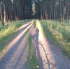
Starting with album of unofficial bicycle routes around Malacky
Käyttäjä MiroJanosik kirjotti tämän 9. Februarya 2016 kielellä EnglishStarting with album of unofficial bicycle routes around Malacky. It can be found at http://rudava.mypage.sk , it is of course based on OSM data (and my paper notes) and drawn by hand in UMAP.
I’m expecting to slowly add new tracks as I find them and as I get contributions from other cyclist in the region. I found a local cyclist group “SCK Záhorák Malacky” which will have knowledge about local paths.
Discussion
Kommentti käyttäjältä Piskvor 10. February 2016 klo 09.25
Nice! Did you consider getting the tracks rendered e.g. using GraphHopper? osm.org/directions?engine=graphhopper_bicycle&route=48.5264%2C17.1365%3B48.5011%2C17.2110#map=14/48.5138/17.1738
Kommentti käyttäjältä MiroJanosik 10. February 2016 klo 10.36
@Piskvor sounds interesting but I can’t imagine how to use it, because I want to display many routes at the same time.
Also Grasshopper is not finding routes that I want to use, for example here: osm.org/directions?engine=graphhopper_bicycle&route=48.4299%2C17.0322%3B48.4511%2C17.1390#map=13/48.4375/17.0892 it switches from route in forest to unsafe car-road as soon as it can. GraphHopper is missing feature of finding a route through predefined points, it only can find route from-to.