Starting with album of unofficial bicycle routes around Malacky
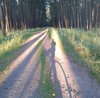
Posted by MiroJanosik on 9 February 2016 in English.Starting with album of unofficial bicycle routes around Malacky. It can be found at http://rudava.mypage.sk , it is of course based on OSM data (and my paper notes) and drawn by hand in UMAP.
I’m expecting to slowly add new tracks as I find them and as I get contributions from other cyclist in the region. I found a local cyclist group “SCK Záhorák Malacky” which will have knowledge about local paths.
Discussion
Comment from Piskvor on %დ %თ %წ at %ს:%წ
Nice! Did you consider getting the tracks rendered e.g. using GraphHopper? osm.org/directions?engine=graphhopper_bicycle&route=48.5264%2C17.1365%3B48.5011%2C17.2110#map=14/48.5138/17.1738
Comment from MiroJanosik on %დ %თ %წ at %ს:%წ
@Piskvor sounds interesting but I can’t imagine how to use it, because I want to display many routes at the same time.
Also Grasshopper is not finding routes that I want to use, for example here: osm.org/directions?engine=graphhopper_bicycle&route=48.4299%2C17.0322%3B48.4511%2C17.1390#map=13/48.4375/17.0892 it switches from route in forest to unsafe car-road as soon as it can. GraphHopper is missing feature of finding a route through predefined points, it only can find route from-to.