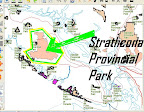
Strathcona Provincial Park, Vancouver Island BC Canada
Posted by acrosscanadatrails on 9 апрель 2010 in English.This one is a very big park. More than 2,000 nodes around.... and that's with fuzzy detail. So i split it up into sections & merged nodes along the edges. It was traced from the Atlas of Canada WMS layer (as it wasn't available int he NRCan protected areas SHP file set).
It will take a while for the renderers to get this whole park. So the pointer is at a zoomed in area.
from http://en.wikipedia.org/wiki/Strathcona_Provincial_Park
Strathcona Provincial Park is the oldest provincial park in British Columbia, Canada, and the largest on Vancouver Island. Founded in 1911, the park was named for Donald Alexander Smith, 1st Baron Strathcona and Mount Royal, a wealthy philanthropist and railroad pioneer. It lies within the Strathcona Regional District. The Clayoquot Sound UNESCO Biosphere Reserve, established in 2000, includes three watersheds in the western area of the park.
 |
| From OpenStreetMap |
Discussion