Virtual Bike Across Canada - Day 004 Port Alberni, BC
Дасланы acrosscanadatrails 28 Травень 2010 на English.I started to "Virtually" Bike Across Canada
So it's doing the mapping part & writing the travel journal for as if i was actually doing the trip. (which i plan on it for next year)
Here's a basic map i made up from http://hikebikemap.de/ and just using windows PaintBrush & the 'PrtScr' button on the keyboard.
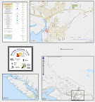 |
| From Across Canada Trails |
I'm drawing in the route (daily trip) using bikemap.net as it has a nice OpenCycleMap background.
http://acrosscanadatrails.posterous.com/day-004-port-alberni-log-train-trail-route-of
Bike route 511872 - powered by Bikemap
Because the actual trail has not yet been mapped (i know that it exists) so i just guessed. My hopes is that by next year, someone will have actually bike/hiked this Log Train Trail.
You can see the red dashed line. Thats the 'proposed National Cycle Network' (in Canada we dont have a National Cycle Network (nor do i know of a proposed one). So i am actually (formally) proposing this route, as i go along. And people are commenting as i go. (and making recommendations). This NCN is a slighly different route than what im 'virtually' biking. As im 'virtually' taking a long time to cover the route.
That's all for now,
Happy Mapping
Sam Vekemans
Across Canada Trails
Абмеркаванне
Камэнтар ColinMarquardt ад 28 Травень 2010 у 19:23
Nice example, thanks for the note. One sugestion: if you screenshot the print preview, it will not have that ugly permalink at the bottom, but instead the full URL of CC-by-SA. (OTOH, in Firefox I always get a slightly different area than what I see when looking at the map in the normal way.)