
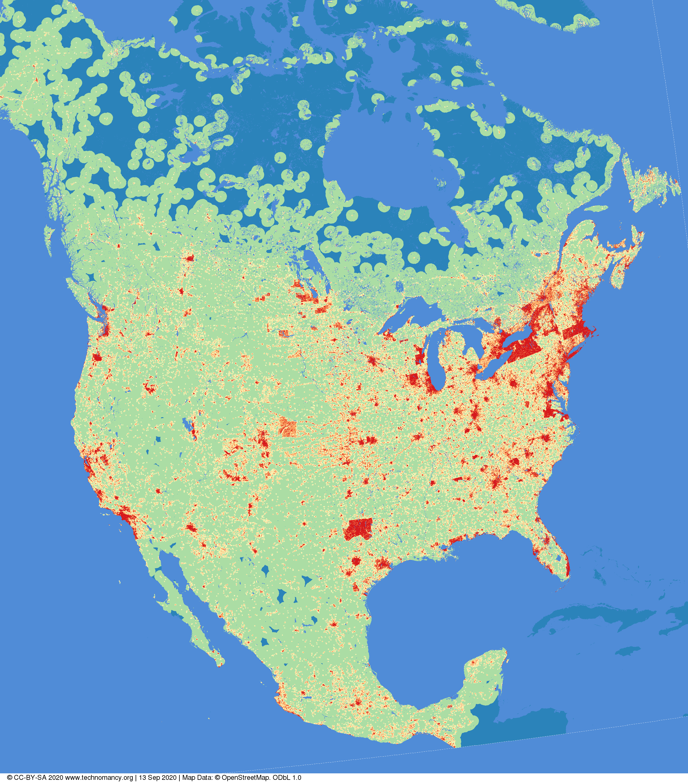
Distance to nearest building in North America
amapanda ᚛ᚐᚋᚐᚅᚇᚐ᚜ 🏳️⚧️ tərəfindən 13 Sentyabr 2020 tarixində English dilində paylaşılıb. Last updated on 14 Oktyabr 2020.Have you ever thought “Gee I wonder if you took #OpenStreetMap data for North America, and coloured the image based on the distance to the nearest building?”
No? What kind of person are you?
(red=<1km, orange=1→2km, yellow=2→5km,green=5→50km, blue=>50km Image © CC-BY-SA 4.0 technomancy.org, Map Data © ODbL OpenStreetMap Contributors)
Canonical Web Page: “Distance to nearest building in North America” on Technomancy.org
Discussion
Şərh mikkolukas tərəfindən 14 Sentyabr 2020 03:55
no
Şərh Sanderd17 tərəfindən 14 Sentyabr 2020 10:28
I’d like a comparison with Europe. Although from some straight lines, I have the idea that the colours depend on imports quite a bit.
Şərh Lejun tərəfindən 16 Sentyabr 2020 09:39
I definitely need a tutorial for this kind of thing ! Let’s say to show the distance to the nearest parking in any area or other OSM entities.
Şərh muzirian tərəfindən 21 Sentyabr 2020 13:51
Interesting
Şərh Jakuje tərəfindən 5 Oktyabr 2020 20:08
Seems like the image is gone. Do you have it stored on some more persistent storage or any steps how to reproduce it for example for Europe?
Şərh amapanda ᚛ᚐᚋᚐᚅᚇᚐ᚜ 🏳️⚧️ tərəfindən 14 Oktyabr 2020 18:41
@Jakuje Thanks for alerting me. I have fixed it.