
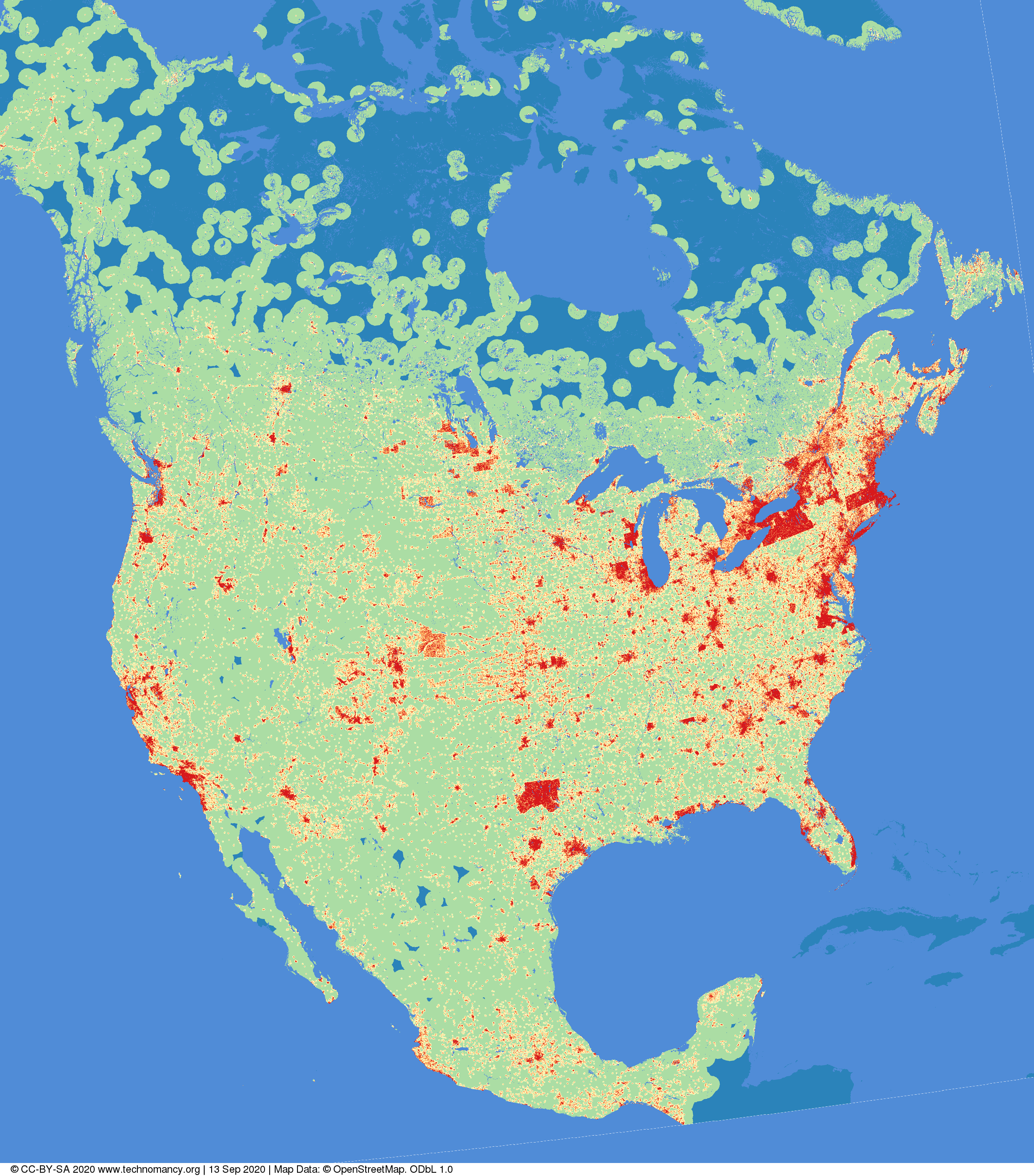
Distance to nearest building in North America
Pubblicato da amapanda ᚛ᚐᚋᚐᚅᚇᚐ᚜ 🏳️⚧️ il 13 settembre 2020 in English. Ultimo aggiornamento il 14 ottobre 2020.Have you ever thought “Gee I wonder if you took #OpenStreetMap data for North America, and coloured the image based on the distance to the nearest building?”
No? What kind of person are you?
(red=<1km, orange=1→2km, yellow=2→5km,green=5→50km, blue=>50km Image © CC-BY-SA 4.0 technomancy.org, Map Data © ODbL OpenStreetMap Contributors)
Canonical Web Page: “Distance to nearest building in North America” on Technomancy.org
Discussione
Commento di mikkolukas il 14 settembre 2020 alle 03:55
no
Commento di Sanderd17 il 14 settembre 2020 alle 10:28
I’d like a comparison with Europe. Although from some straight lines, I have the idea that the colours depend on imports quite a bit.
Commento di Lejun il 16 settembre 2020 alle 09:39
I definitely need a tutorial for this kind of thing ! Let’s say to show the distance to the nearest parking in any area or other OSM entities.
Commento di muzirian il 21 settembre 2020 alle 13:51
Interesting
Commento di Jakuje il 5 ottobre 2020 alle 20:08
Seems like the image is gone. Do you have it stored on some more persistent storage or any steps how to reproduce it for example for Europe?
Commento di amapanda ᚛ᚐᚋᚐᚅᚇᚐ᚜ 🏳️⚧️ il 14 ottobre 2020 alle 18:41
@Jakuje Thanks for alerting me. I have fixed it.