Logo OpenStreetMap OpenStreetMap

Deník uživatele jfd553

Nedávné deníkové záznamy

Mapping Project: Updating the Magdalen Islands

Zapsal jfd553 28. 3. 2024 v jazyce English. Naposledy aktualizováno 2. 4. 2024

The Magdalen Islands (Îles-de-la-Madeleine) are an archipelago located in the center of the Gulf of Saint Lawrence (Eastern Canada). The heart of the archipelago is made up of seven rocky islands connected by long sand barriers, sand spits, dunes, and salt marshes. Including internal lagoons, the islands cover about 330 square km. The archipelago is sparsely populated and counts about 12K permanent inhabitants.

In June 2023, OSM describes the islands’ coastline, road network, some trails as well as some human and natural features. Overall, the islands were mapped using about 56K nodes, 5K ways, and 116 relations (Figure 1).

Figure 1 
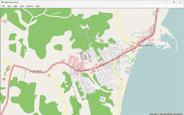
Figure 1: Cap-aux-Meules, before starting the project—Historical OSM data as of June 30, 2023, on Maperitive.

Zobrazit celý záznam

Místo: Les Îles-de-la-Madeleine, Urban agglomeration of Les Îles-de-la-Madeleine, Gaspésie–Îles-de-la-Madeleine, Quebec, Canada

Cartography in OSM is twofold: drawing and tagging. While the former only require the ability to click with a mouse for drawing a line on a screen, tagging a feature is more demanding. There are only two options for finding appropriate tags to describe a feature.

The first is to browse the wiki and find the feature’s page. Once there, you often need to dig through many other pages to find the accepted keys/values that would describe the detailed characteristics of the feature. All of this is very laborious, even for a seasoned contributor, particularly when mapping a feature for the first time.

The second option is to use search tools to find the tags you are looking for (keys or values). You can use a search engine (e.g., Google) by adding “OpenStreetMap Wiki” with your keywords to narrow down the results. You can also use OSM tools, such as TagInfo, TagFinder, OSMantic JOSM Plugin and some others. These tools work well if your keywords match existing keys or values, but it gets trickier if they don’t. However, for a few months now, a new tag search alternative has been offered: ChatGPT.

ChatGPT (Chat Generative Pre-trained Transformer) is a chatbot launched by OpenAI in November 2022 [1]. OpenAI is an artificial intelligence (AI) research and deployment company that gives a free access to its chatbot for the time of the “research preview” [2]. Basically, once registered, a user can ask any type of questions to the chatbot. I then decided to test the chatbot on its ability to find appropriate tags for OpenStreetMap features.

Since I’m currently working in tagging businesses, I tried a few ones. Here are a sequence of questions/answers tried on ChatGPT.

Q: What would be the tag use in OpenStreetMap for a restaurant serving pizza?

A: In OpenStreetMap, the tag for a restaurant serving pizza would be “amenity=restaurant” and “cuisine=pizza”.

The answer is good, but restaurants and pizza could easily be linked together. So, I decided to make it more difficult…

Zobrazit celý záznam

Místo: Rock Forest–Saint-Élie–Deauville, Brompton–Rock Forest–Saint-Élie–Deauville, Sherbrooke, Estrie, Quebec, Canada

How to stay active during Covid-19 lockdowns? Mapping projects!

Zapsal jfd553 5. 10. 2020 v jazyce English. Naposledy aktualizováno 16. 3. 2024

I have started a Covid-19 mapping project in mid-April of this year. My objective was to map the buildings in the city I live in (and updating what needs to be). So far everything is going well. After having mapped about 30K buildings, 80% of my objective has been achieved. I keep moving forward with mapping and updating buildings and any other features that interest me.

Ho! I forgot to update the information. I finished mapping around January 2021. Since then, other mappers have started adding stores within building boundaries. That’s cool!

Místo: Les Nations, Sherbrooke, Estrie, Quebec, Canada