Mapping Project: Updating the Magdalen Islands
jfd553님이 English로 2024년 3월 28일에 게시함. 최근 2024년 4월 2일에 업데이트됨.The Magdalen Islands (Îles-de-la-Madeleine) are an archipelago located in the center of the Gulf of Saint Lawrence (Eastern Canada). The heart of the archipelago is made up of seven rocky islands connected by long sand barriers, sand spits, dunes, and salt marshes. Including internal lagoons, the islands cover about 330 square km. The archipelago is sparsely populated and counts about 12K permanent inhabitants.
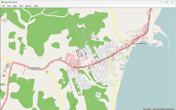
In June 2023, OSM describes the islands’ coastline, road network, some trails as well as some human and natural features. Overall, the islands were mapped using about 56K nodes, 5K ways, and 116 relations (Figure 1).
 Figure 1: Cap-aux-Meules, before starting the project—Historical OSM data as of June 30, 2023, on Maperitive.
… 모든 항목 보기
